Snow Observations List
Screenshot of winds from Lulu Pass wind station during the storm.
Full Snow Observation Report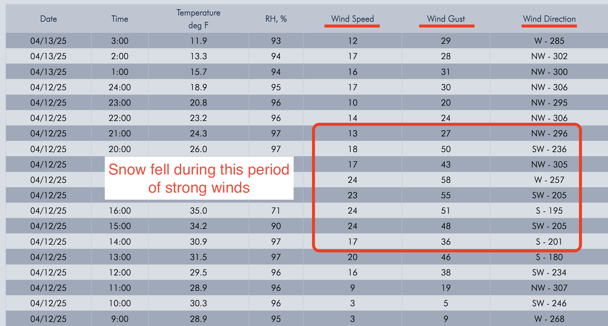
Today I was skiing in East Hayden Creek. I witnessed a cornice fall around 1230pm. Also I triggered multiple wet loose avalanches on several aspects including a north facing slope 9400 ft. None bigger than D1
Full Snow Observation Report
I rode into Fairy Lake. There was 2-3” of new snow above the elevation of Fairy Lake, a trace below. Winds were cranking at ridge top elevation, transporting what soft snow there was. Minimal hazard formation. I spotted one fresh wind slab avalanche near Hardscrabble. The slide ran several hundred feet in steep terrain but was very thin (R1,D1).
There was a mostly supportable crust below the new snow about 1” thick. The snow below the crust was moist.
Full Snow Observation Report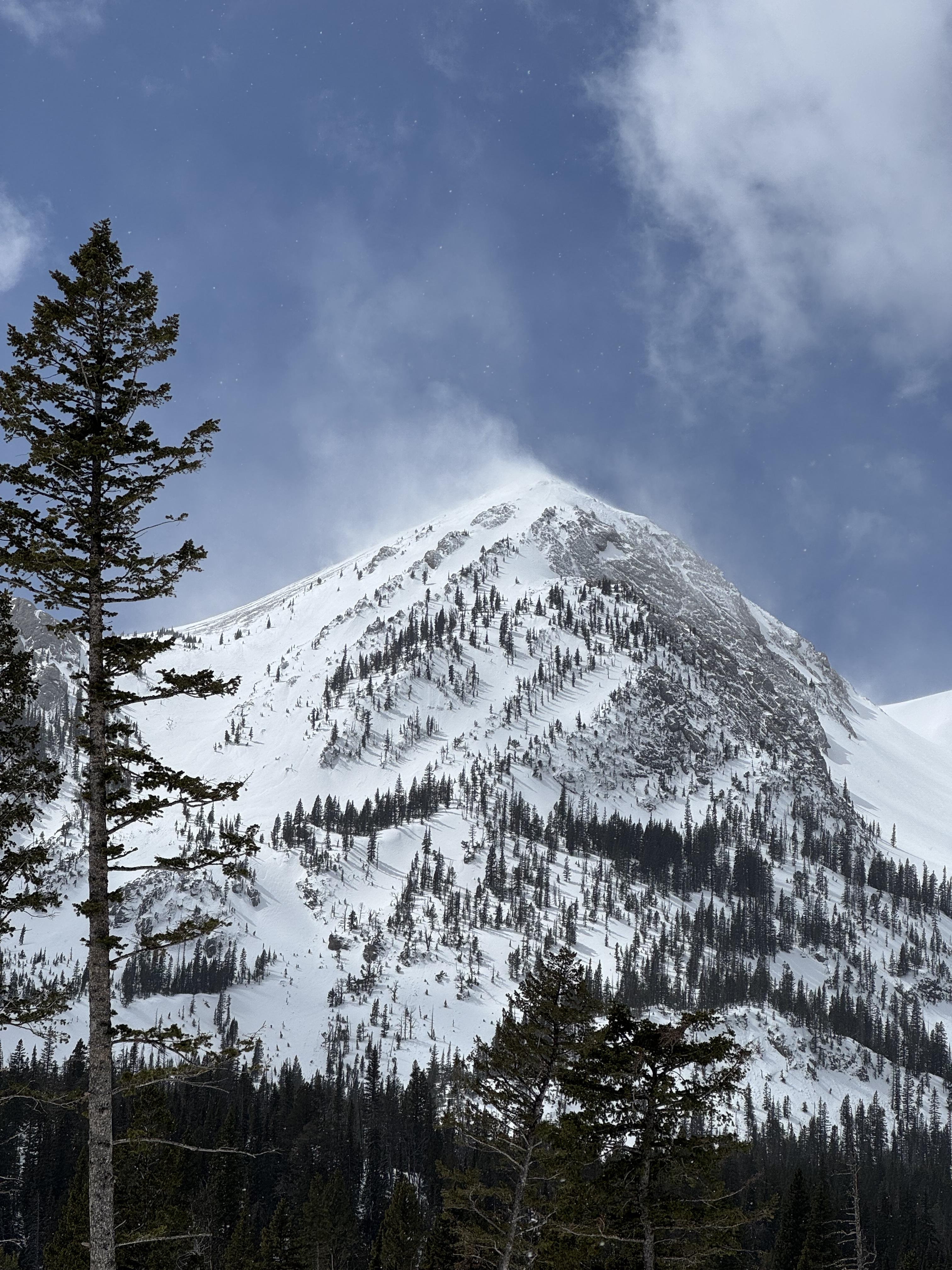
Found some reactive fresh windslabs that were on northeast terrain features yesterday Wednesday 4/9 easily triggered with a very small cornice we dropped in the northern Madison range, the pocket slabs didn’t propagate super wide but did pack a punch and were up to 1 ft deep.
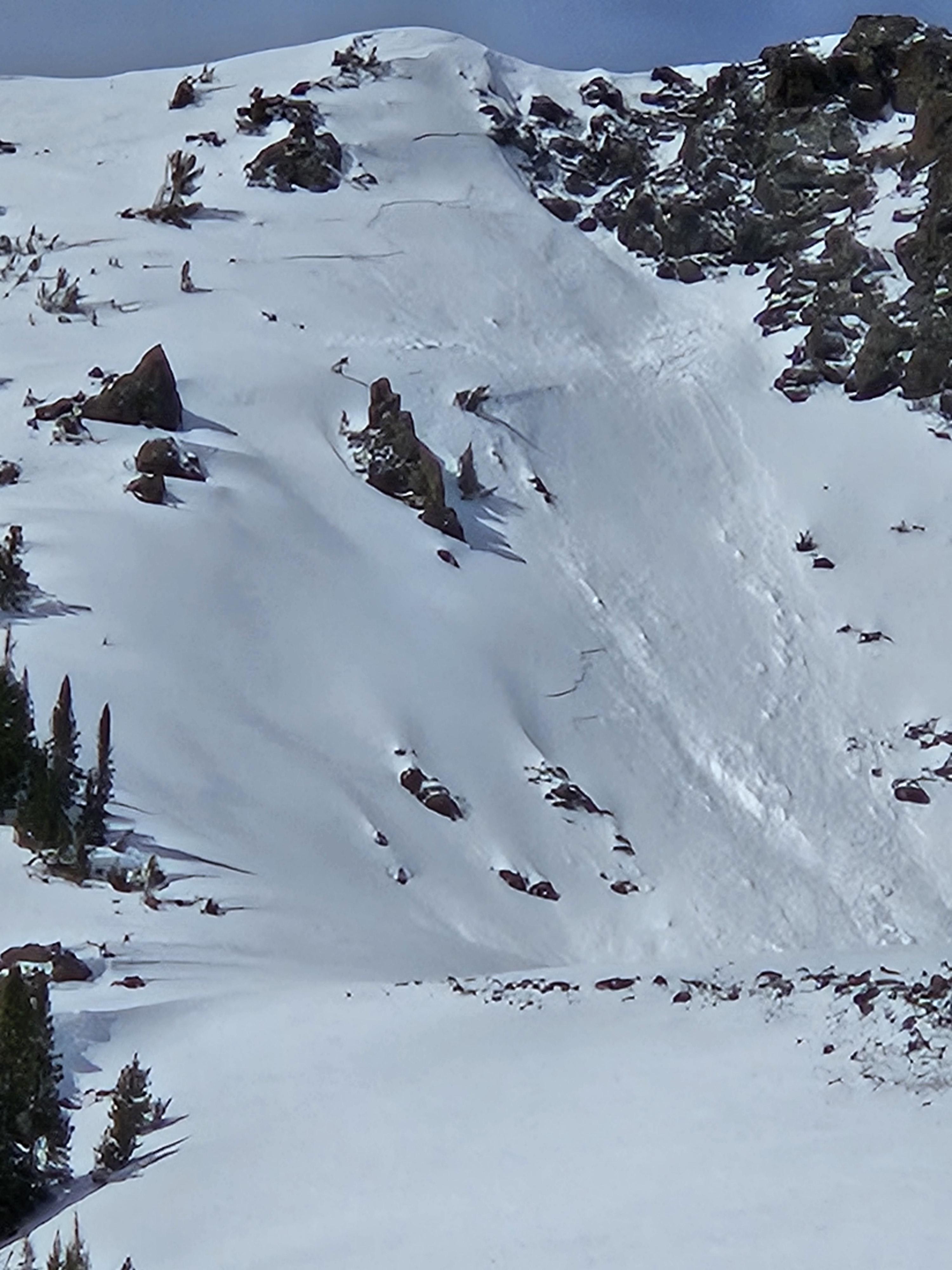
Full Snow Observation ReportRoaring wind, graupal, low to no visibility. 3-5'' of mixed snow forms. Skiing was surprisingly good and wind slabs generally unreactive, but I was just on lower Fisher, right below Lulu. Picture is South East on Scotch Bonnet
Full Snow Observation Report
Today A Skier triggered a 6”x20’ wide wind slab on a N aspect at 9,800’.
Skiers triggered D1-D1.5 wet loose on SE aspect at 10,000’.
There were also natural small wet loose slides today and yesterday. Long running, but narrow, in steep terrain. Typically initiated near rock outcrops.
Today was hotter than yesterday and the top of the snowpack got pretty wet before clouds built in the afternoon. Snow stayed dry on due north up high.
Full Snow Observation Report
Busy weekend in Cooke. A lot of sled and ski tracks in all types of terrain. Avalanches were minimal. Small wet loose or wind slabs involving top 1”-8”. We skied in and around a lot of avalanche terrain.
We rode into Fairy Lake and climbed up to the Great One. Surface conditions ranged from gloppy, wet snow to firm, dry wind slabs with very little powder in between. There had been a fair amount of wind-slab and wet loose avalanche activity in the area over the weekend, but things were quite today. We had a report of a human-triggered wind slab avalanche in the Great One on Saturday.
By 11:00 AM a layer of high clouds moved overhead and limited the melt-down input from the sun. Ambient temperatures reaching 50 degrees F didn't do the snow quality any favors at mid and low elevations but additionally didn't result in any natural wet snow avalanches that I saw.
Wind-slabs were relatively thin (a couple inches to 8" thick). We did get cracking in a few drifts that was limited to the area directly influenced by our skis. We dug at the top of the Great One with unremarkable results and proceeded down the run.
Tomorrow looks to be cooler with limited snow accumulation. If this forecast pans out, triggering an avalanche will be unlikely. Let's hope for more snow than is in the forecast!
Full Snow Observation ReportLOW danger today

While touring south of town today, we observed two D1 wet loose avalanches on an east aspect at 10000’. Both occurred at 11am and were triggered by a small cornice fall due to rapid warming.
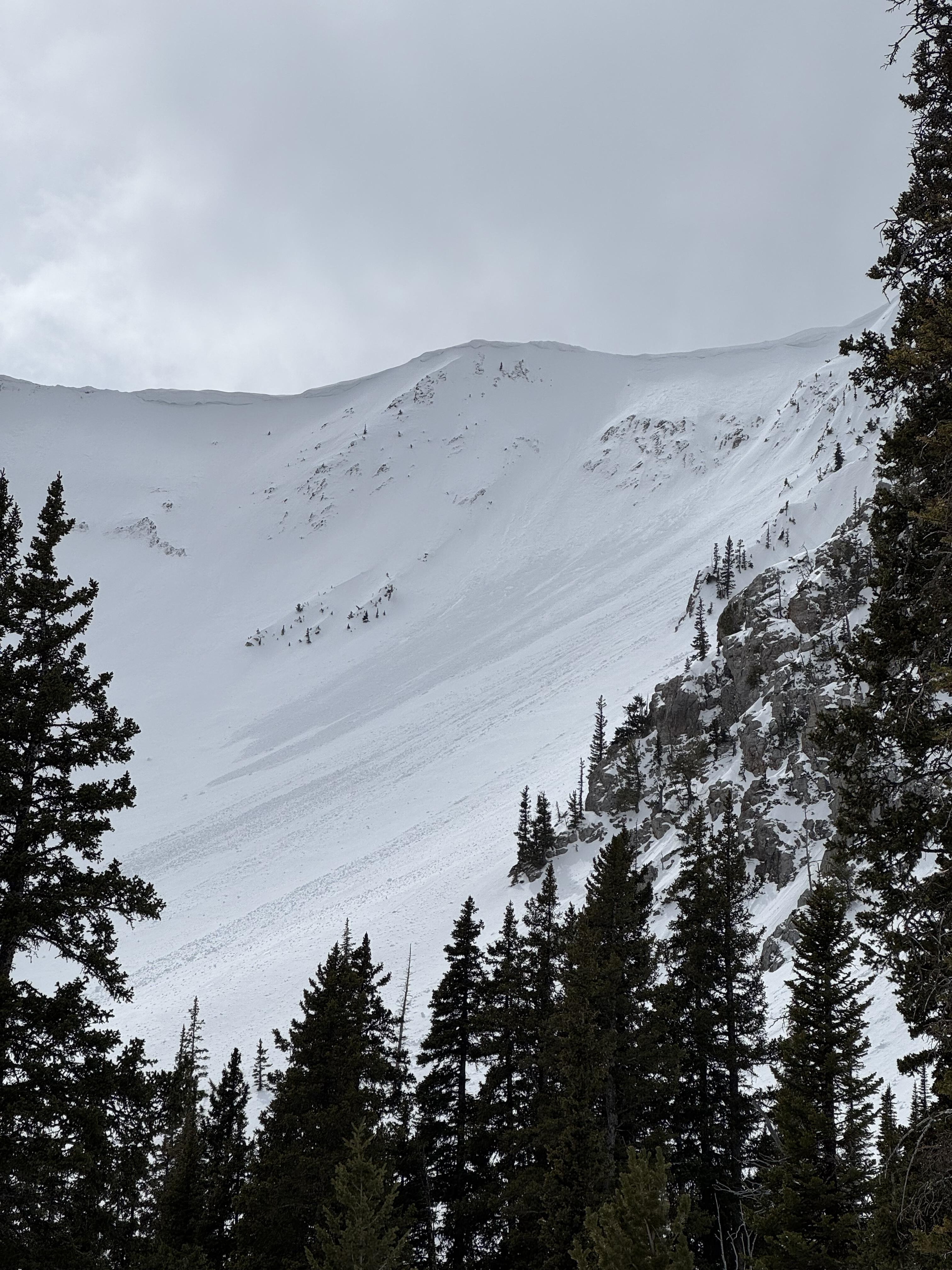
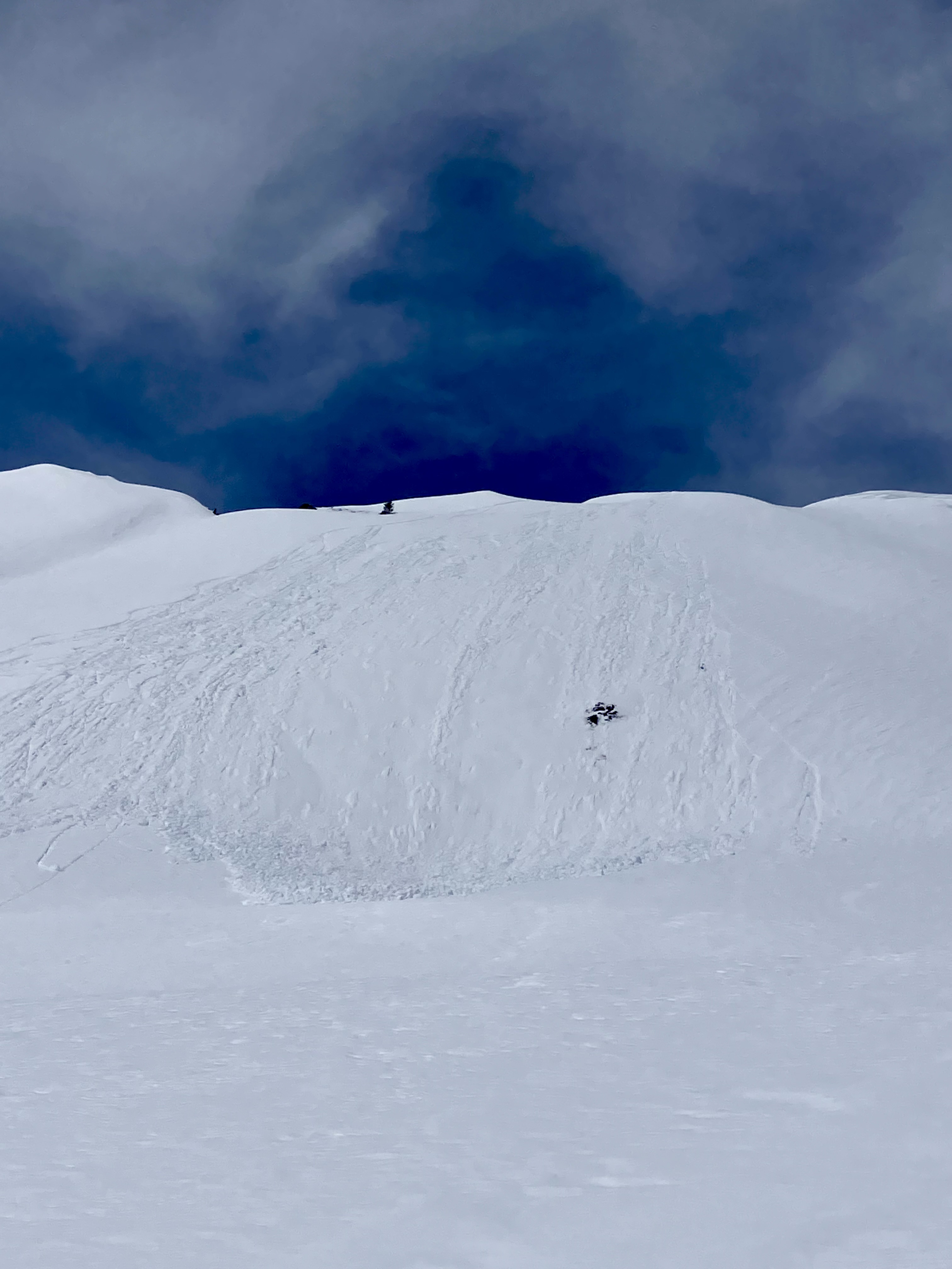
Full Snow Observation ReportWe skied near Henderson Mtn. and Lulu Pass. Skies were clear with a light breeze near the ridgelines. Temperatures stayed below or just barely above freezing.
We saw a couple 3-6" deep natural wind slab avalanches and a few dry loose slides that looked to have happened within the last 24 hours. On southerly slopes below 9,000' there were some wet loose slides from yesterday afternoon.
Wind slabs were still reactive today. We triggered 3 small, 3-8" deep x 5-15' wide, hard wind (1F+) slabs on convex test slopes well below the main ridgelines. 9,800', NE aspects. Also triggered one softer (4F) wind slab just below the high ridgeline, 10,200', NE aspect. 10-15' wide x 6-8" deep.
Snow stayed dry on northerly/shady slopes. Any sunny slopes got moist and had a crust formed by late this afternoon. We did not notice any fresh wet loose slides or roller balls on southerly slopes above 9,000'.
Stay alert for unstable drifts of snow, wind slabs formed last week are still breaking. Anticipate wet snow hazards to increase in size and distribution as the days get hotter this week.
Full Snow Observation Report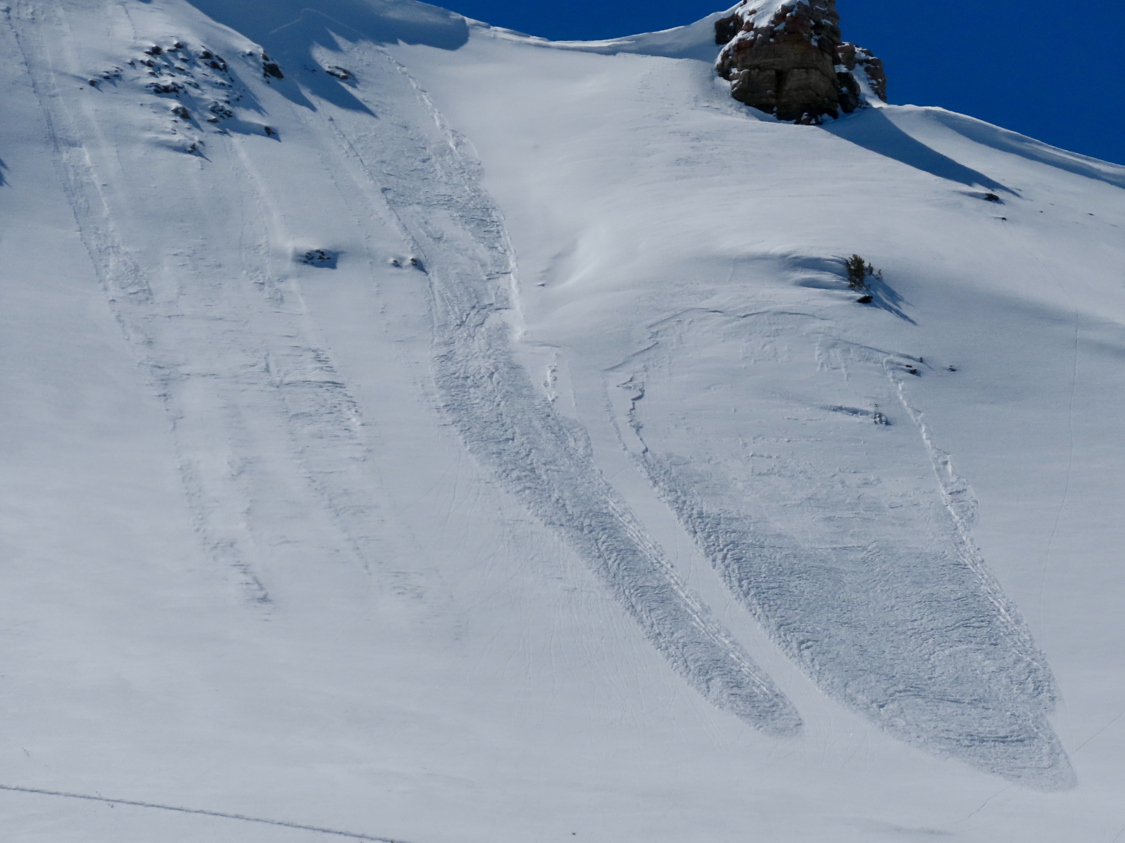

We snagged an early morning tour to avoid the heat today and it (mostly) worked. We saw no avalanches, cracking or collapsing while out.
-We found a 2-4cm thick breakable crust on SE, S, SW, and W aspects that probably formed during Friday’s sunshine capping 6-10” of fresh snow above 9k’
-There was much less fresh snow below 9k’ (baked off?)
-Northerlies held stable soft snow!
-Small natural dry loose activity started around 11am on steep NE and E slopes initiating from around rocks/trees
-We sniffed out some south facing corn, but it was generally grabby/sloppy wherever a few inches of recent fresh snow remained
Full Snow Observation ReportA snowobarder tagged us in an IG story of triggering a long running, powerful wet loose slide in the Bridger Range.
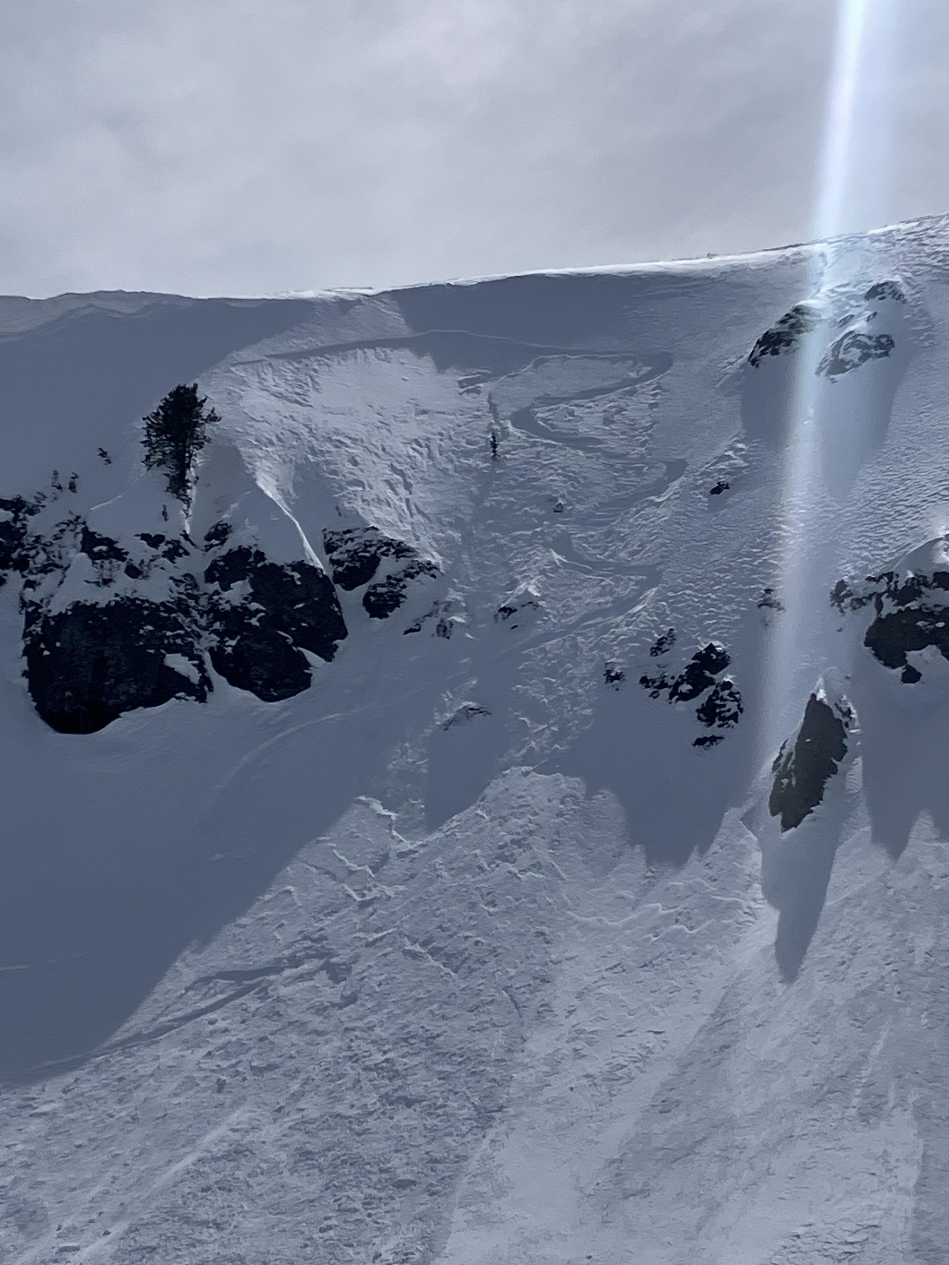
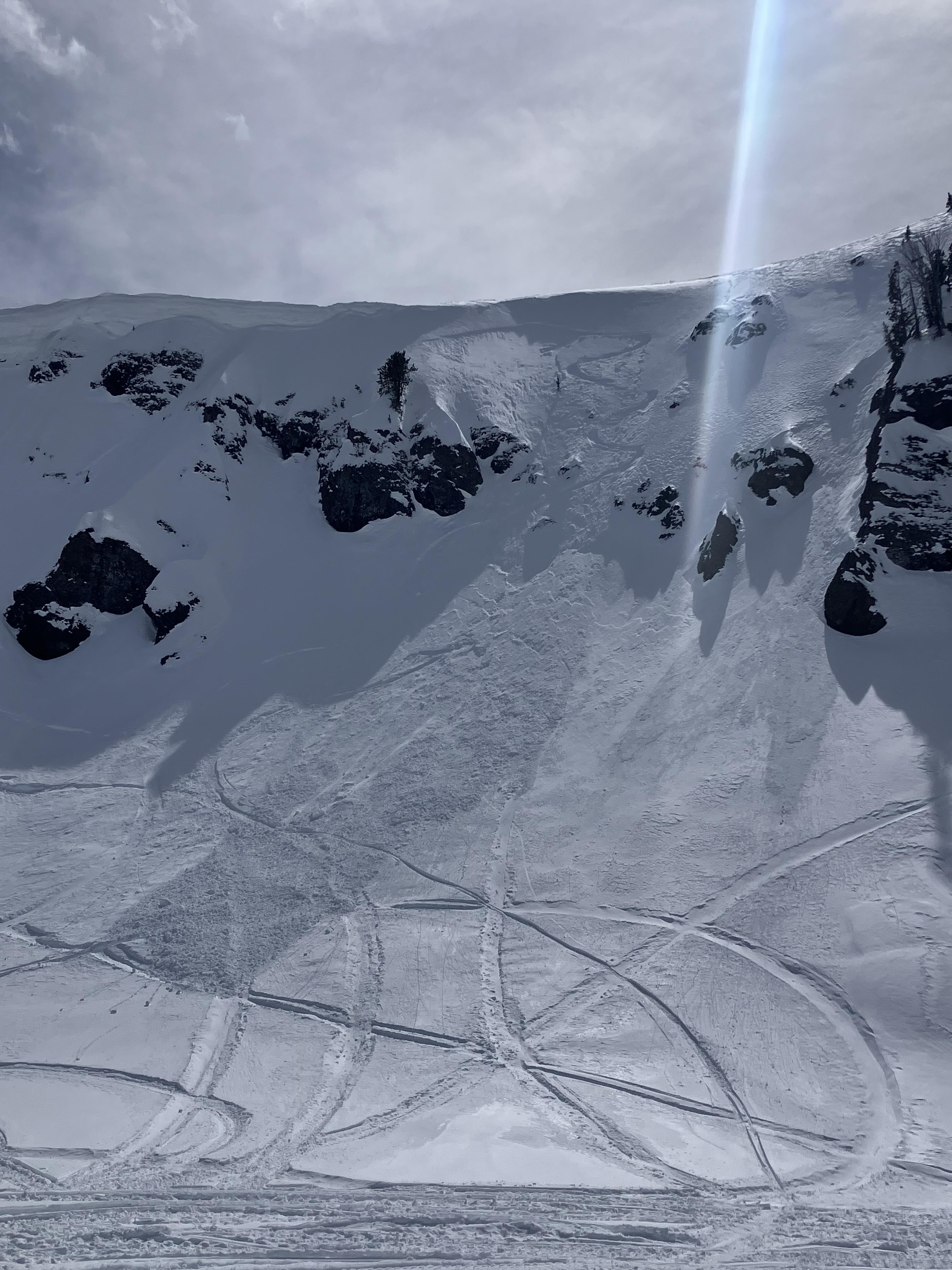
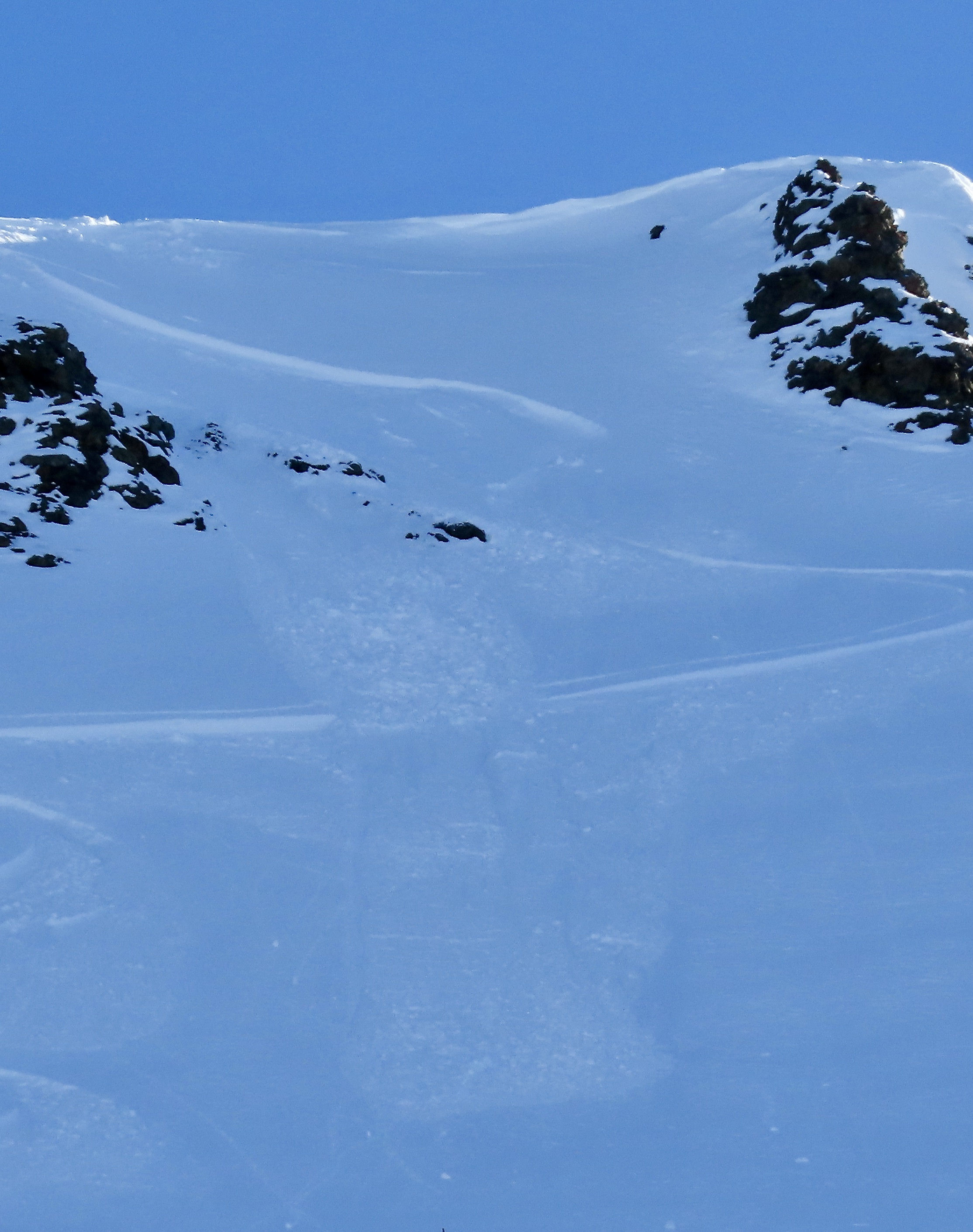
Full Snow Observation ReportWe went on a tour in the Bridgers today, we ascended the east ridge of Naya Nuki to the entrance of the Great One. Wind was blowing and we were being careful about potential wind slabs up high.
Skier 1 ski cut the top of the chute and produced a small wind slab that ran to the break in the chute and continued another 100 vert down the east apron. After all meeting up halfway down, skier 2 proceeded to ski the E facing apron. A wind slab propagated and carried skier 2 roughly 300 vert down the apron where skier 2 was able to swim out of the fall line and came to a rest on top of the debris. Everyone was okay aside two missing ski poles.
On the way out, we saw a few more small natural wind slabs that broke naturally near ridge lines as well as point and release wet slides.
Full Snow Observation Report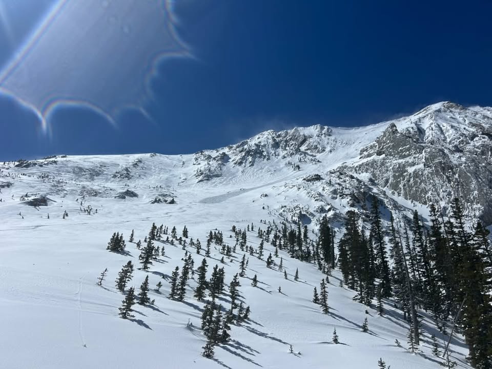
From BBSP: " At 2.45?pm a... solo skier triggered a wind loaded pocket on the main face of Saddle Peak that ran down over the cliff and produced an impressive powder cloud.... I met him... and confirm he was alone and no one was in front of him. The avalanche looked to be 2' deep on the southern flank and 5" deep on the northern flank... It entrained more snow on the way down, one 2' deep downhill wind loaded pocket and some loose wet snow. It ran into the bottom of the going home chute, gouging a large hole and then 100ft downhill left a 200ft by 30ft wide shallow debris pile."
Full Snow Observation Report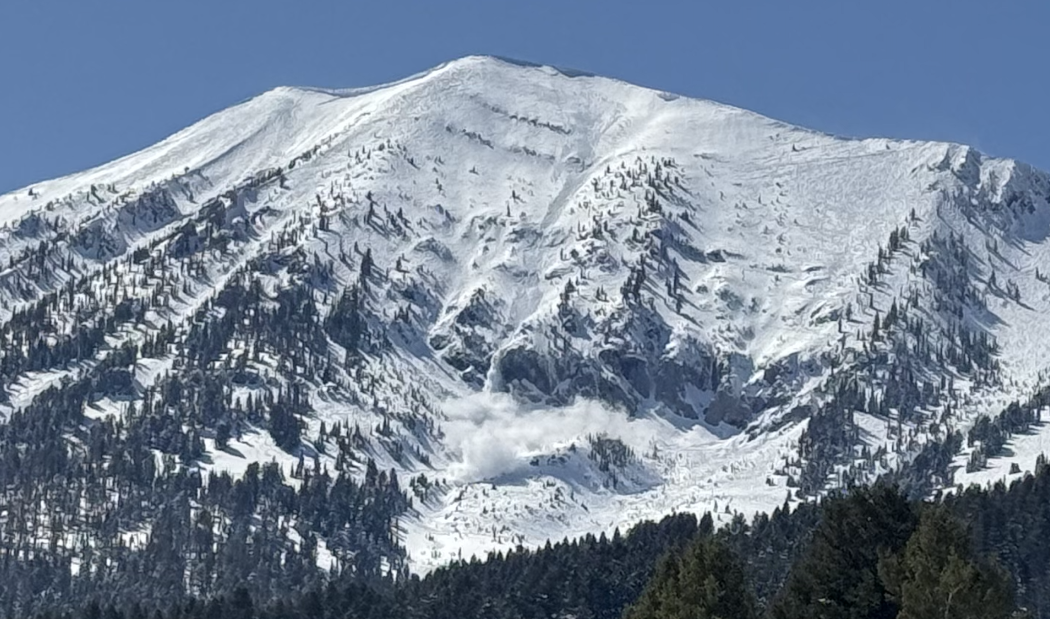
Observed multiple D1-1.5 natural dry loose avalanches (and some tiny wind slab pockets under the ridge cornice) that likely occurred during peak warming around 2-3 PM. North/sheltered aspects from ~9- 8.5k held an average of 8+ inches of dry, drifted snow. Early AM to mid-afternoon, very active wind transport followed by tapered winds and a rapid increase in temp. Also observed one small wind slab occurring between Saddle & the Football Field, possibly skier-triggered.
Full Snow Observation Report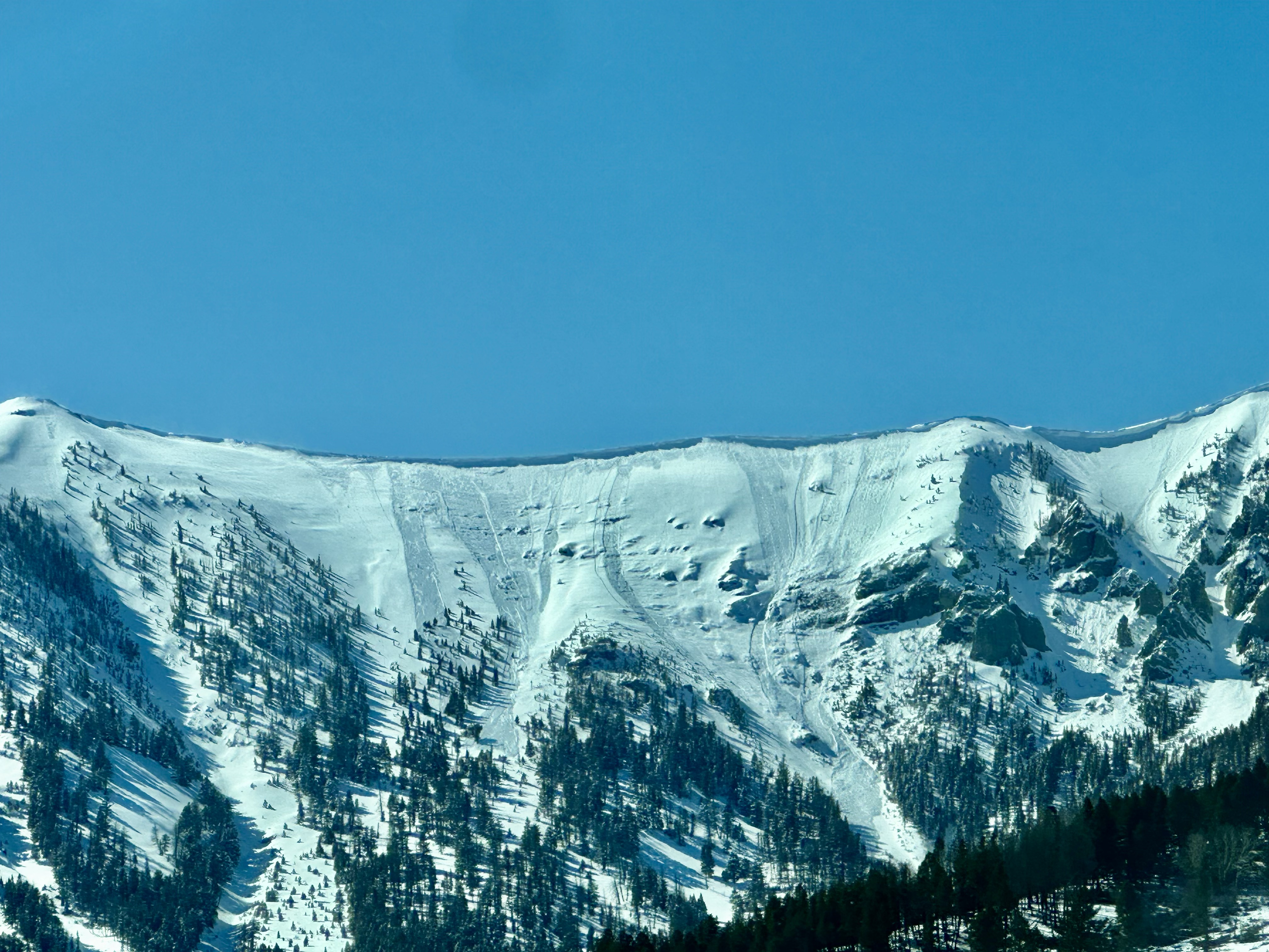
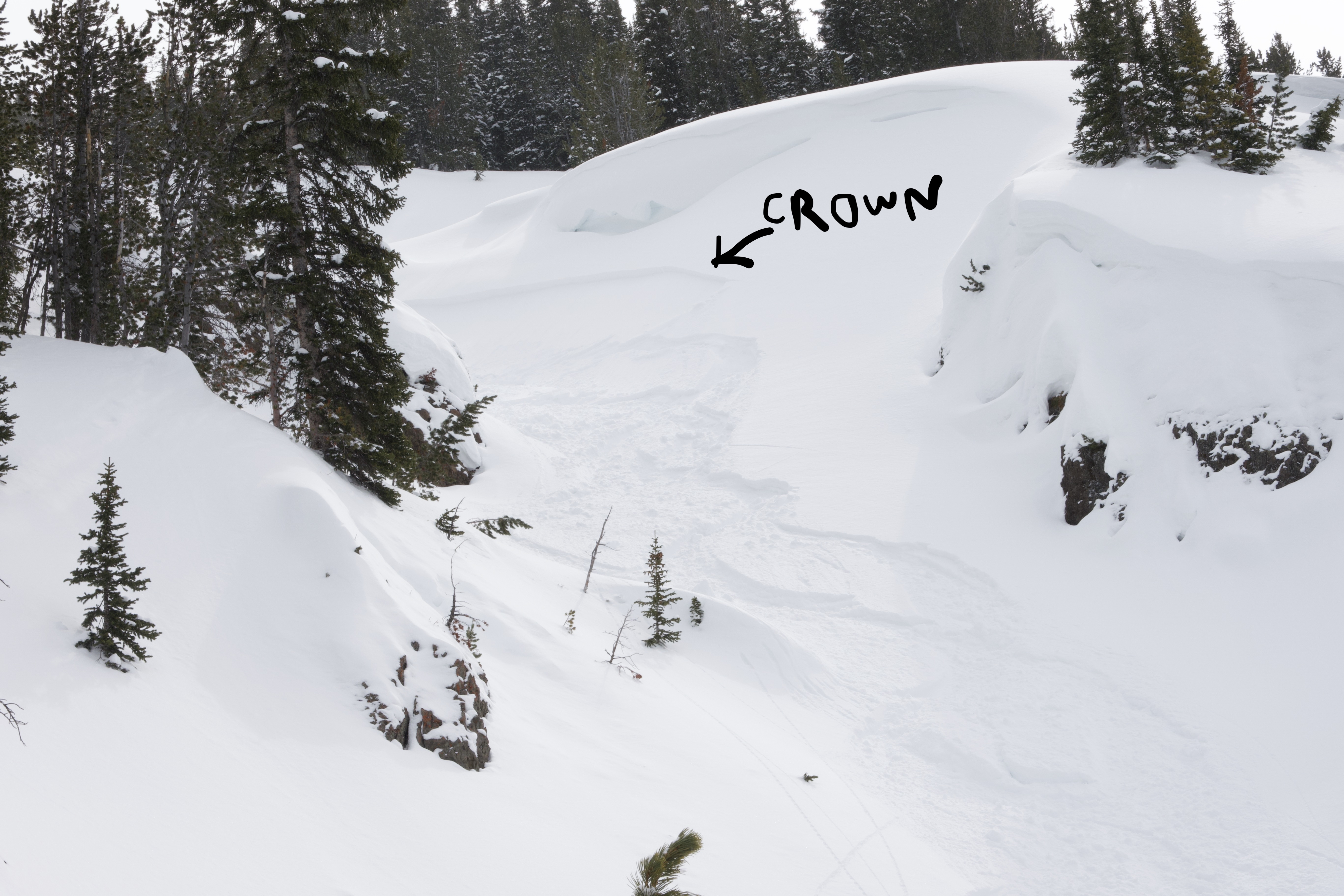
Party of 3 skiers triggered a wind slab about 500 feet below the entrance to Moe's Gullies, just south of Mount Cowen. Skier 1 ski cut the entrance to the couloir, with no visible effect. Skiers 1, 2, and 3 then one by one skied down about 200 feet before cutting into the skiers right gully. This was also skied one at a time, after which they regrouped about 500 feet below the entrance/ridge. Skier 1 then traversed out so ski the apron, and triggered a D1 avalanche on a wind slab which broke about 100 feet above. Crown is estimated to be about 20" at the deepest, and was at the transition point between the choke of the parallel gully and the apron below. Skier 1 was carried about 200 feet before being able to self arrest. Skiers 2 and 3 were in a safe spot and not caught. Avalanche ran the full length of the path, and triggered sympathetic avalanches on the way down. This created a relatively large debris pile compared to the size of the initial release. Avalanche seemed comprised mostly of the last storm snow running on a hard crust below.
No injuries were sustained.
Full Snow Observation Report
Wind slab near Cooke City from yesterday. Intentionally triggered. North aspect, 10,100'. 1' deep, 20' wide.
Full Snow Observation Report
I was skiing in bounds on Slushman’s lift and saw a pair of R1, D1 avalanches on Saddle Peak. One appears to be a loose snow avalanche triggered by a skier coming off of north Saddle Peak That ran a couple hundred feet. The second was a small slab coming out of Spencer’s with debris running into Going Home Chute.
There were many tracks across the visible Saddle Peak terrain.
Full Snow Observation Report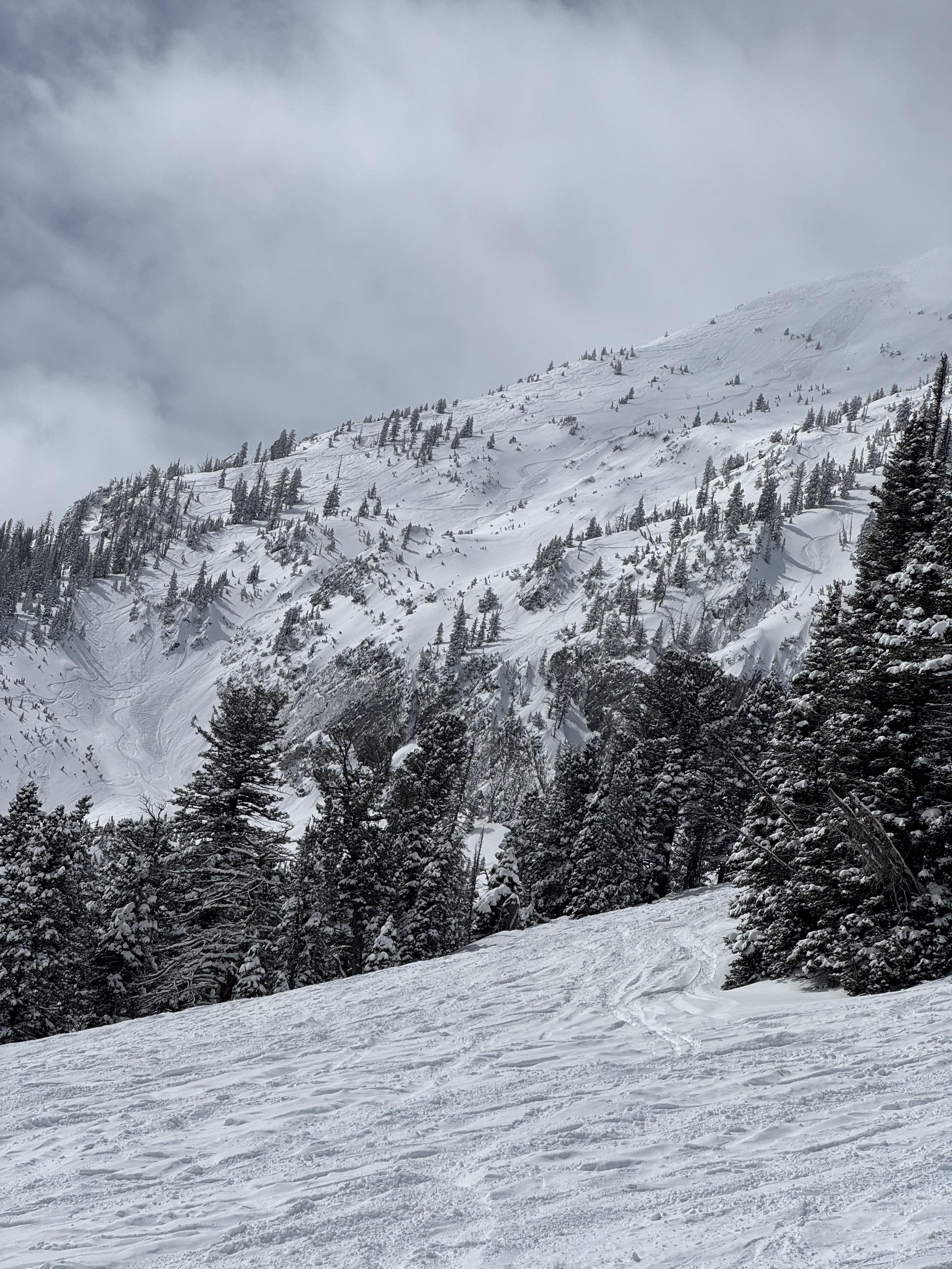
My ski partner and I toured up Ellis today and skied the typical east facing gullies.
We found the new snow to be bonding well to the crust and no significant instabilities within the new snow. Light snowfall off and on throughout the day, total accumulation no more than 0.5in, sky broken to obscured. Excellent skiing above 7K
Full Snow Observation ReportSkied around Beehive Basin today; there was lots of new snow and very little wind effect. Skied into the top of Bear Basin from Beehive by going up going home and down the east side, right-side-up powder skiing. While descending Island Boy into the South Fork of Spanish Creek, we had similar 60-100 cm of right-side-up new snow on a heavily textured melt-freeze layer of old snow. Felt the snow density stiffen up from light low density snow around 300 meters down the ski line so cut to the left into a safe zone, the slope at the my skis broke about 15-20 meters wide and 15 cm deep at the flanks to 40cm deep in the gut, SS-ASu-R1-D1.5-I-M(L)-TK. About 30 meters downhill, the slab rode up onto the new snow and ran out of momentum before reaching the runout. Right where the slope broke, we had wind wrapping around the north ridge cross-loading the couloir (skiers left to right), downslope, and on skiers' right of the line, there was no evidence of wind transport. Skied the rest of the line and looped back into Beehive with no other excitement.
Full Snow Observation Report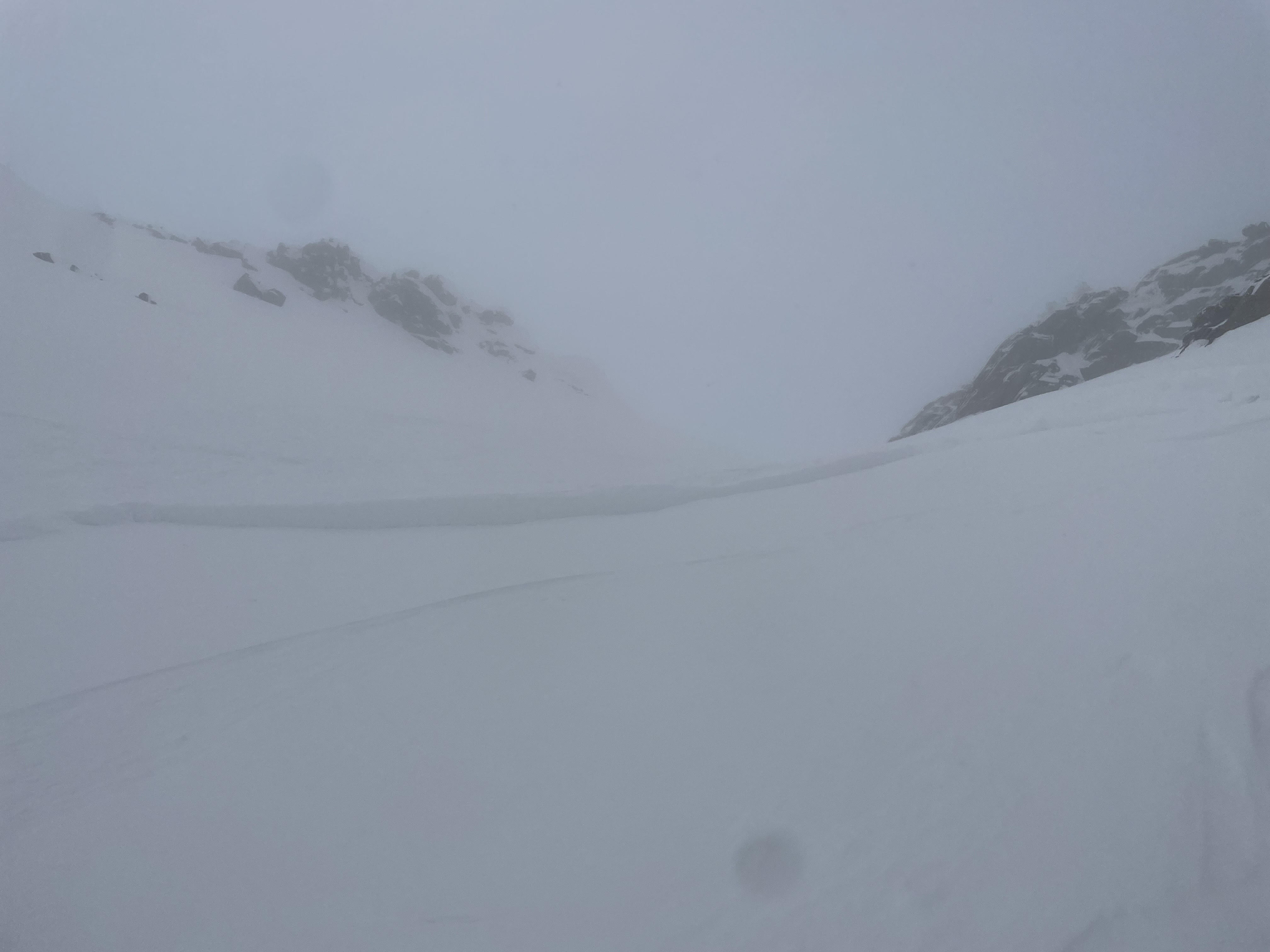
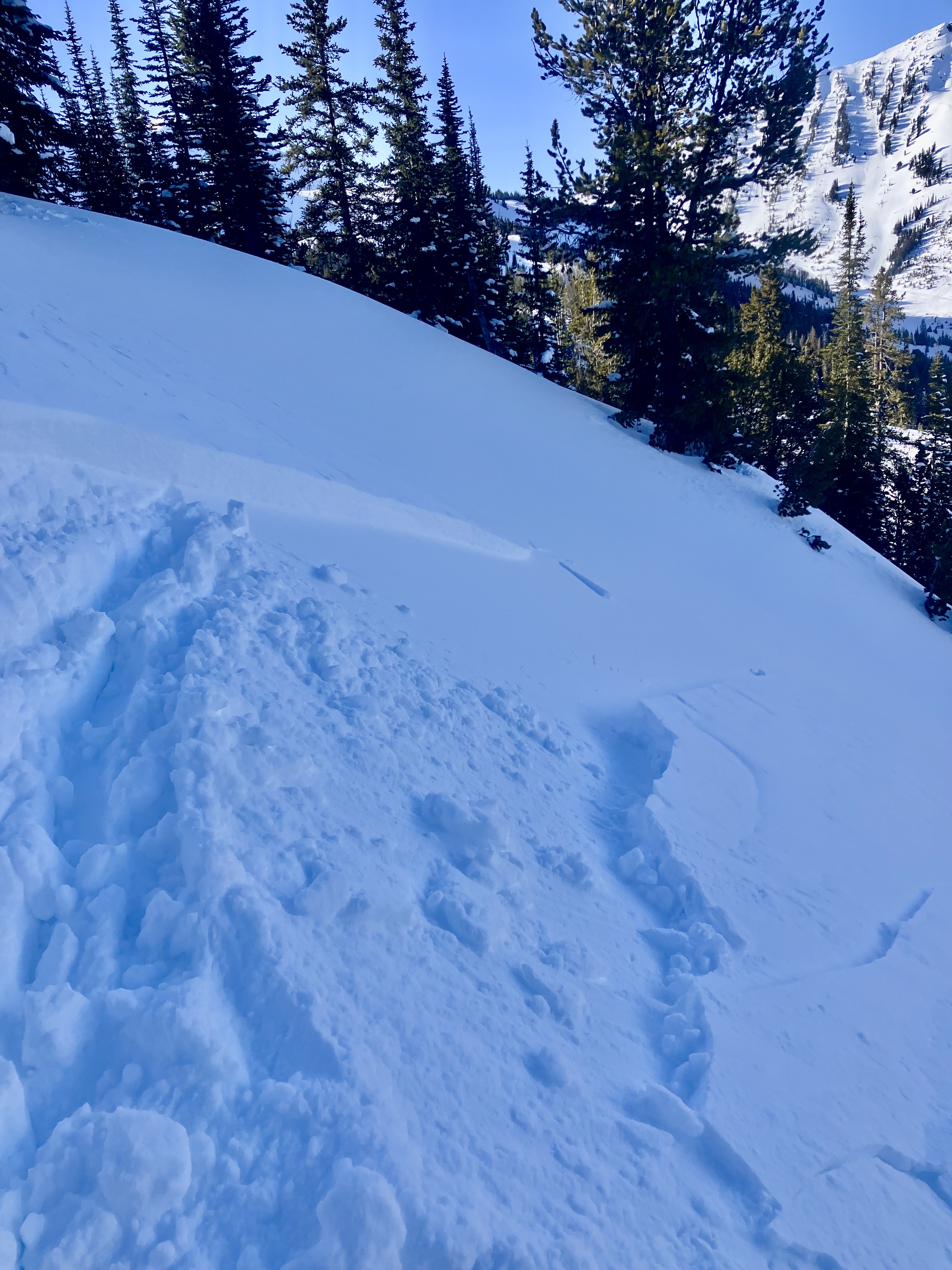
Ice Cream Scoop on Skiers Left Side in Gully, North Aspect, 9280'
SS-ASu-R1-D1-S
One of the few spots on the gully where there are no trees as a wind block on the skiers left (south) side. Noticed a few cornices on south side of gully where it is exposed to W/SW/S winds. Skier took a left turn under cornices to scrub speed and released a 6-10" windslab 40' wide which ran 10' at most. Super soft and easy to ski through.
Full Snow Observation Report