Snow Observations List
Went skiing north of Cooke City today near Zimmer Creek. I saw a few wind slabs. Some appeared to be skier triggered, some were natural. No other avalanches seen. Moderate to strong wind from the west all day. I saw shooting cracks in obviously windloaded areas.
Full Snow Observation Report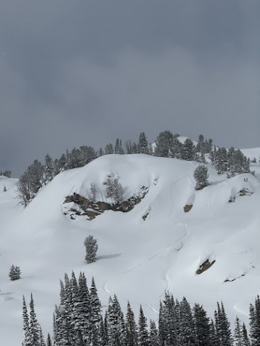
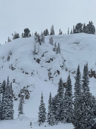
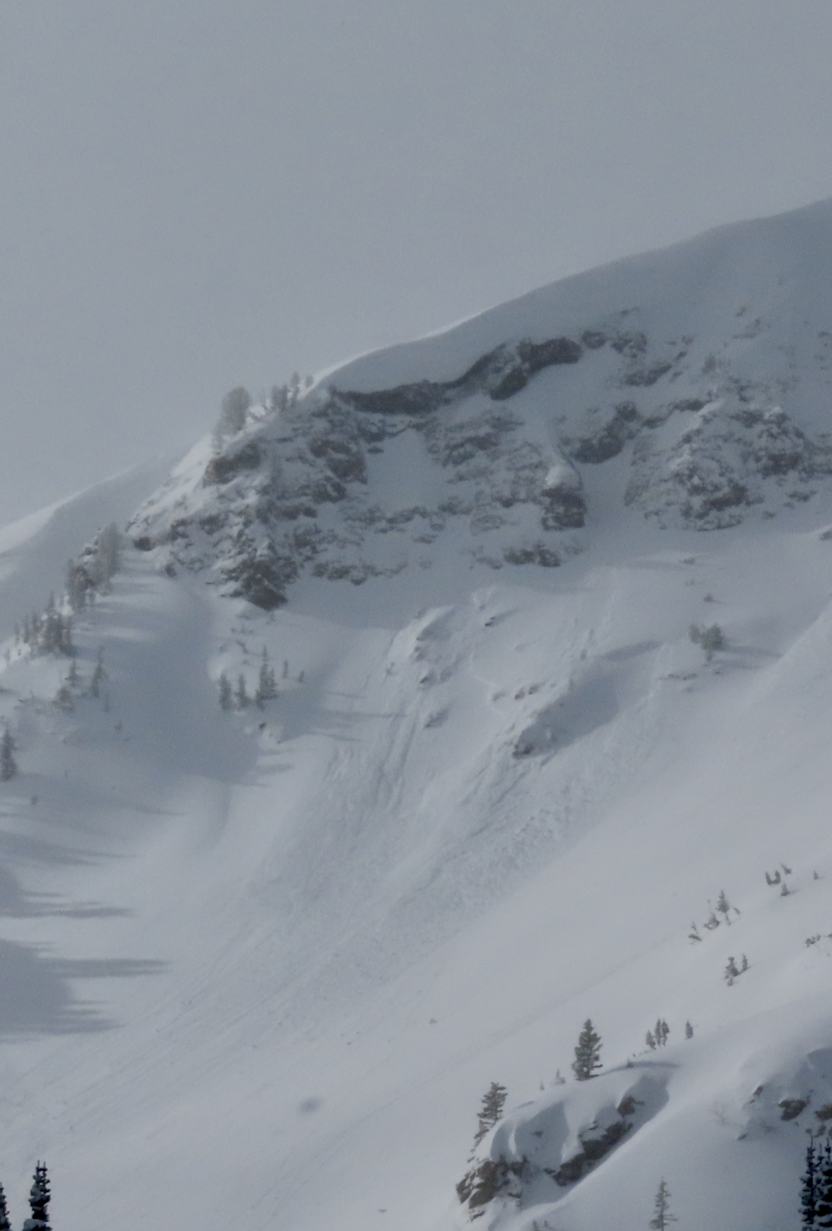
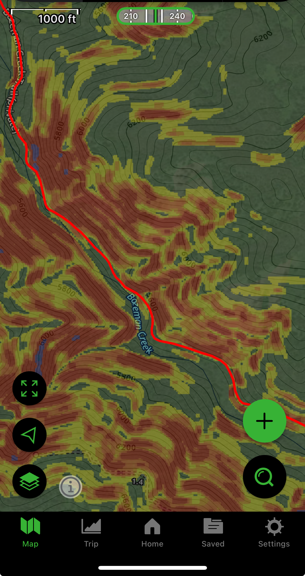
Toured the ramp today and observed an avalanche in hour glass. It was a soft slab that broke in some rocks near the top of the chute, it ran the entire length of the chute and the debris was fairly large (d1.5). The crown looked to be between 8” and 1.5 ft, and was about 30 ft wide.
Full Snow Observation ReportDig on the way up to Mt. Blackmore on a W aspect at 8000’. Snow was pretty shallow (130cm) for the area. Noticed the dust layer underneath the most recent snow. Had unremarkable pit results. ECTN11 on the dust layer being the most notable. Saw a couple of small wind slabs and intentionally triggered one on a small rollover. Definitely a good bit of active transport going on out there.
Full Snow Observation ReportBacon Rind
Consistent crusts at Around 75cm up and 63cm up
Facets at 35cm up to Ground
44.96280, -111.08678, 10:14
7850ft
68 E
20 degrees
HST 110cm
ECTP 25 65 cm up
ECTp 16 35 cm up
44.96019, -111.09583, 11:30
8578ft
59 NE
10 degrees
Hst110cm
ECTN25 75cm up
ECTP16 63cm up
Full Snow Observation Report
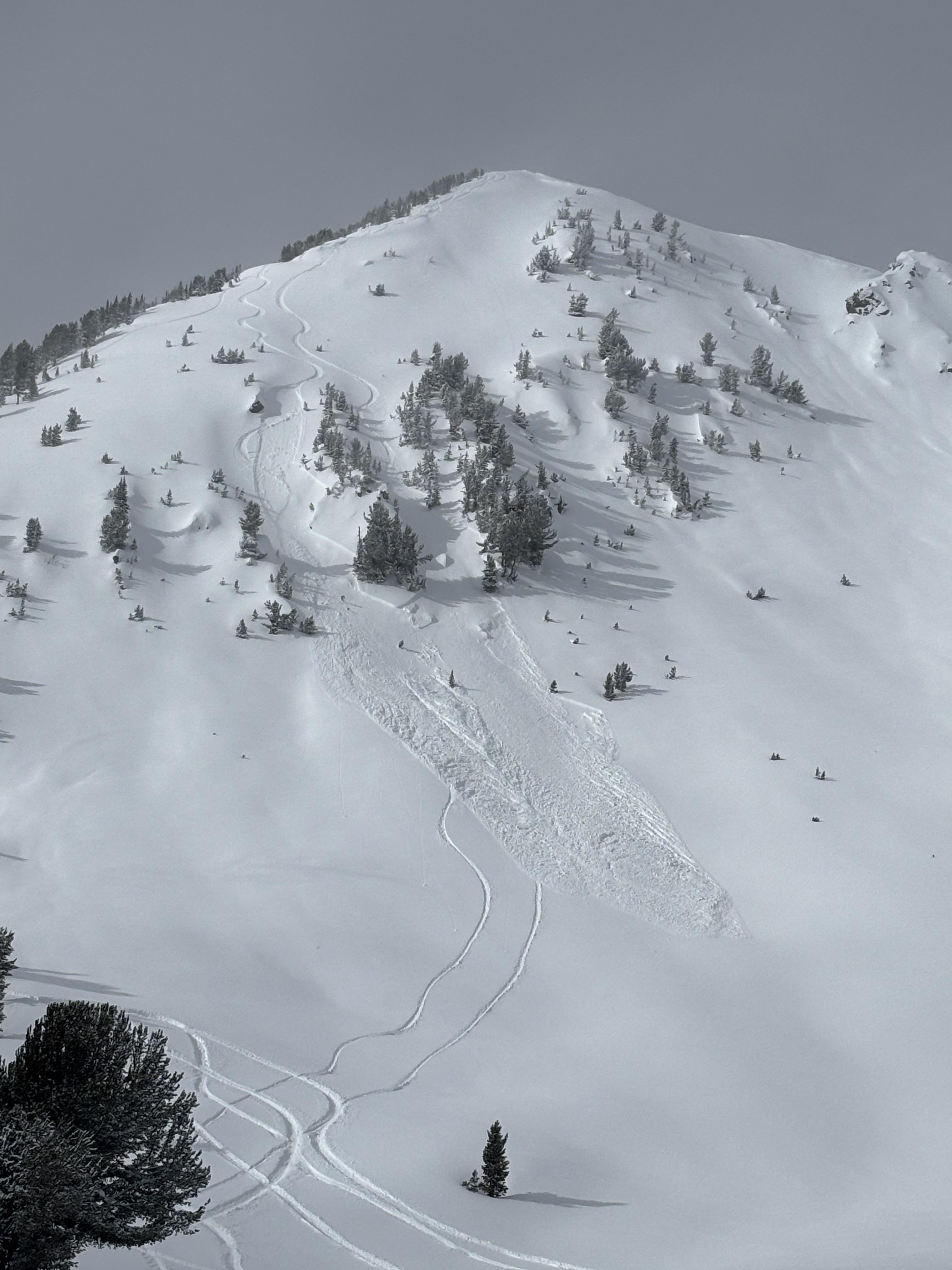
We rode over Daisy Pass out to Mt. Abundance, then behind Fisher and around Scotch Bonnet back to Lulu Road. Snowed light this morning with partly sunny skies mid-day. Wind was moderate and gusty out of the west. We were able to see most terrain north of the passes. Clouds obstructed great views of east Henderson and east Miller.
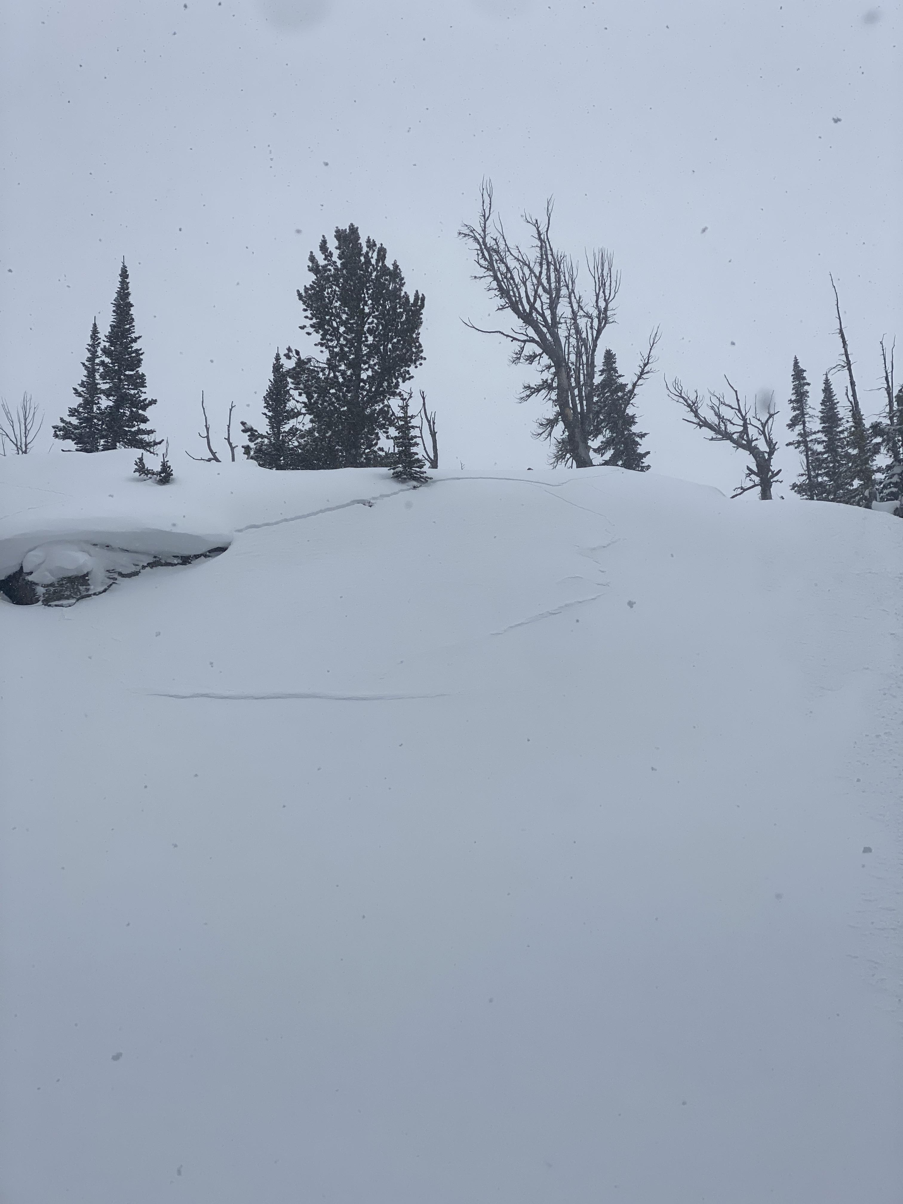
We saw a fresh natural wind slab near Wolverine, R1-D1.5 (photo attached). We watched two snowboarders trigger separate wind slabs, while riding one at a time in avalanche terrain, on the south side of Scotch Bonnet (photos attached). They rode away safely. These looked 12" deep and 20' wide, and entrained snow to run a good distance, R1-D2.
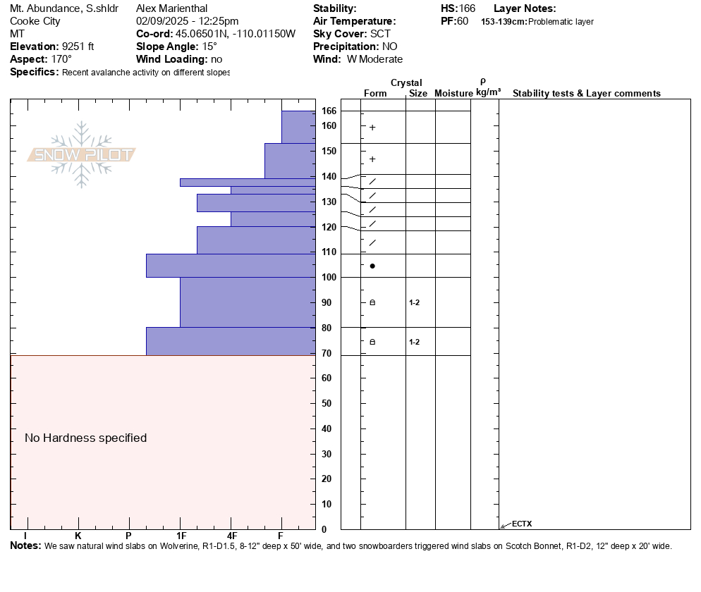
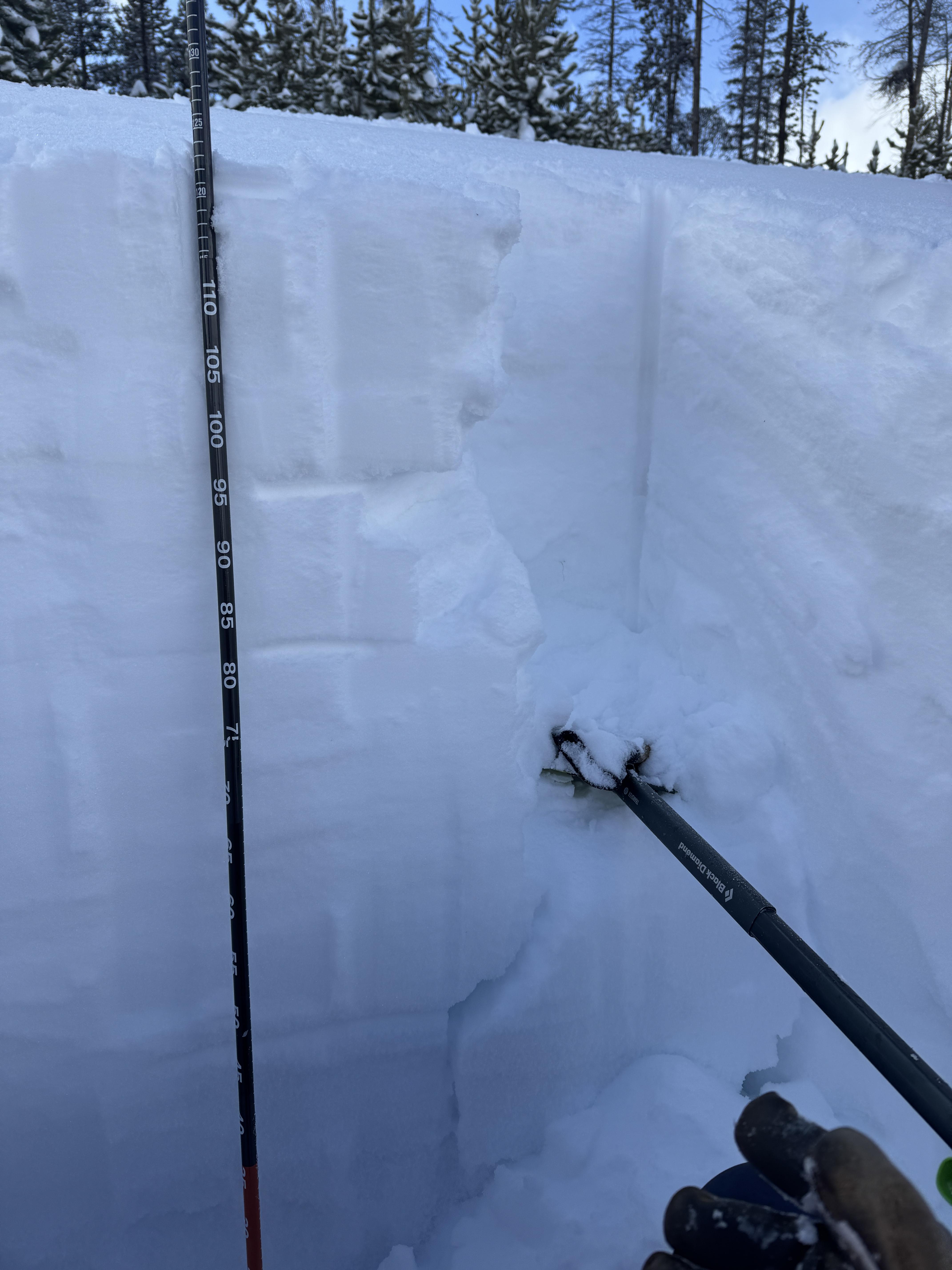
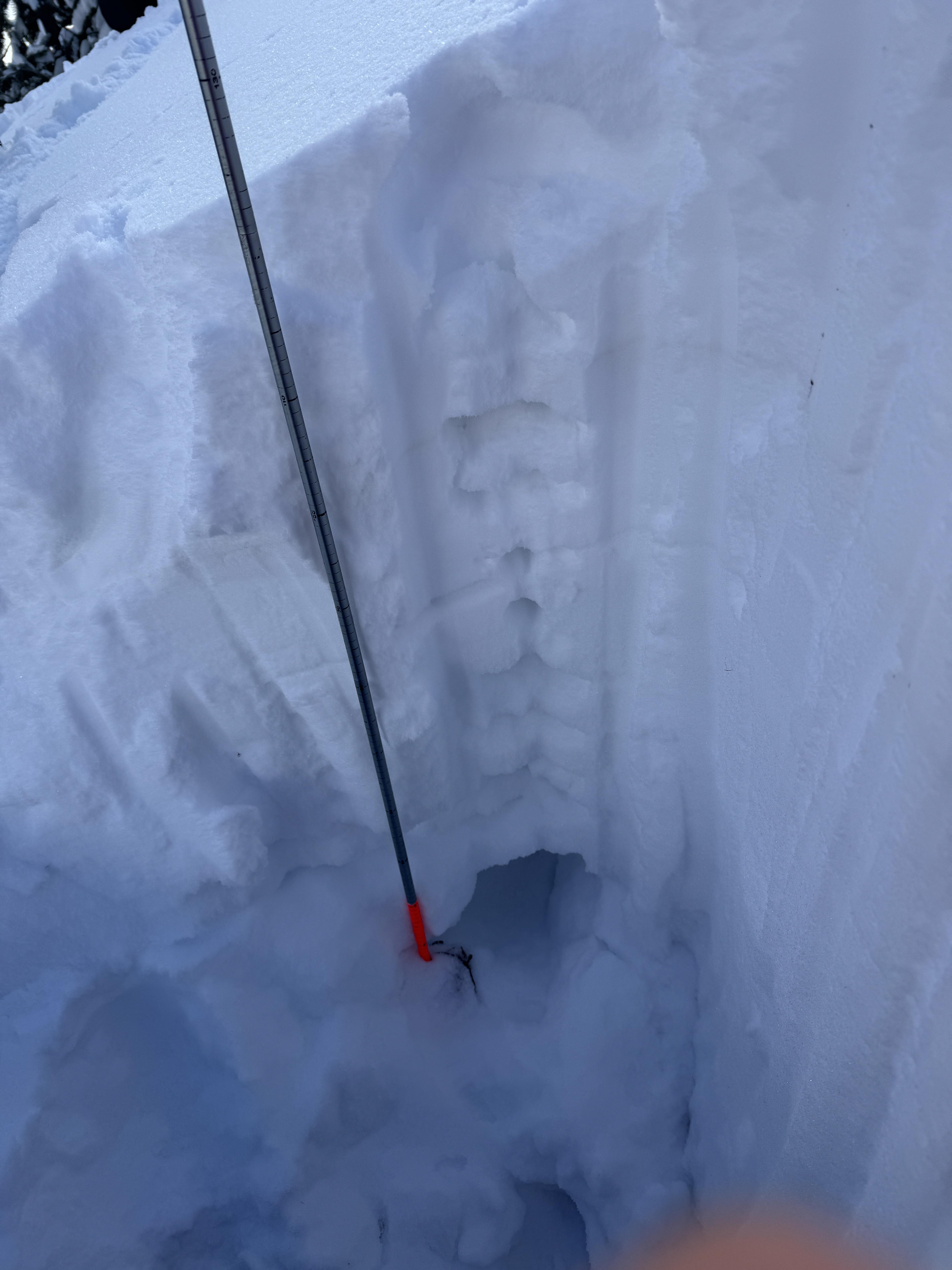
We dug a pit on the south shoulder of Mt. Abundance and had an ECTX. There were some density changes in the recent snow that might contribute to wind slabs or storm slabs breaking easier for another day or two, but they seemed more stubborn than yesterday.
Wind slab avalanches were the primary concern today, and I expect they will continue to grow tonight and with any more wind tomorrow. They will remain likely and easy to trigger for at least another day.
We have not seen any persistent slab avalanches breaking below last week's snow or deeper over the last few days. This is a good sign, but I am not ready to write off the possibility quite yet. It is worth continuing to dig and test for buried weak layers for now. The avalanche on east Henderson last Tuesday and the avalanche on Crown Butte last Monday were deep and possibly broke on persistent weak layers, and were on heavily wind loaded slopes. These types of areas are worth avoiding and where a bigger avalanche may be possible to trigger.
Full Snow Observation Report
Felt like CONSIDERABLE on wind-loaded and MODERATE otherwise.


Toured up Mt Ellis from Bear Canyon. I was surprised at how non-wind affected the snow was after yesterday's strong winds from E-W. Cornice buildup on the ridge was minimal, soft snow was still on the surface, and the trees along the ridge to the summit still held snow. I dug a quick pit on a NE aspect at 8260', looking for buried surface hoar and/or near surface facets. Found about 8" of fresh snow on top of a right-side-up snowpack. ECTX. About 2.5' down, I found rounding facets. While I may not have found persistent weak layers in my snow pit, I suspect there are locations where SH/NSF are still preserved. Dig down and see what is going on underneath your feet, before committing to any steep slopes.
Full Snow Observation ReportOn the ascent, particularly above 8000 ft using quick pole insertion tests, my group noticed a first crust at about 12-15 cm, a middle soft weak layer, and then about 45-50 cm down a second crust, then weak soft snow to the ground.
On a SE slope at 8750 ft elevation, my group performed an ECT and PST test. The snow temp was -15 C and the air temp was -14 C.
Snow height was 115 CM.
Test results:
ECT X
PST 55 cm/100 on the weak layer of depth hoar from 25 cm to ground.
The first 8 cm was fresh snow--dendrite or decomposing precipitation particles (F hardness). The next four layers from 107-67 cm were various layers, including a dust layer, mostly rounds, minimal faceting, 4F hardness. From 67 CM and lower, there was an increase in faceted snow, and of course, depth hoar for the last 25 cm.
Overall, a great day of low-angle tree skiing.
Full Snow Observation ReportWe dug at couple and got propagation irregularly. Snow surfaces were soft on NE, Wind affected on S and E.
44.94818, -111.06373
7505 ft
69 E
HST 95 CM
EctN 5 25 CM down
ECTP 19 65 CM down
CT2 q2 down CM 25
CT17 Q2 down CM 65
44.94458, -111.06444
7736 ft
55 NE
Hst 135 CM
ECTN 5 96 CM up
ECTN 17 82 CM up
ECTN 27 45 CM up
We did not find any signs of weak layers from the recent high pressure while touring throughout Bradley Meadows area.
HS of 125-155cm in Bradley Forest North, 130-200cm in Wolverine woods. CT4-12Q2 down 25 (new/old interface), ECTN x 3 in Bradley Forest North.
Moderate/high winds, Few clouds, no precip, air temp 5F deg around 2pm.
Full Snow Observation Report
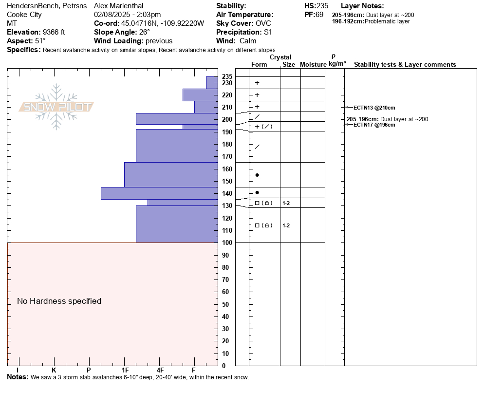
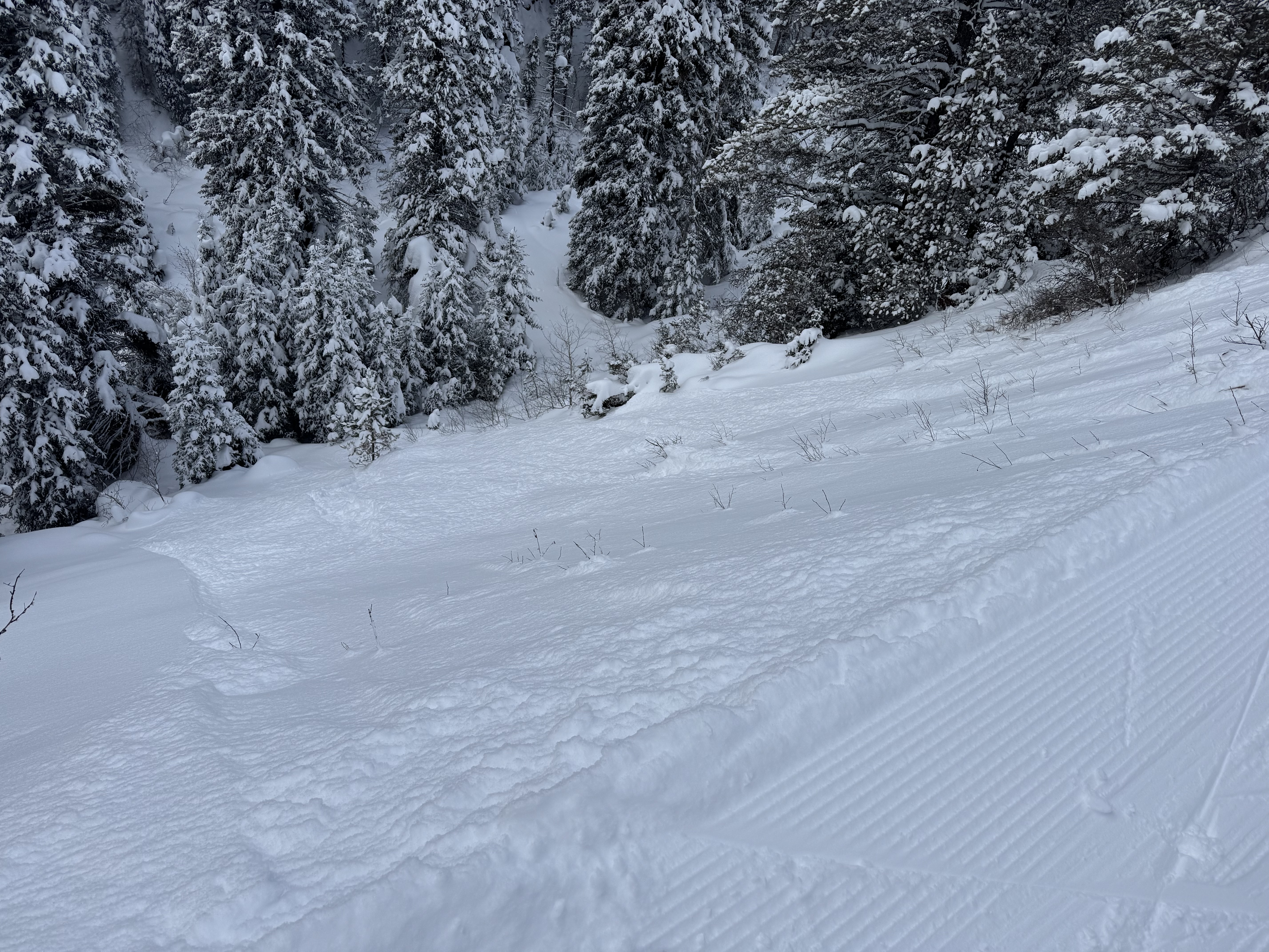
This afternoon we rode up to Henderson Bench, then up Lulu road to the Cabins below Scotch Bonnet. It was snowing lightly most of the day with light to moderate wind. Wind was steady moderate near Lulu Pass. Visibility was limited, but we got a brief look at some of Henderson Bench and Scotch Bonnet.
We saw 3 avalanche that broke 6-10" deep within the recent snow, R1-D1s, 20-40' wide.
For the next 1-2 days I expect any fresh drifts will be easy to trigger. There are some density changes within the recent snow that could cause storm slab avalanches to break easier on non-wind loaded slopes.
We dug on a northeast facing slope at 9,360' elevation. Below the dust layer that was deposited at the end of last week's storm there is a lower density layer of precipitation particles that was preserved. This produced an ECTN in our test, but seems like it could contribute to avalanches for the next few days at least. (profile attached).
Snow that fell since last weekend was settled to about 2.5-3 feet. We did find some small facets buried below the last week's snow, but they were not showing obvious signs of being a widespread problem. I am still cautious that larger, wider avalanches could break on this facet layer until the snowpack has 1-3 more days to adjust to the weight of recent snow, especially on wind-loaded slopes.
Practice cautious route finding and careful snowpack assessment as avalanches are likely within the recent snow, and possibly could break 2-4 feet deep below all the snow that fell over the last week.
Full Snow Observation ReportOverall, the snowpack seems to lack widespead pwl problem (below the recent snow), but visibility and digging was limited today. I remain hesitant until we can gather more evidence and give the snowpack more time. Potential for wind slab and storm slabs seems enough to warrant CONSIDERABLE danger. Danger could come down quickly as loading tapers off, but this could change if we see something different tomorrow like concerning pit results or larger avalanches.

Toured into the north Gallatin today and skied on north facing terrain. Saw obvious loading in the new snow up high on the ridge lines, but no recent natural avalanches. We encountered several debris piles that were covered by new snow, probably from a few days ago and likely wind slabs based on the terrain. Skiing, we triggered 3 wind slabs (ss-d1-r1) on a north west facing slope at around 7800’, each ran the entirety of the face. Notably, one of the slabs propagated above the skier and about 20-25 ft to the right. Skiing a north east slope (slightly more sheltered), no signs of instability were observed. We didn’t observe a weak layer underneath the most recent new snow, but we did see a layer of dust and crust deeper in the pack.
Full Snow Observation ReportSaw this small soft slab above Round Lake today. SE facing, 9500 ft. Likely skier triggered, there were lots of ski tracks on that hill.
Poor visibility today but no other avalanches observed.
Full Snow Observation Report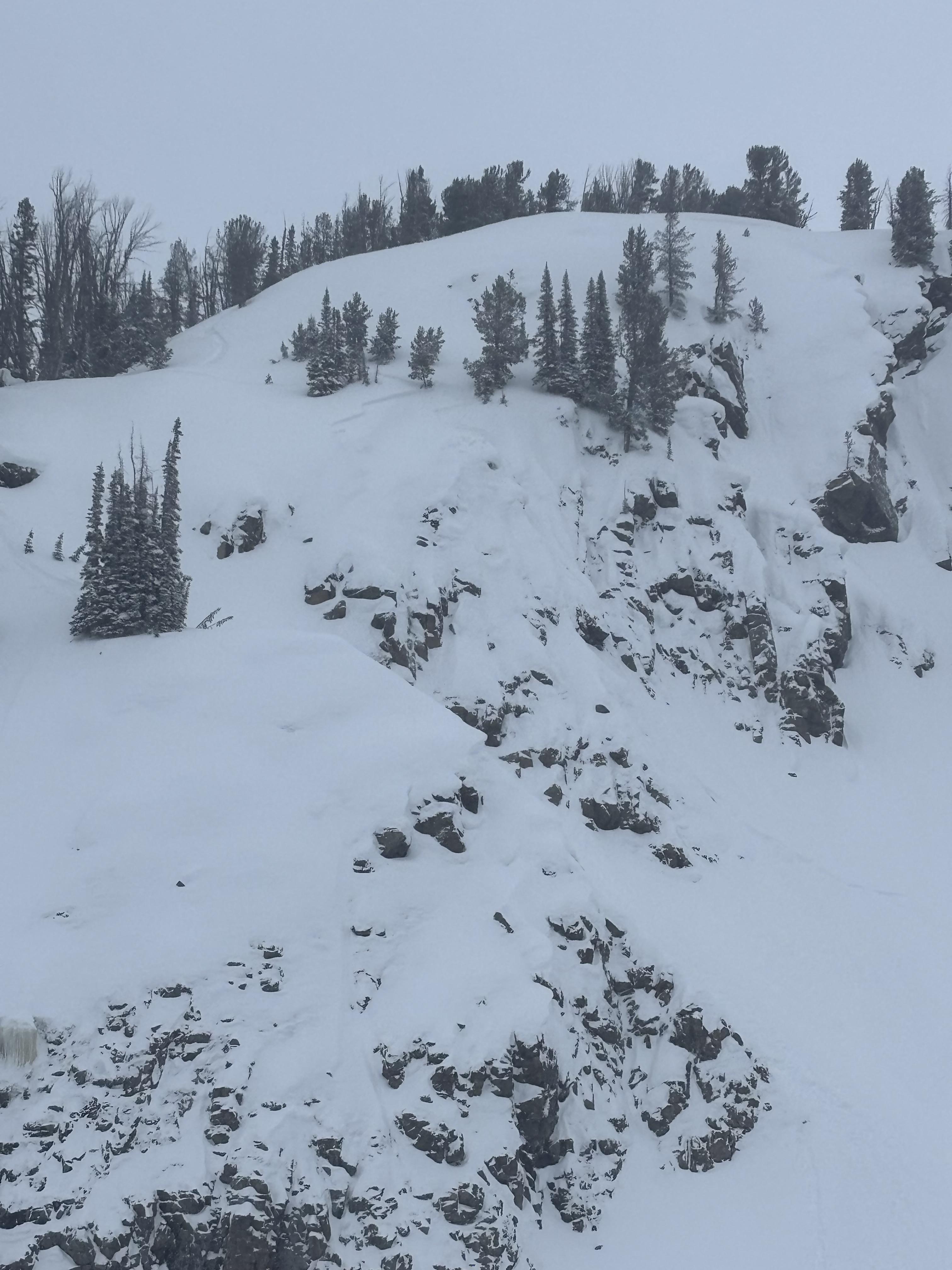
I went skate skiing up Sourdough Canyon today. The trail intersects a significant amount of south and southwest-facing avalanche terrain that generally does not have much snow coverage due to exposure to the sun.
However, the snowpack is much deeper than normal in the Gallatin Valley and in the low-elevation mountains around the Valley, and these slopes make me nervous, especially because they would impact a trail that sees heavy use by people who do not intend to expose themselves to avalanches and who are not prepared for avalanche rescue.
Currently, 2.5 to 4 feet of snow is in the terrain near the trail.
These slopes WILL probably avalanche when:
- We get the first sunny, warm day.
They MIGHT avalanche when:
- We get another big storm.
- People or animals traverse or choose to ski above the trail and inadvertently trigger a slide.
What you should do:
- Recognize that ALL steep, snow-covered terrain (30 degrees plus) has avalanche potential.
- If you choose to recreate in abnormal locations, there may be abnormal considerations and consequences--there are families, kids, and dogs below you.
- SO, Be cautious and respectful of other users. One good way to do this is to AVOID traveling in avalanche terrain above unsuspecting travelers.
Full Snow Observation Report

We rode below the Throne and towards Fairy Lake, mostly at elevations 6,800-7,500'. It snowed steady S1-2 most of the day and tapered off in the afternoon. Wind was a stout moderate out of the east and south in the parking lot. Wind was light to moderate out of the south up higher/"mid-mountain". There was a brief clearing mid-day and we could see the bowl and ridge south of Naya Nuki.
We saw a couple storm slabs that broke in today's snow 4-6" deep, 10-30' wide, and we triggered one 3-4" deep wind slab, "remotely", from a few feet back on a small ridgeline. R2-D1. These slabs were very soft, F- to F hard.
The interface below this week's storm was generally well bonded to the surface below and lacked a weak layer from the recent high pressure. I would not totally rule out the potential of something breaking wider on a weak layer because we did not get a good look at higher elevations, but so far it seems less likely to have a persistent slab problem involving a layer below this week's snow in the Bridgers as compared to other parts of our forecast area.
Full Snow Observation Report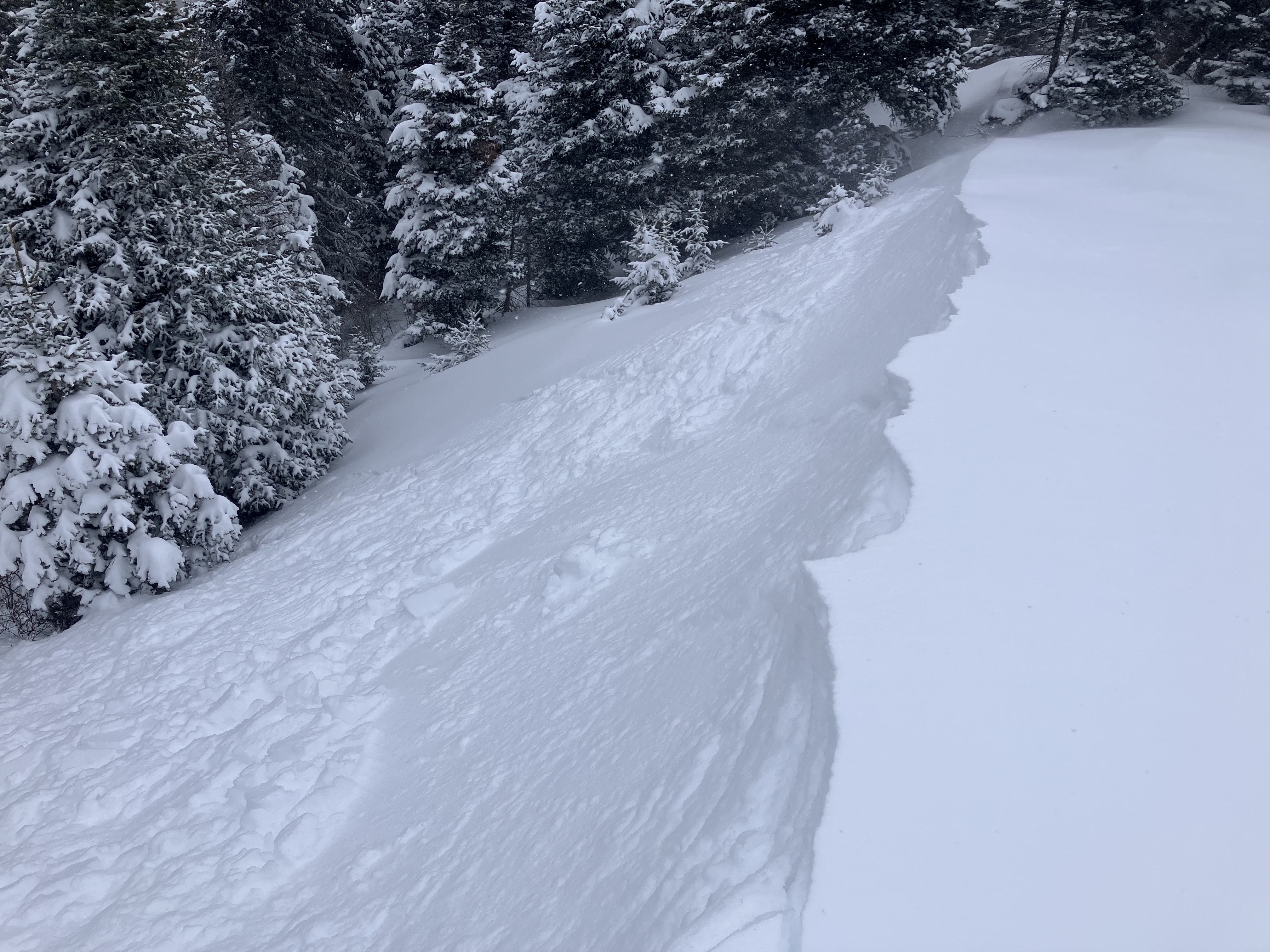

At the base of G2 I triggered a 3 inch x 100 foot soft slab. I was surprised how far it propagated. It looked like it failed on a density change under the morning's new snow. 40 feet up on the first large bench we triggered another slide, 6 inches deep, the entire width of the bench. It could have pushed a climber off if they were in the middle of it. It was snowing steady (1"/hr) and wind was minimal, but a few hours later we could see plumes higher up in the gullies.
It had such zip to the propagation that I'm thinking it might take a day for it to not be reactive. There was no way we wanted to get on anything open and steep.
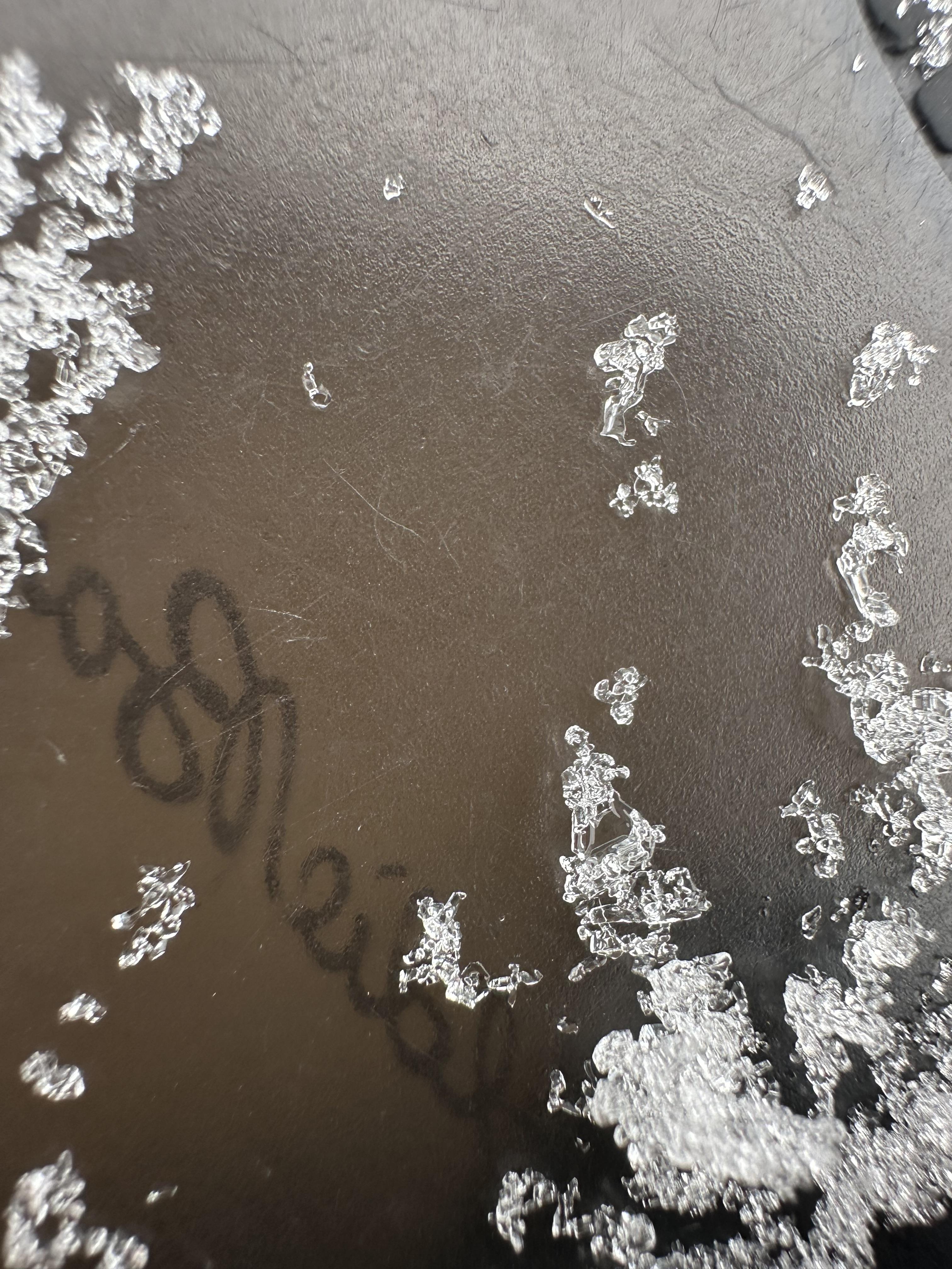
Full Snow Observation Report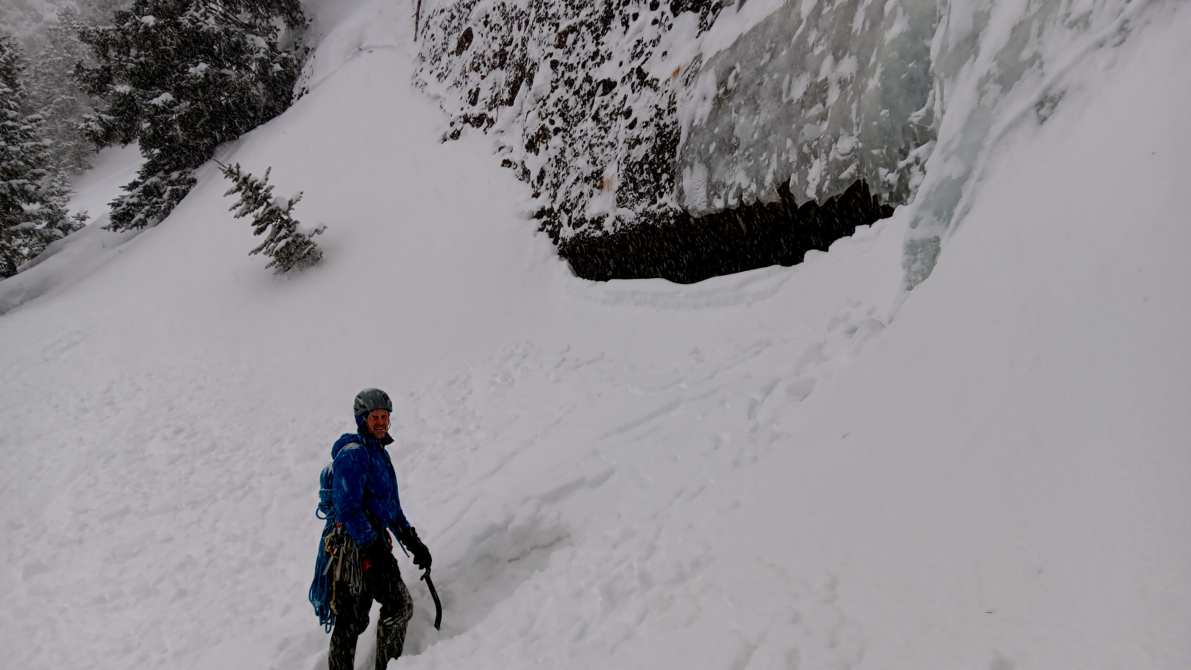
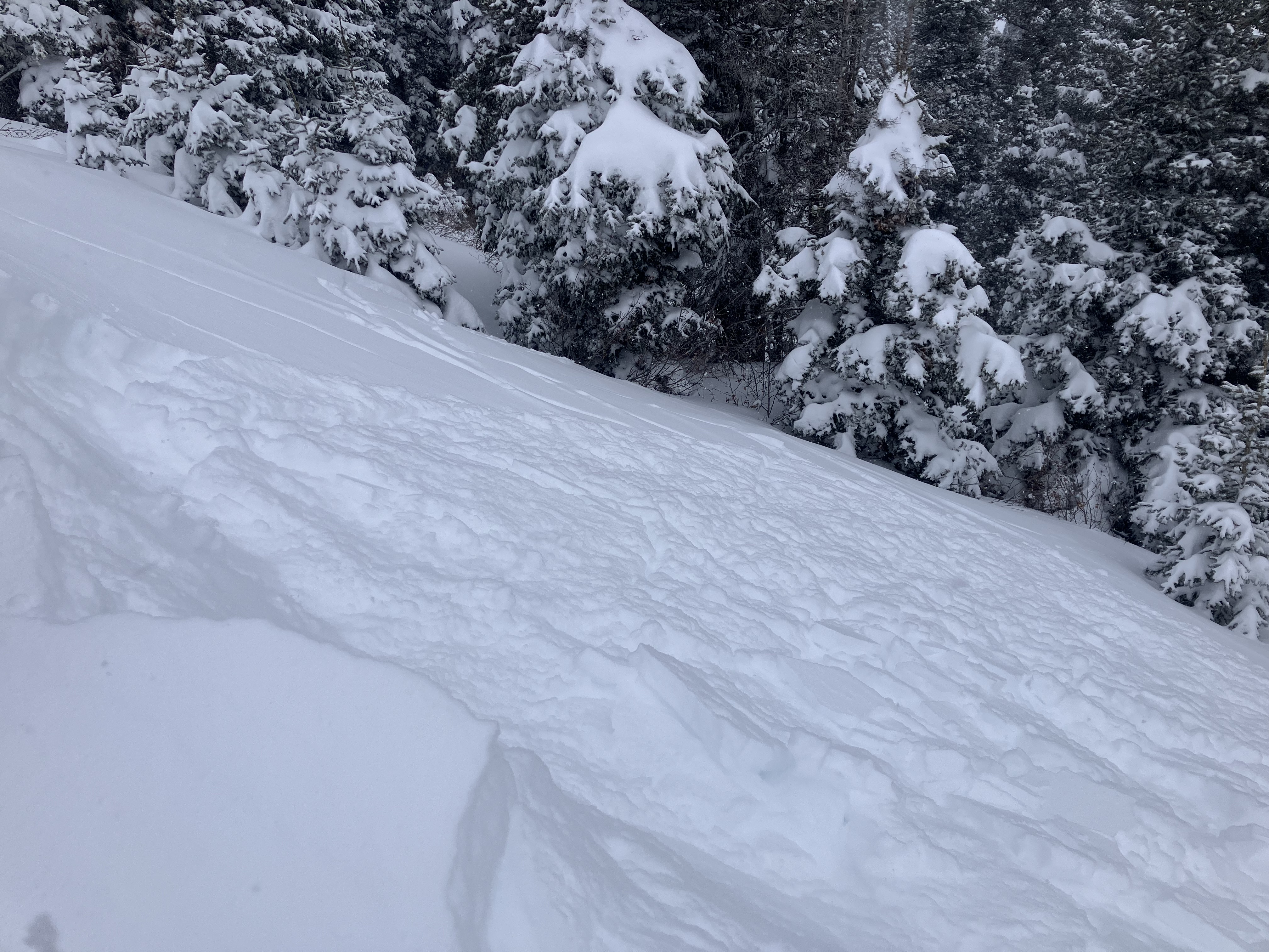
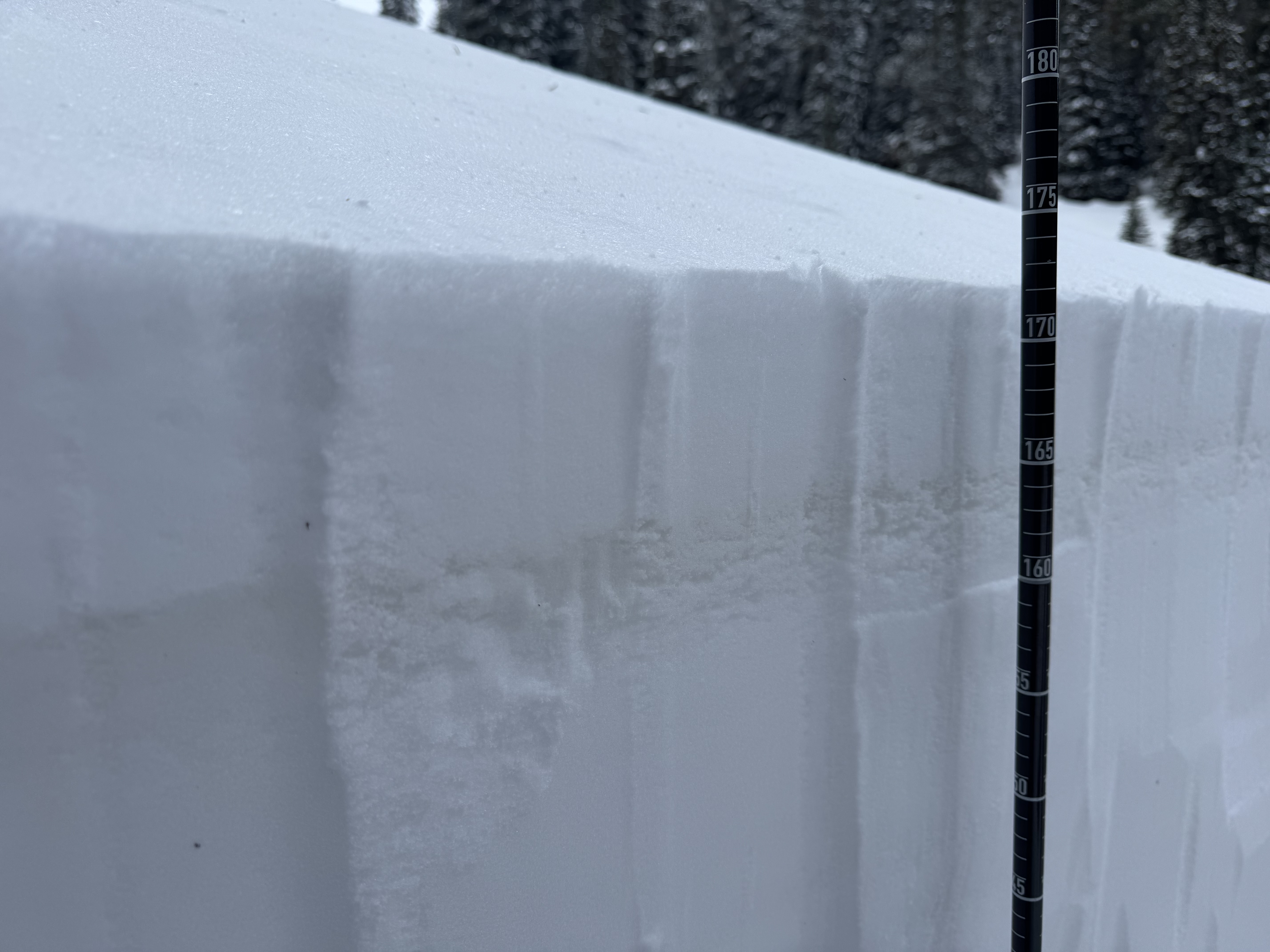
Dug on a NE aspect at about 7800’ on Mt. Ellis. Noticed pretty significant wind loading/cornice development from yesterday and was easily able to get small cornices to break off. Most notable test result was ECTP16 down 35 cm on a layer of surface hoar. Besides the concerning surface hoar layer the snowpack was generally right side up and seemed pretty solid. Photo of pit profile attached.
Full Snow Observation Report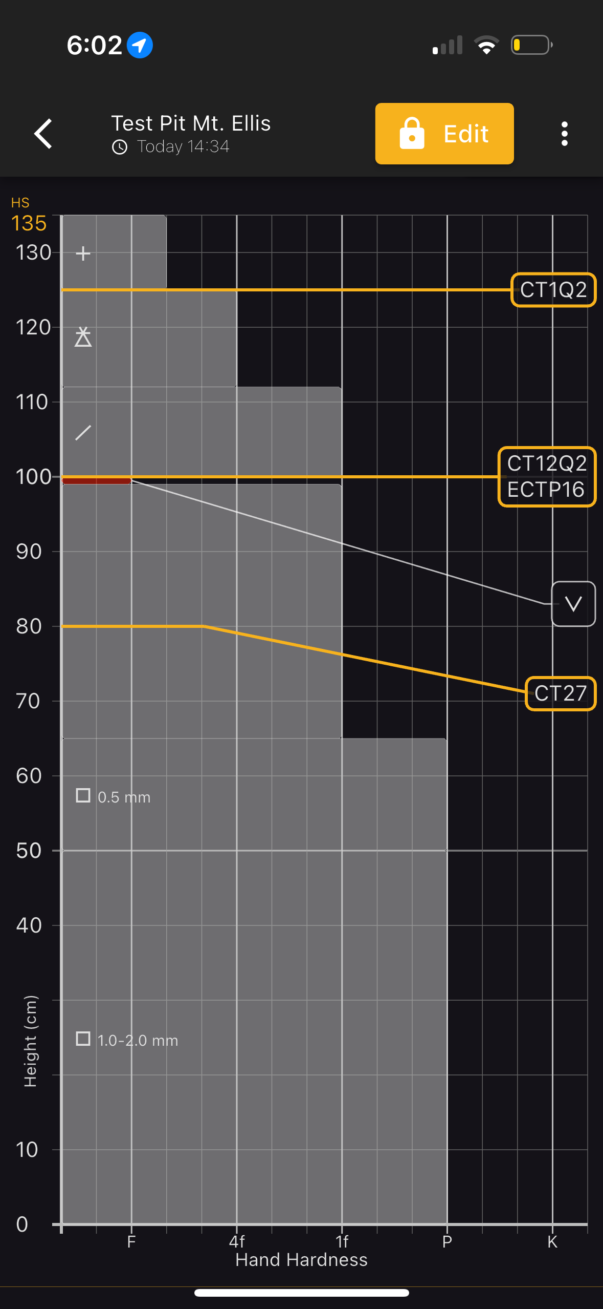
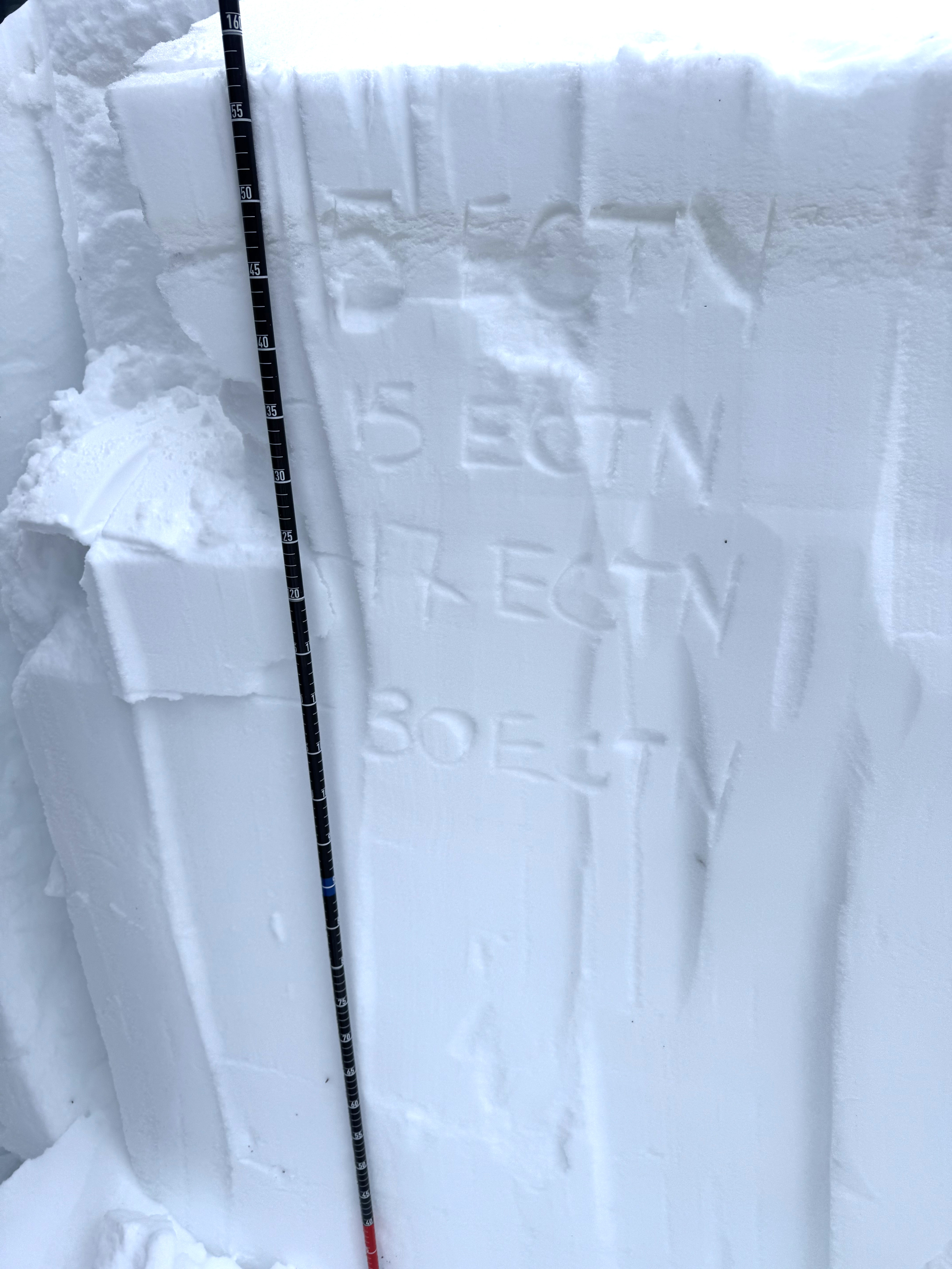
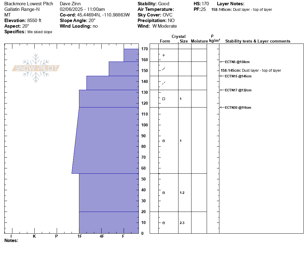
We toured up the standard ascent route on Mount Blackmore to the shoulder. Three to four inches of new snow from yesterday sat on top of the dust layer that got deposited across most of the forecast area on Monday and Tuesday.
We stopped and dug a full pit on the lowest pitch of skiing and found good stability in this wind-sheltered terrain. Incidentally, this lowest pitch was also the best skiing by a large margin. All the terrain above this was very wind-affected. We were looking for near-surface facets and surface hoar that formed last week and got buried by recent snow in some areas. We didn't find it. This bodes well for long-term stability, but we'll keep looking. Test scores were unremarkable, ECTN5 below yesterday's snow, ECTN15, 17, and 30 at various levels within last weekend's storm snow. No other failures, no propagation.
The wind had hammered snow surfaces at all elevations above this. Surfaces stiffened. There was a tree that blew over recently. Elephant Mountain and the summer trail area were scoured down to the tundra. There was evidence of several R1-2/ D1-2 wind slab avalanches that likely ran this weekend on the east face of Blackmore.
We dug again on the shoulder with unremarkable results and no evidence of new weak layers that will be players.
Bottom Line:
- Wind effect is widespread.
- It is difficult to tell precisely where loading occurred with the fresh snow covering drifts. You won't know until you move into the terrain and feel the underlying snow stiffen under your skis, board, or sled (I don't like not knowing).
- We didn't find any evidence of new weak layers of concern.
Manage it by:
- Maintaining a conservative mindset in all upper-elevation terrain that isn't obviously scoured.
- If you want to ski and ride in steeper terrain (slopes above 30 degrees), do so at lower elevations on slopes sheltered from the wind. We didn't find new weak layers below this weekend's snow, but I would still dig 2-3 feet down to look for them before committing to avalanche terrain.

Skied south of Cooke today. Winds were strong with frequent gusts to extreme out of the S. 3cm of new between 1530 and 1700. No cr, co and the wind slab produced moderate, non-planar results in hand pits. Limited vis and no avalanches observed.
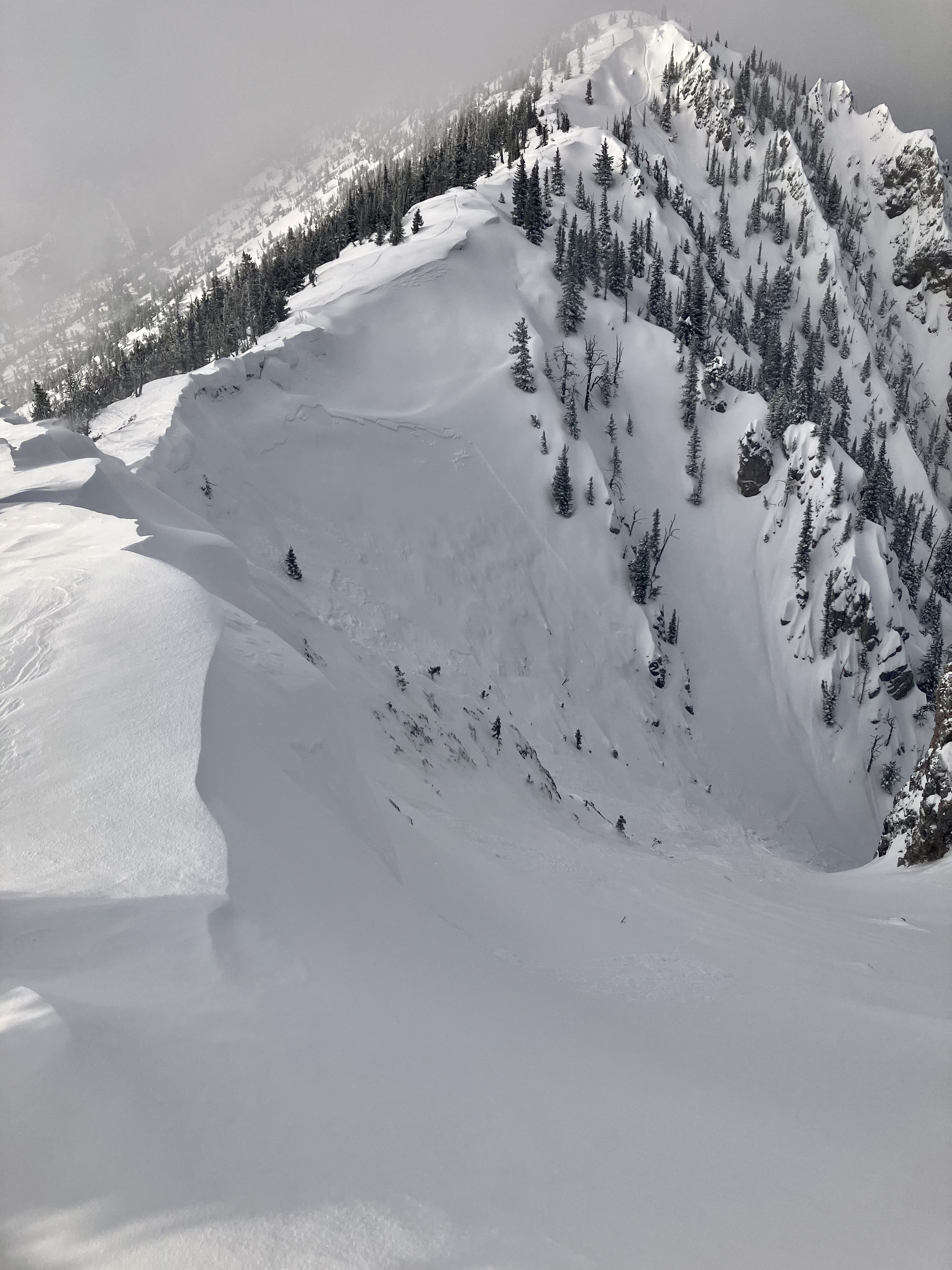
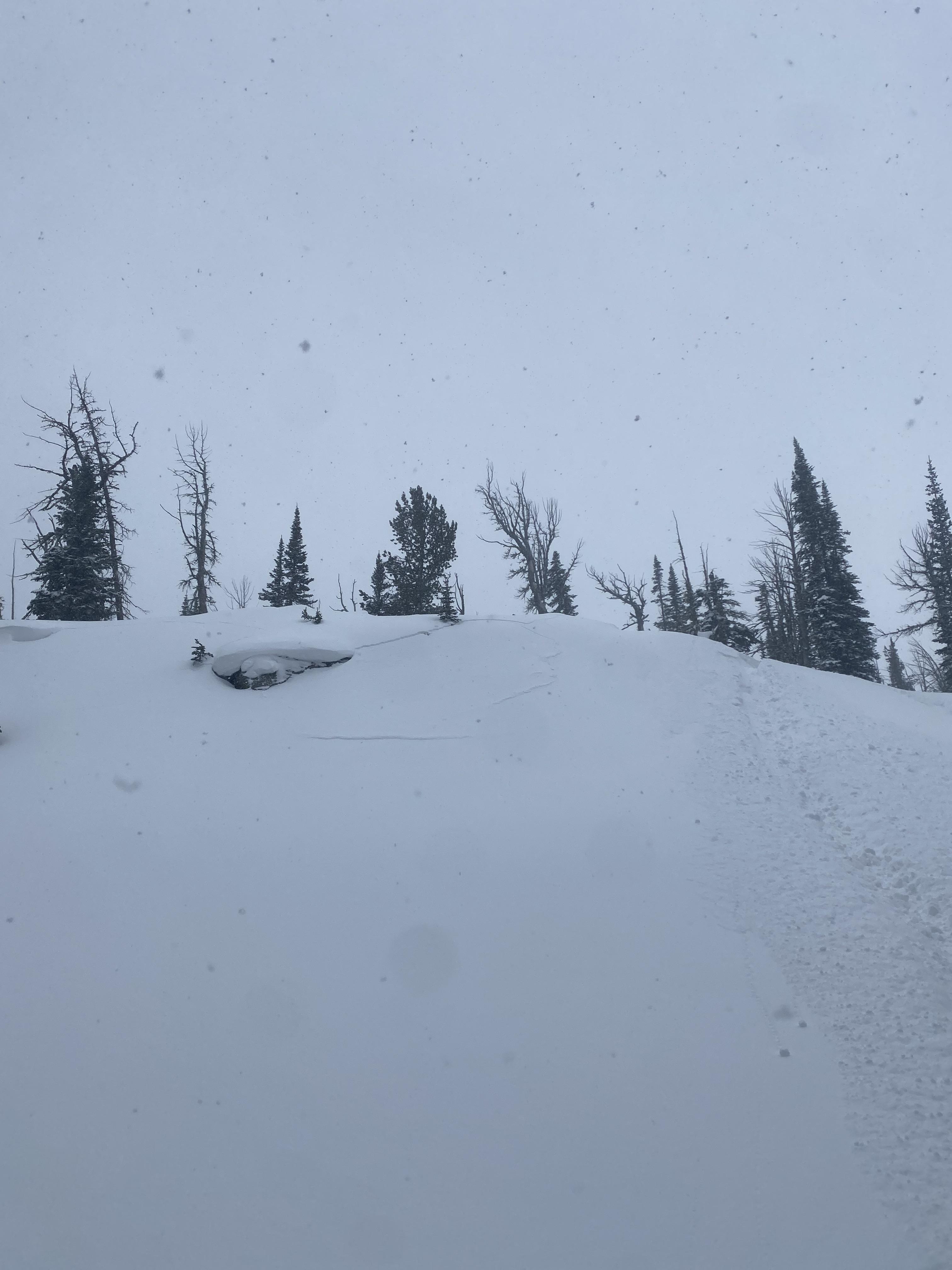
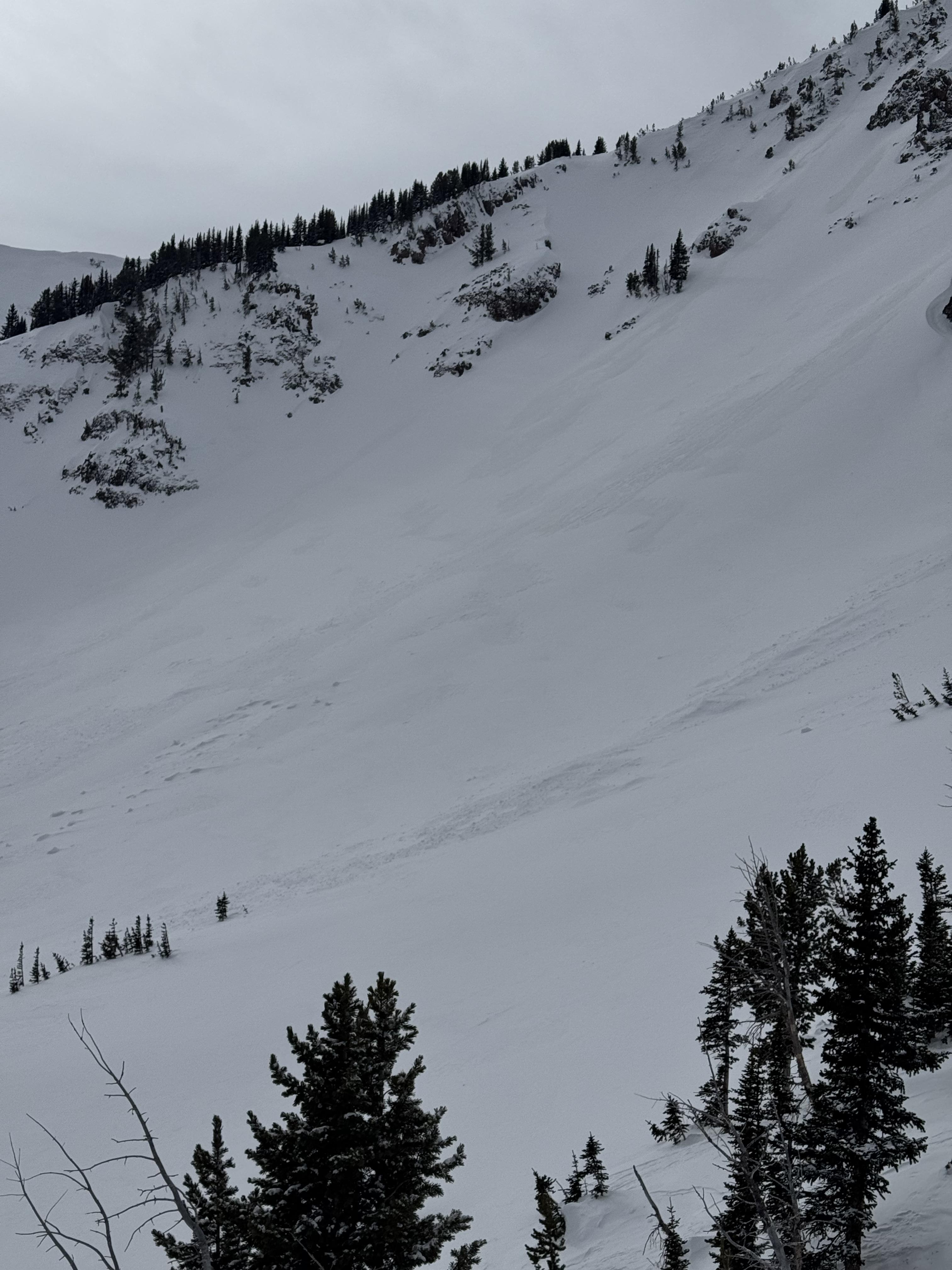
Full Snow Observation ReportToured up the ramp and north towards hourglass couloir right after heavy snowfall at Bridger. Observed presumably natural wind slab avalanche crown at top of Hourglass (picture). Broke roughly 200ft wide and rather shallow, did not manage to run fully into the apron. Also noted many other small natural avalanches almost all breaking right at the top of the ridge. Strong winds from west loading slopes. Followed some solo tracks down just skiers left of hourglass, noted some instability but no major propagation or slides while skiing. Storm slab not quite cohesive this evening, but could definitely see it getting pretty spooky tomorrow.
Full Snow Observation Report