Snow Observations List
Had several large whumphs in windslabs at the top of bacon rind today. Interestingly they only started once a few inches of new snow had accumulated from the cold front. At the end of the day the windslabs are out there with enough load to make them pretty touchy.
No obvious signs of instability where there was no wind loading.
Full Snow Observation ReportFigured I would send in some observations as we were out yesterday in Whits Lake back in Dutchman's Basin and with extreme wind the snow was getting moved around and the wind was putting snow in unusual locations. This was a wind loaded hill but a very shallow angle hill maybe 20-25 degrees. Snow broke on an old layer before this past weekend's storm, that slab was probably 14-24" think in spots. Snow was generally stable other than wind blown spots.
Full Snow Observation Report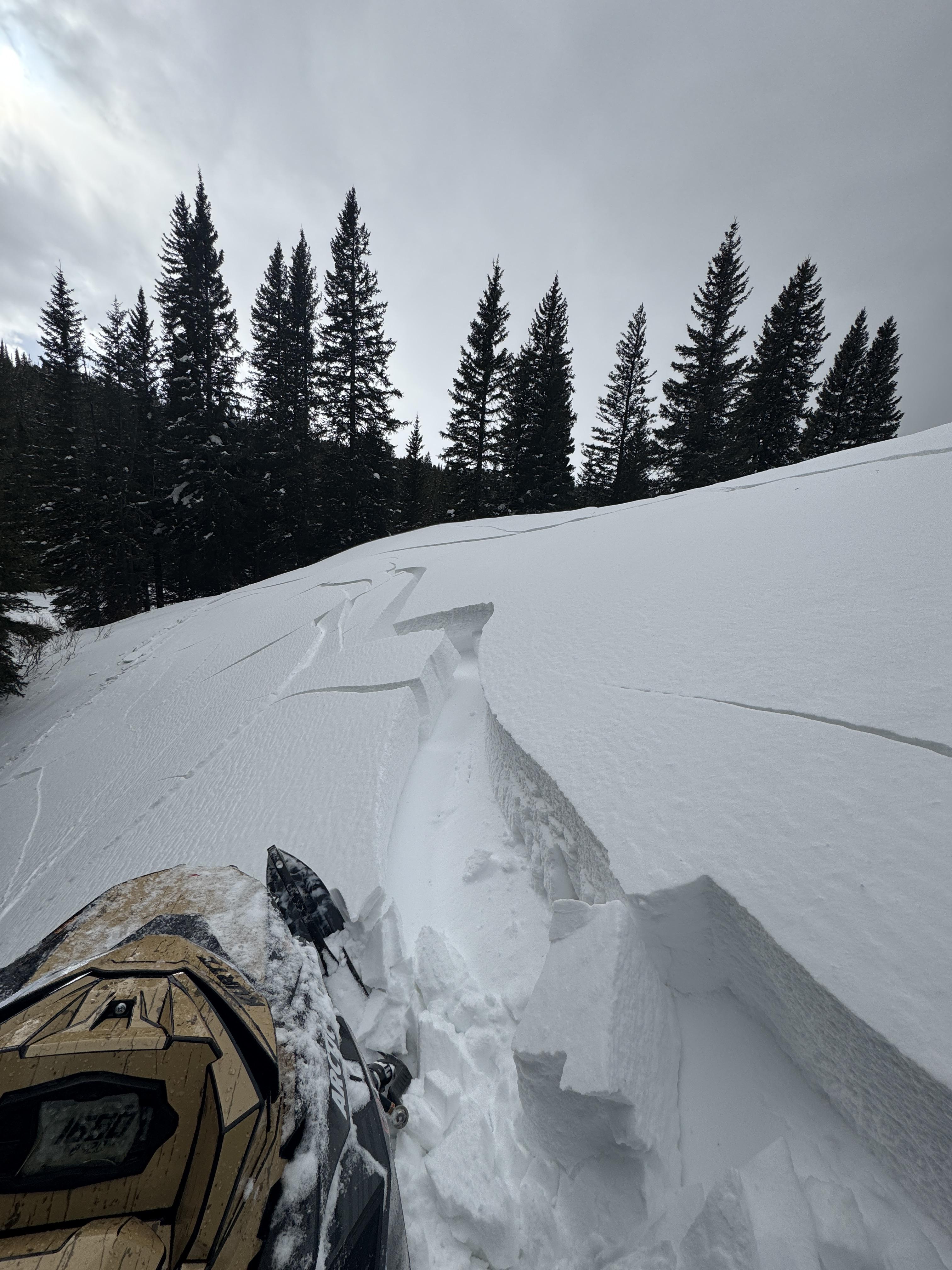
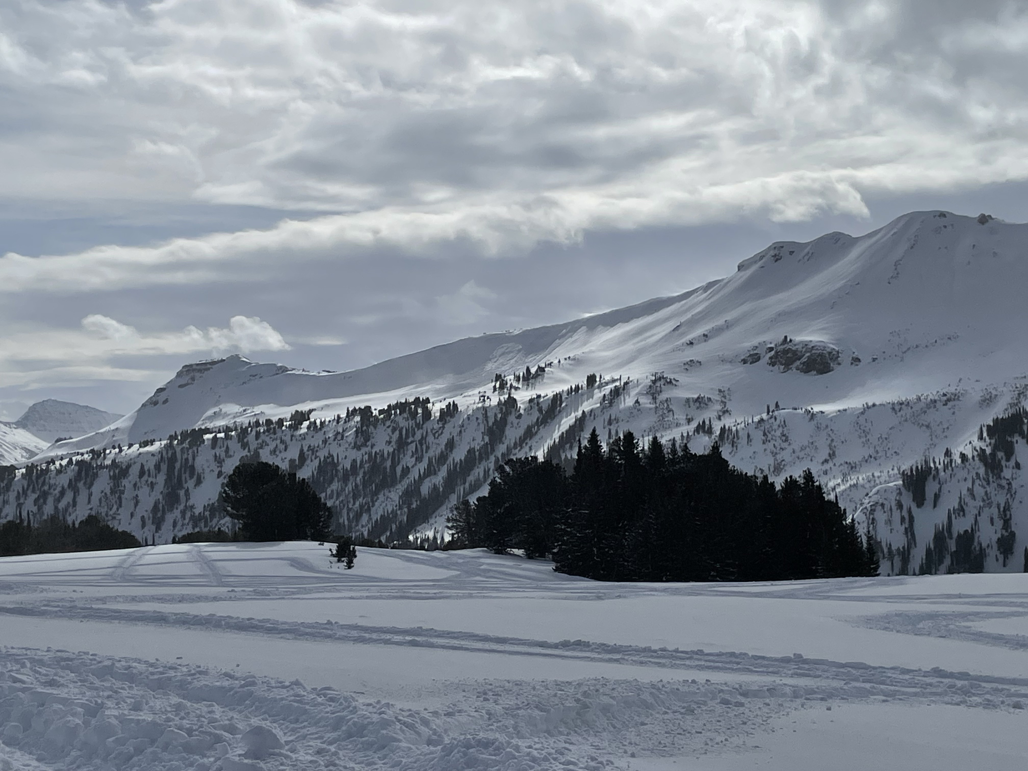
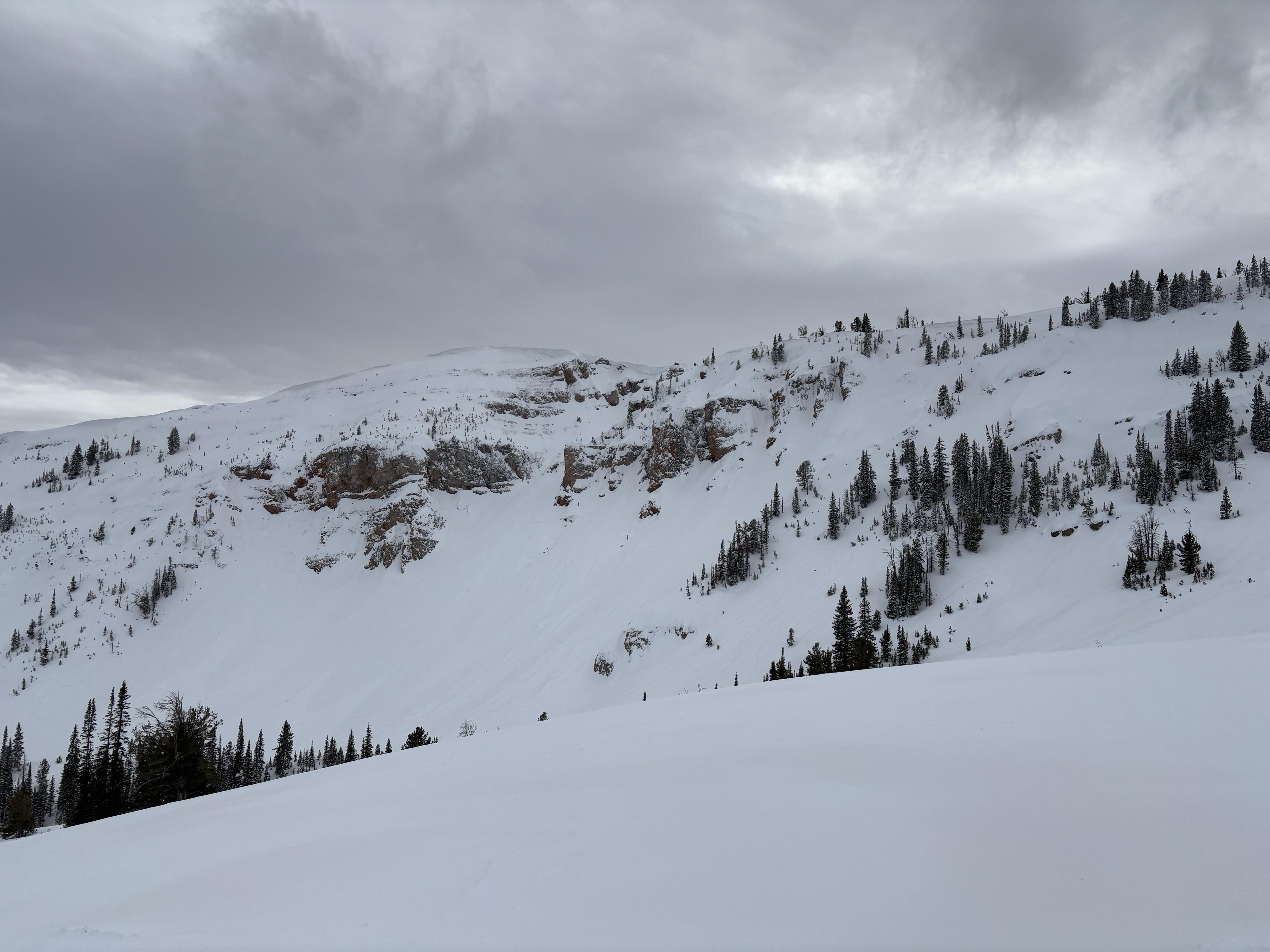
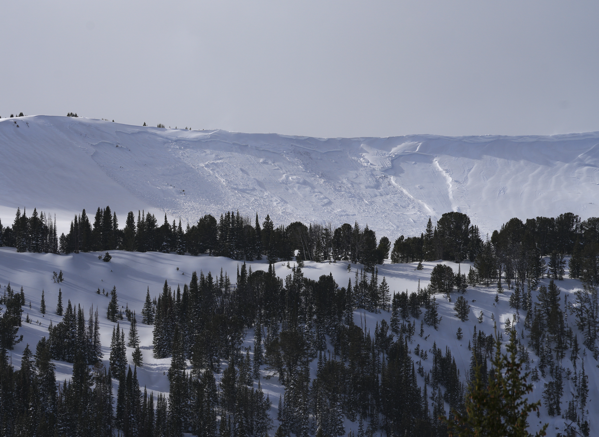
After skiing Bradley's Meadow, we skied north into Wolverine Bowl aiming to go up the backside of Texas Meadows. When we were in the large flat meadow to the north of Hourglass Chute we heard two avalanches come down from the ridge a few hundred yards north of Hourglass. Too low of vis to estimate size or see anything but the powder clouds come over the bottom cliffs.
Full Snow Observation ReportNew storm snow accumulating over the course of the morning became quite reactive once we descended out of the inversion. Significant change starting around 7,200', where the surface had remained cold. We didn't observe any signs of instability while skiing between ~8,200' and ~7,200'.
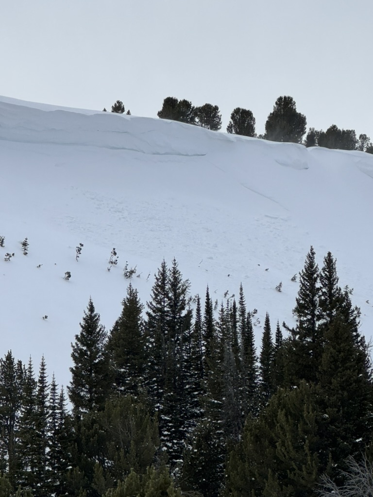
Photo is a of remote trigger, SE facing slope, ~100' crown, ~3" depth. Lots of shooting cracks and smaller remote triggers while touring out the FS roads.
Full Snow Observation Report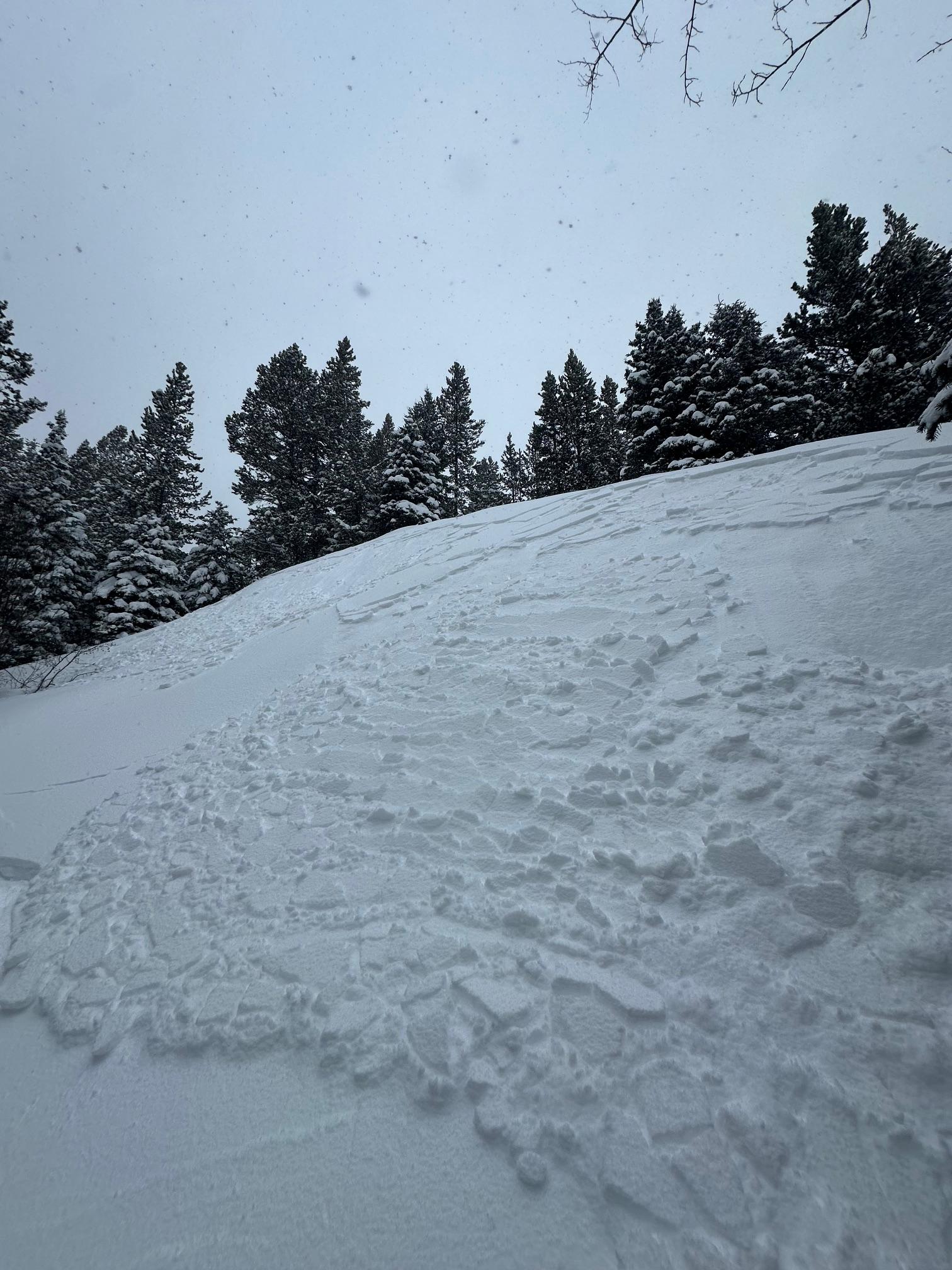
Skied big Ellis this morning. The temperature inversion was still active but not as dramatic as yesterday. The snow in the warm zone, near the top, of the inversion was well bonded and clearly affected by warmer temps. It was snowing hard up there but coming down as graupel. In the cold zone of the inversion the new snow was extremely active. We were remote triggering every small slope we passed on the gully exit. We saw many naturals breaking on any large open slope in the gully. The snow on the cold side of the inversion was blower but not bonding well at all. Could be a very sketchy setup if you find your self skiing in avy terrain that stayed cold over the last few days.
Full Snow Observation ReportSkied the East Meadows of Ross Peak, had about 4 inches of fresh snow come down in 2 hours. Lots of cracking and small storm slabs remote triggering on small rollovers on the way out. This was a small remote trigger next to the skin track, about 20 feet wide by 10 feet long. New wet snow seemed especially poorly bonded with the old snow below 7000 feet where the snow fell on very cold snow from affected by the inversion.
Full Snow Observation Report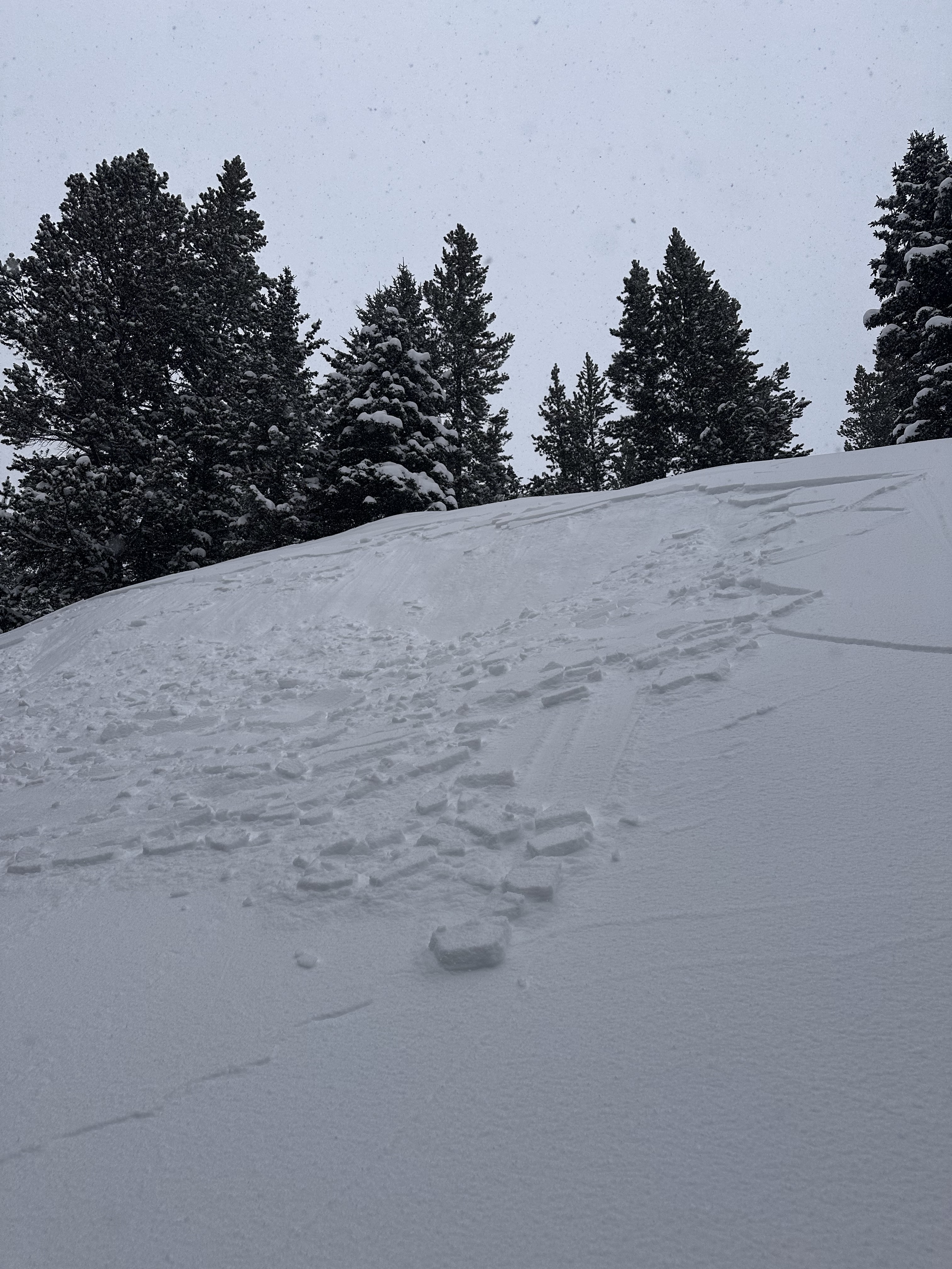
Started touring from the road around 8:30, with temps just above 0F. Half an hour later and 200 feet higher (~6150 feet) we were down to base layers and temps were above freezing. The top 5cm of surface snow was moist for most of our tour, with about 15-20 cm of dry snow below, overlying a buried crust in most areas.
As we got higher (~7000 ft) we noticed roller balls from the previous day, as well as dust on the snow surface.
Above 8000 feet surface snow became mostly dry on northerly aspects but a surface MFcr or a thin layer of moist surface snow still existed on southerly aspects. We skied a northly aspect first and it wasn't too bad.
Around noon graupel showers turned into S2 snowfall with sustained strong winds at ridgetop. A very abrupt change in weather and snow conditions. As we descended and drove back to Bozeman the temperature inversion was still going strong.
Our main thoughts are that this bodes for weird things to come. The snow yesterday was falling on a crust at higher elevations, but burying cold (potentially faceted?) snow at lower elevations. There were signs of developing wet snow problems at higher elevations but mid-winter conditions at lower elevations. It seems like our standard way of thinking about avalanche problems/hazard distribution may have to become inverted along with the temperatures.
Full Snow Observation Report
Swift Current lift shut down all day Wednesday 2/5/25 by ski patrol
Full Snow Observation Report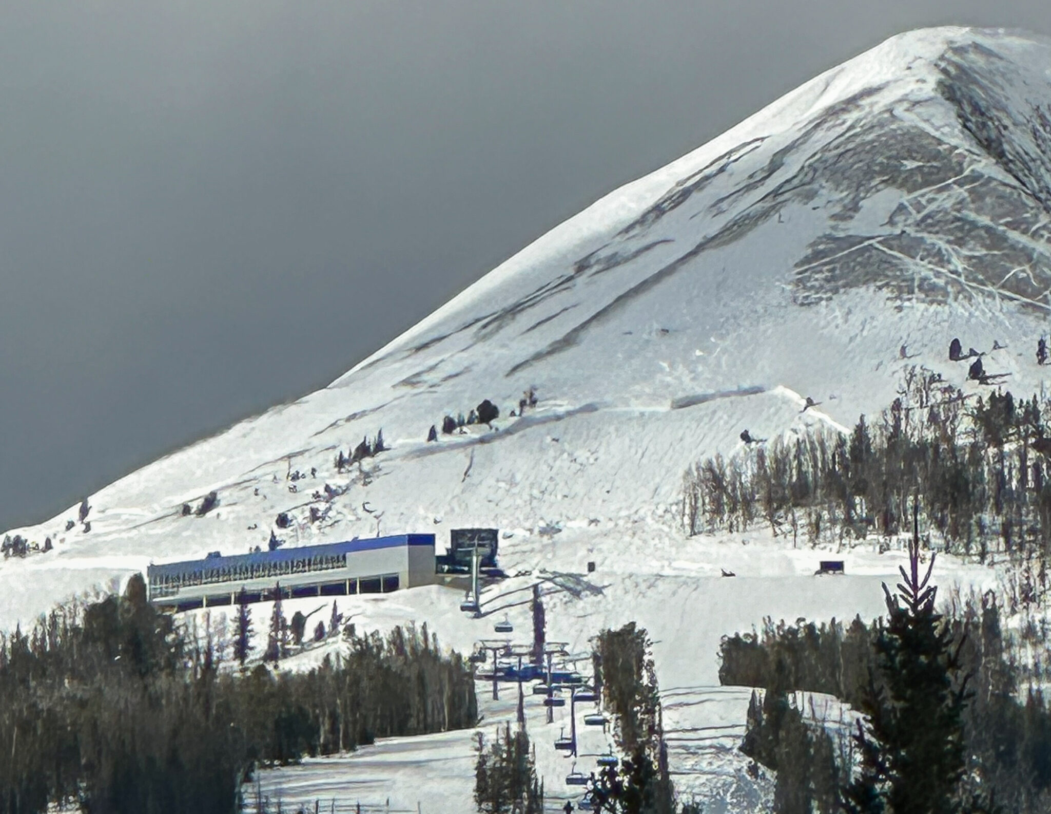
We toured up Lick Creek today. The temp in the parking lot was 17*f temperatures warmed as we climbed out of the valley. At the top of the ridge at 8450’ it was 45* +/- a little on the little thermometer on my pack. The snow was wet and heavy, ski quality was mediocre to poor. Things were stable with nothing moving. Lots of glopping on the skins! The ski out was ok in the track but sticky elsewhere making things somewhat challenging. Back at the parking lot at 3 pm it was 15*f. The last 100’ to the road was cold powder.
I have never seen an inversion quite like that!
Saw a number of slides today, as to be expected. All the large ones I noticed were north facing. Also, the dirty snow was so odd to see mid winter. It was brown all over the sled zone.
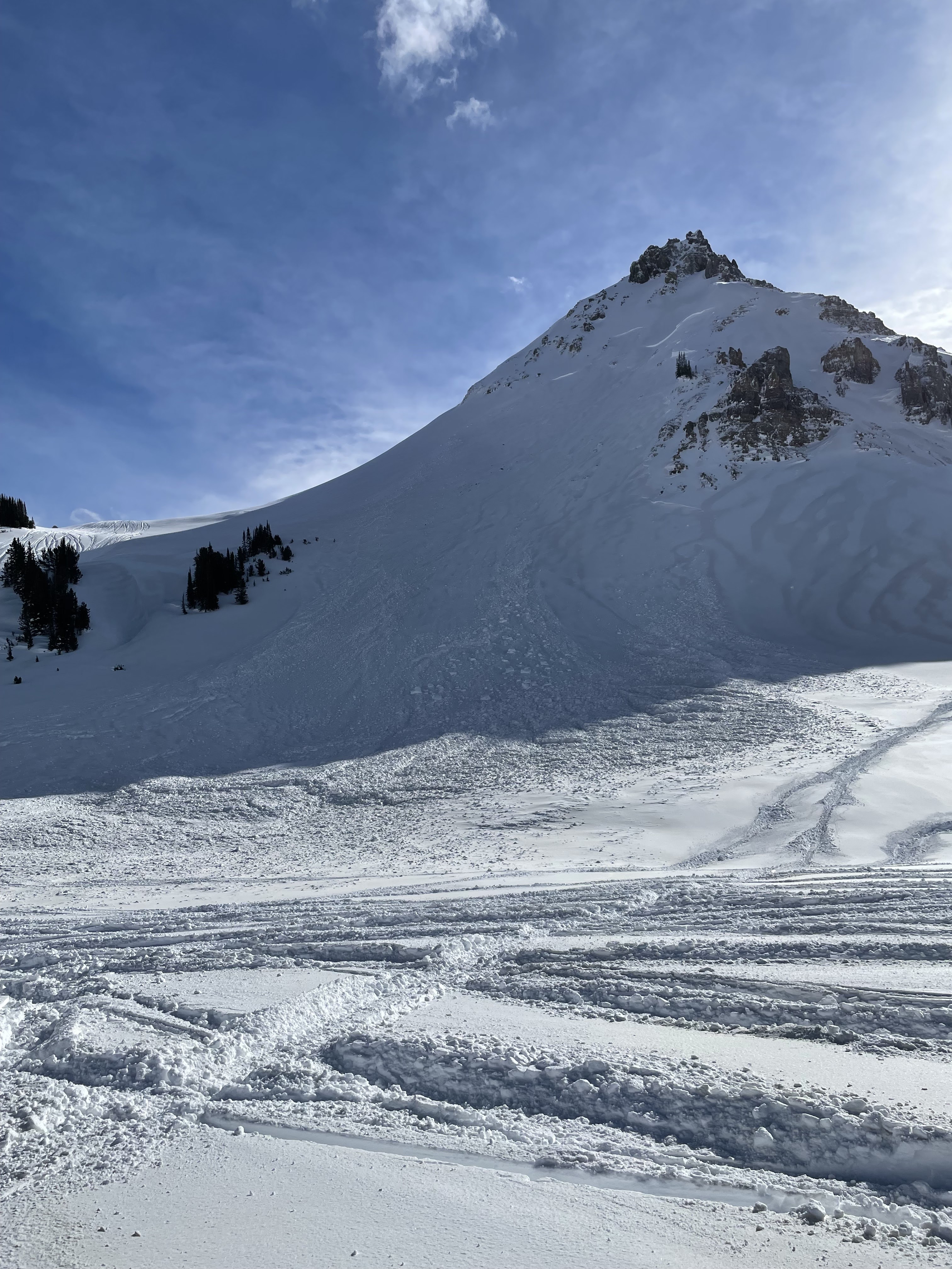
N face of crown butte, looks like it slid before the dirt event (we think the end of the storm yesterday/ or last night must have been dirty snow?). It was extremely deep and terrible vis yesterday, but blower snow. Not the case today with how warm it got.
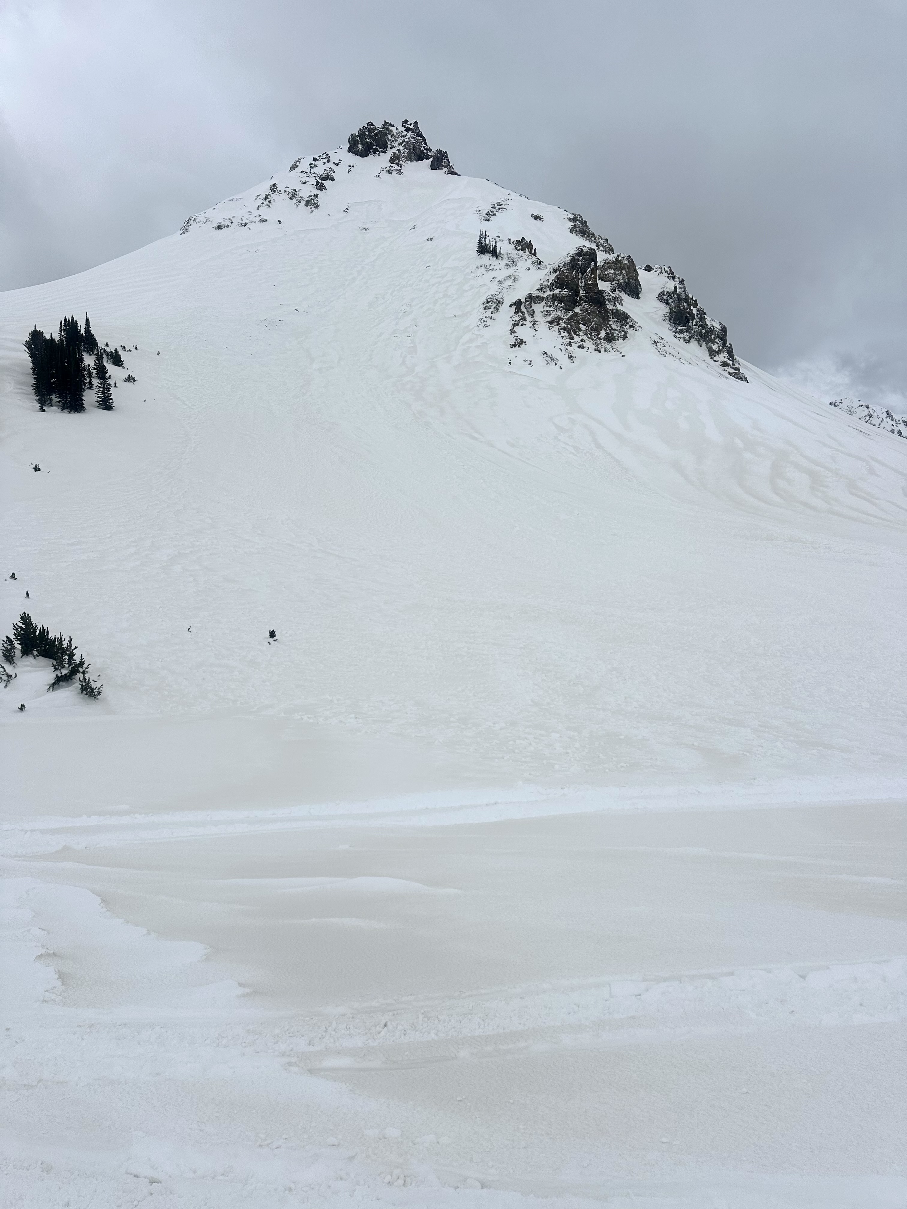
This is the N side of scotch bonnet, looks like a big break, didn’t get any closer than this however.
Also saw some decent sized slides on the N side of Henderson, but was too far away to get photos.
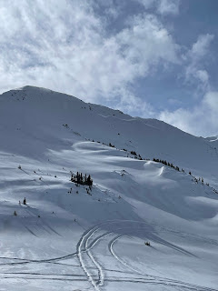
Just a little wind load cornice break, but it broke while I was coming down that track to the right.

While sledding today we observed 3 different avalanches. The first was on E Henderson above the bench in nearly the same spot as the 12/30 avalanche. It ran sometime between 11:30 and 12:30 today.
The second was on the north aspect of Scotch Bonnet. The third was on the north aspect of Crown Butte. We don't think these broke on any deep PWLs, since none of the crowns were impressively deep. The latter two likely ran at the end of the storm yesterday. The crowns were starting to drift in, but there was little to no new snow on the debris.
Notably, there is a widespread dust layer on the snow surface, and possibly another layer further down within the recent storm snow.
Blowing snow was moderate to intense at ridgetops and west aspects are scoured. Winds were light to moderate out of the S and W. Skies were SCT to BKN.
Full Snow Observation Report
Shooting cracks on Tick ridge in the Dudley drainage. This slab from my ski cut was about 20” deep and 60’ wide. It’s NE facing so pretty wind blown. I took a gladed path but in more open sections I imagine this would have propagated much wider and further downslope. Probably 35 degrees here.
Full Snow Observation Report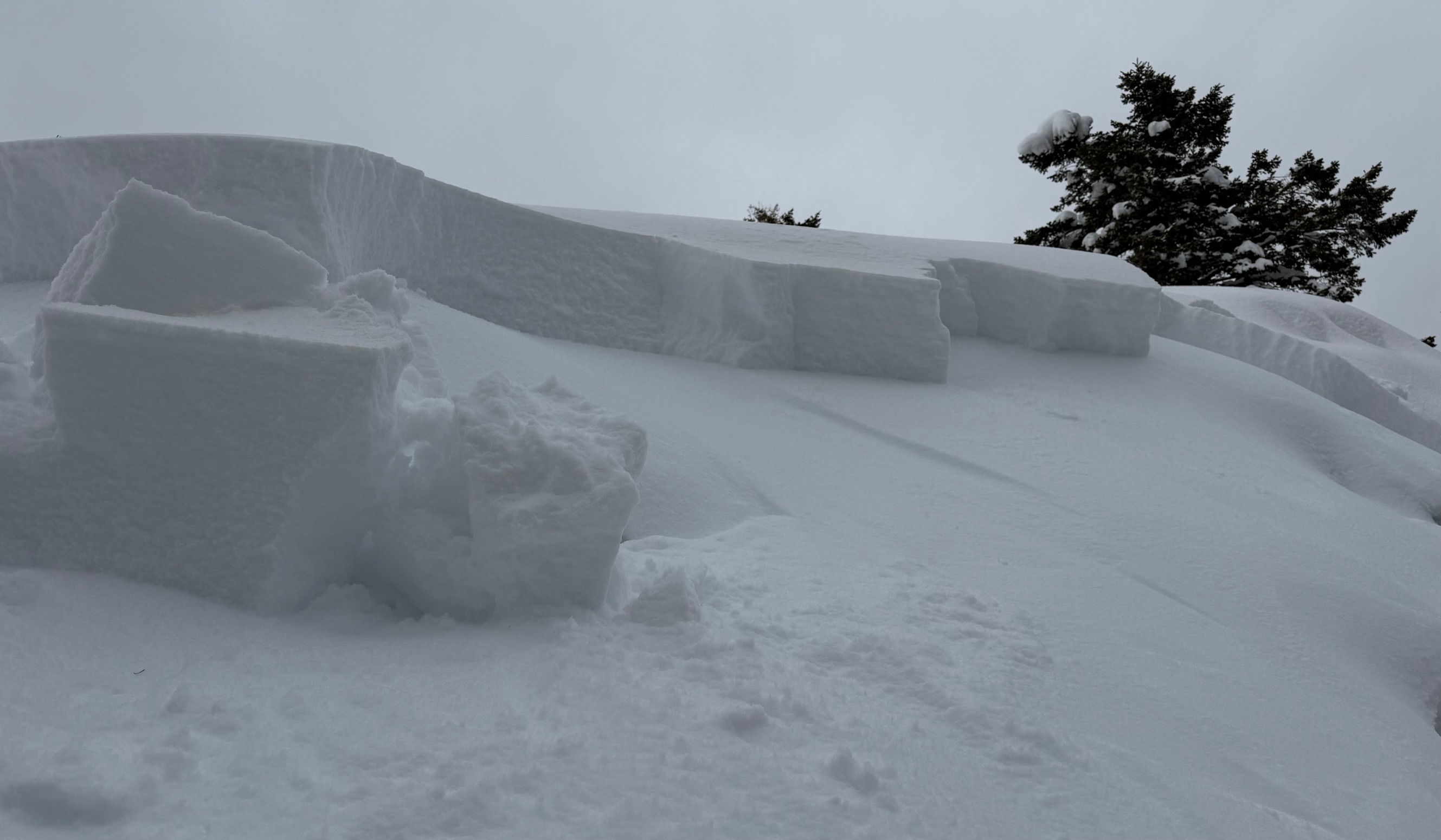
Today, we had the pleasure of riding with USFS Snow Rangers from Bozeman, Livingston, Gardiner and Cooke City. We rode into First and Second Yellow Mule and Buck Creek drainages.
Temperatures were warm, topping nearly 40 degrees at the parking lot around 4pm. Strong winds blew all day from the SW, sustaining 30mph at ridgelines. Snow was actively transported all day by winds, and plumes were visible on far away ridgelines and summits. There was around 1.5-2' of new snow from the weekend. Widespread dirt and/or dust was also noted on snow surfaces.
Our primary concern today was slopes where strong winds had formed thicker slabs from recent snowfall. On the headwall of the Second Yellow Mule, we saw two recent wind slab avalanches. These were small (R1 D1), immediately below the ridge, and likely broke late last night or this morning.
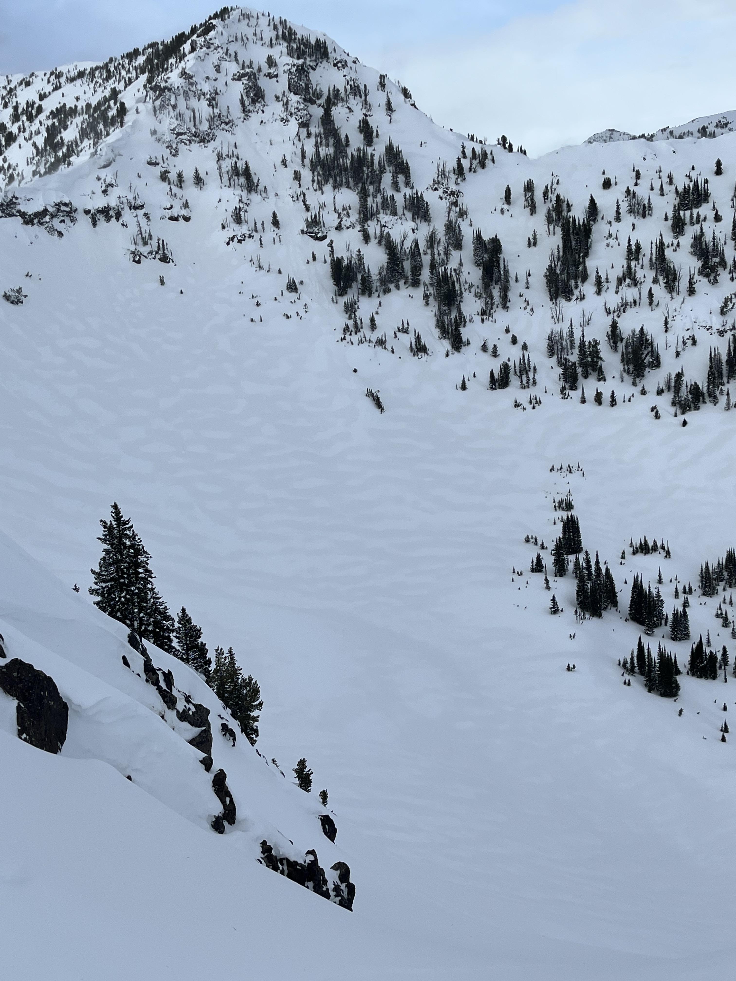
Our snowpits today were relatively anticlimactic. We were curious as to how recently buried weak layers were reacting to the new snow. In three separate locations, we performed multiple tests and saw high scoring propagation in only 2 of 9 total tests. This propagation was difficult to replicate. We had ECTN's within the new snow and on the new/old interface. We found broken surface hoar feathers and facets under the new snow, but even those weak grains were not visible in every pit. That being said, we did not travel into Bear Basin, where, prior to the recent snow, Alex found large, buried surface hoar (https://www.mtavalanche.com/node/33832). We did not observe any cracking or collapsing.
Full Snow Observation Report

We toured up Lick Creek today. The temp in the parking lot was 17*F, temps warmed as we climbed up out of the valley. At the top of the ridge at roughly 8450’ the temp was 45*F in the shade according to my zip o gauge thermometer on my back pack +/-. The snow was wet and heavy, ski quality was mediocre to poor. The conditions were stable with nothing moving and lots and lots of buried tracks. There was lots of glopping on the skins! It was quite a problem. The ski out was ok in the track but sticky elsewhere making making things somewhat challenging. Back at the parking lot at 3pm it was 15*F. The last 100’ to the car was cold powder.
I have never seen an inversion quite like that!
sorry no pics or video.
Thank you for the work you do!
I hope this is useful and not redundant.
Jon Goodman
Full Snow Observation ReportPlenty of wind slabs ranging in size on Lionhead ridge and on surrounding slopes. Noticed a few natural slides on the way in, a few more on the way out that were rider triggered. Snow was quite wet by this afternoon @8500’.
Full Snow Observation Report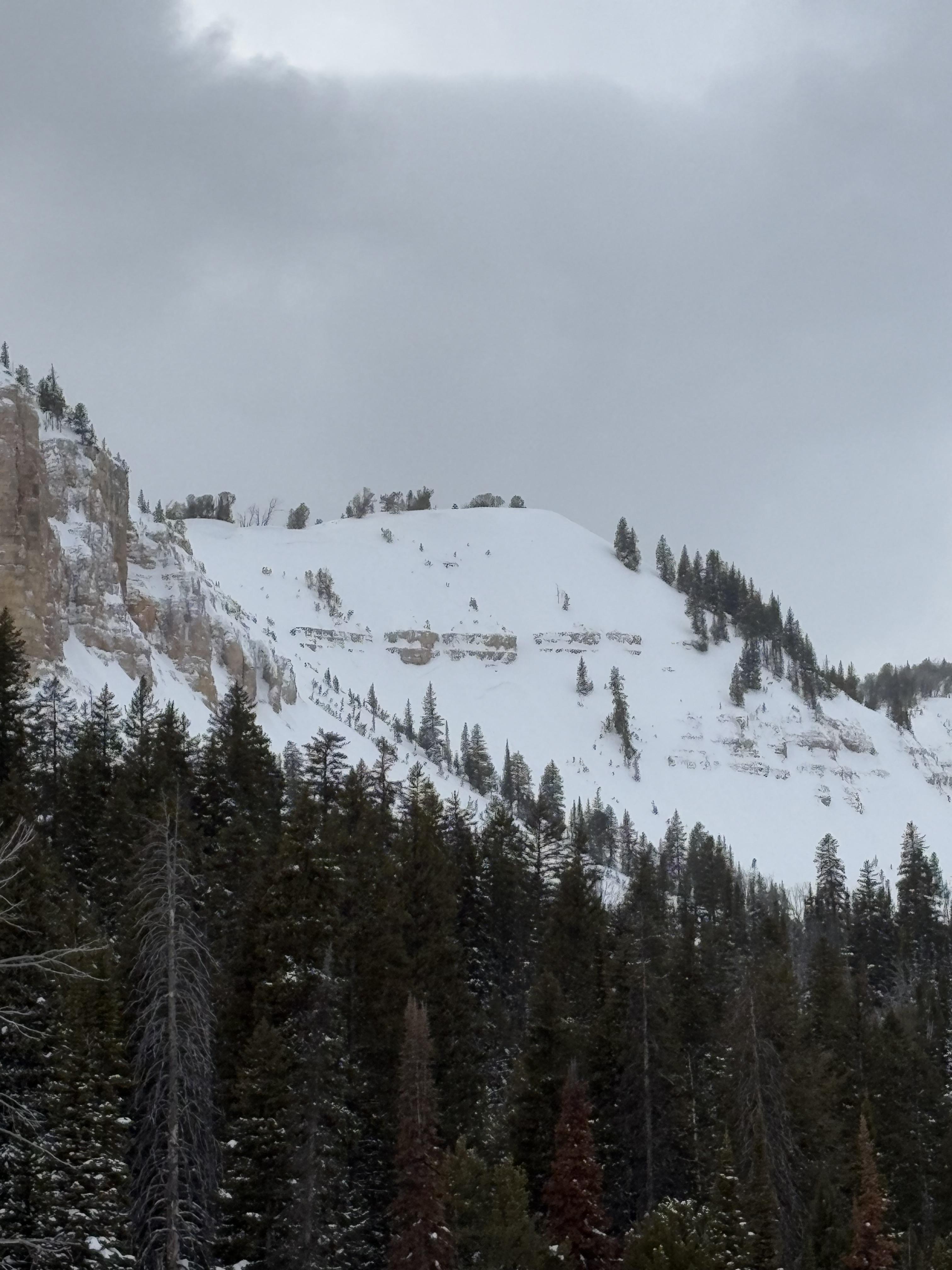

Afternoon ski/ snowmobile tour north of Cooke City today. Some recent avalanche activity noted on east Mt. Henderson, and NE Miller Ridge. Photos attached.
Very warm temps today (33F for a high at Fisher Creek, but 47F at 2pm the NE Entrance!)
There is now a widespread dust/ pollen layer on the snow surface from recent strong SWerly winds also.
The new snow was a bit upside-down and sticky today with the warm temps, but still skied well on the right aspects and timing.
I measured the new snow depth up near the base of Lulu Pass and was finding 65cms settled new. Much less in the lower elevations around Cooke City though.
Also, yesterday we were ski touring up Republic Creek on westerly aspects of Woody Ridge. I was able to ski cut a small test slope and get a wind slab to crack and move a short distance (6" deep), but aside from that, no other natural avalanche activity noted on west Woody (good visibility in afternoon on exit).
Also, on our exit yesterday we observed 3 D1 storm slab/ wind slab natural avalanches on east Mt. Republic. All mid slope, where it is common for cross-loading. These appeared to be failing at the new/ old interface.
No collapsing noted the last 3 days of ski touring.
Full Snow Observation Report
I went for a walk up the main fork of hyalite today and observed a very dirty snow surface from the strong SW winds, also the cornices are growing rather large from the recent wind
as the day progressed the snow surface became moist on any aspect that the sun kissed along with roller balls coming off rocky terrain
The dry powder took a beating from the warm temps in the alpine
Full Snow Observation Report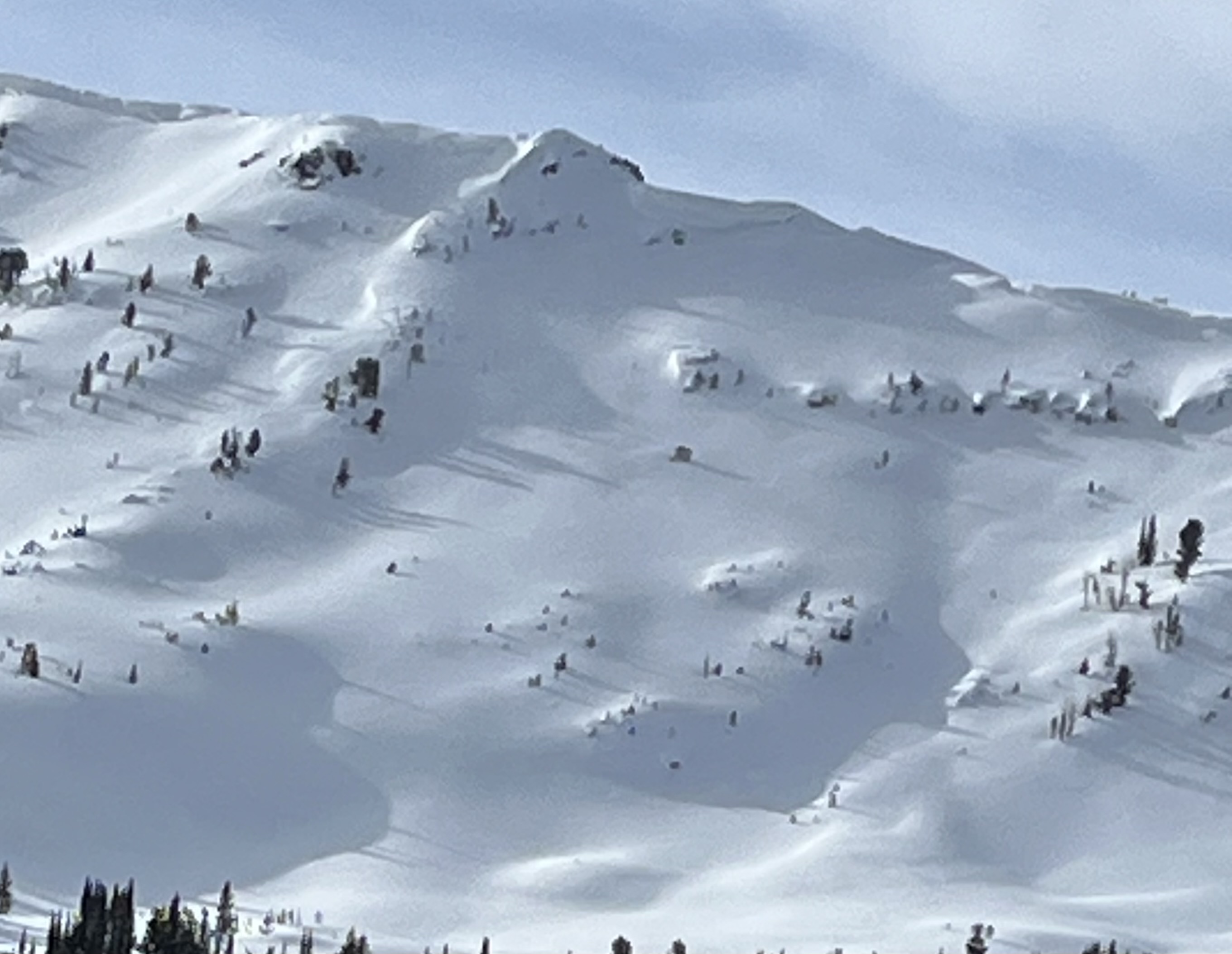
Toured up around fairy lake today, winds were ripping all day. Saw several d1 soft slabs in upper elevation terrain, many of them running quite far. We opted ski a lower elevation zone and were surprised to find a soft slab (d1/r1) that ran on an east facing slope at about 7500’ and about 500-600 ft below the ridge line on a slope just over 30 degrees.
Full Snow Observation ReportFrom FB Messenger: re-entry triggered avalanche in the Lionhead area (R1,D1)
Full Snow Observation Report
During a full day of ski touring near Round Lake, we saw about 4" of new snow. Hard to tell though because the wind was really blowing snow around. I saw two small shallow wind slab avalanches but vis was poor.
Full Snow Observation Report