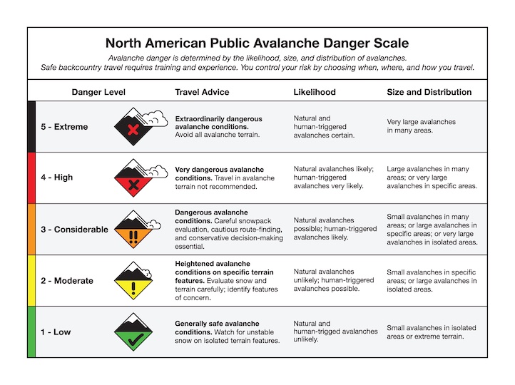
Snow Observations List
Noticed crown and debris on drive up Bridger Canyon this morning. Looks like a wind slab.
Full Snow Observation Report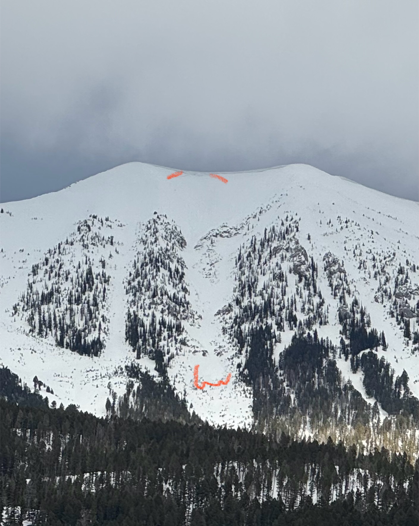
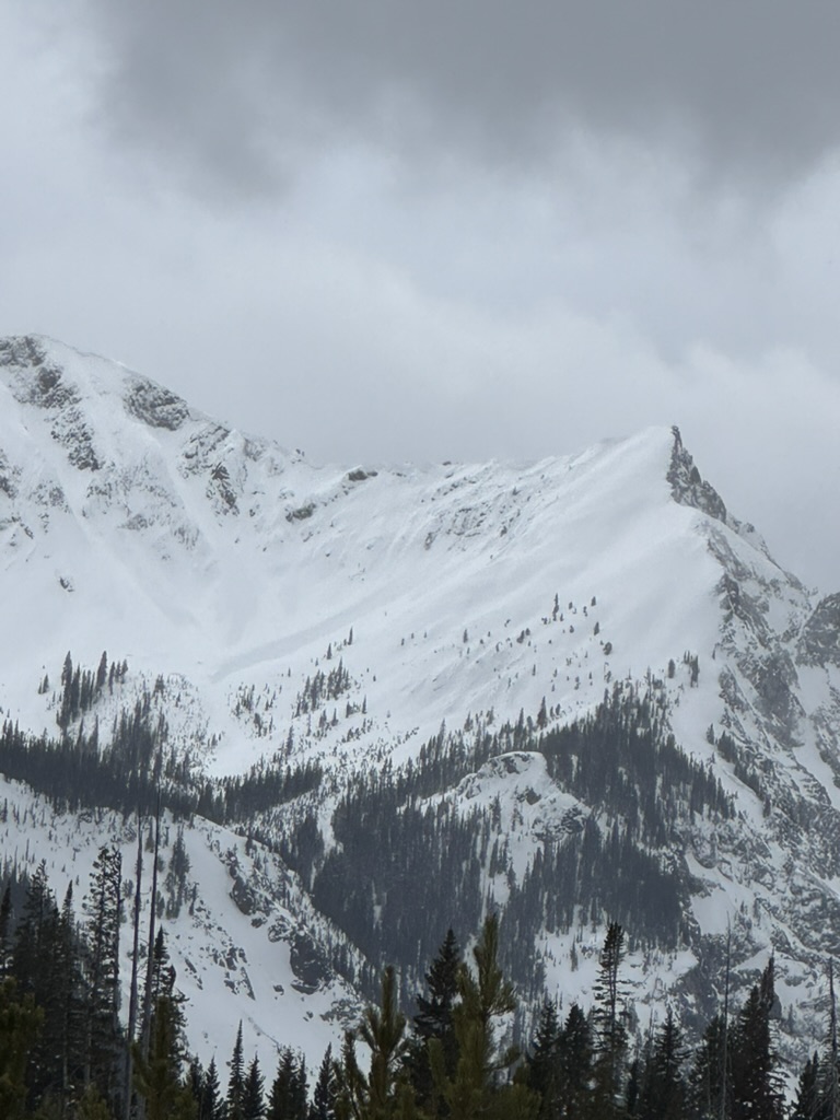
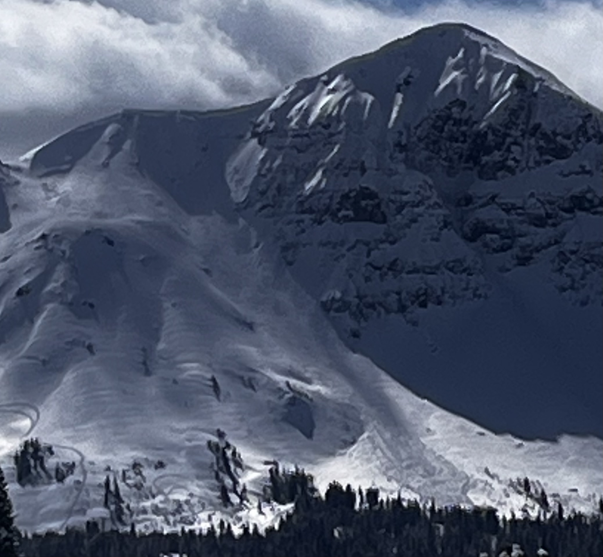
Today, Dave and I did the full mechanized boundary tour north of Cooke City. We rode up and over Daisy Pass towards Wolverine Pass and Mount Abundance, up Lulu Pass, to the Goose Lake boundary, and back out through Round Lake.
In thirty miles of riding, we noted one avalanche on the Fin that likely occurred yesterday or early this morning from a wind slab or cornice fall. That being said, low cloud cover obscured views and the light was relatively flat all day. What was visible were strong winds transporting snow, especially at high elevations. We chose to stay out of steep upper elevation bowls that are regularly wind loaded and out from under corniced ridgelines.
As we rode, we dug a few snowpits looking for the weak layer that we found yesterday buried about 2 feet deep. While we were able to find this layer, we only got propagation in one of three tests (ECTP 26, E aspect, 9070').
Throughout the day, the snow surface became denser and denser. The little precipitation that fell was noticeably rimed and when we rode back into Cooke City around 1pm it was nearly 40 degrees in town. Driving out of Cooke and into the Lamar Valley, we saw a good number of wet loose avalanches breaking in steep, cliffy terrain just south of the road.
Looking ahead, we are preparing for a sudden shift in the weather with above-freezing temperatures into the alpine and direct sunshine. We are keeping an eye on wind slab avalanches at upper elevations, but will start to shift our focus towards the potential for wet snow avalanche problems in the coming days.
Full Snow Observation Report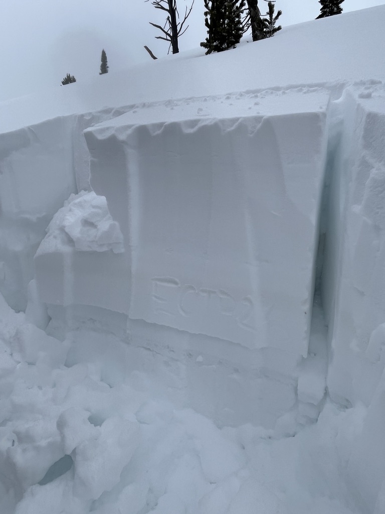

Fin had a slide on it today. I was too cloudy to tell if it was released naturally or not.
Full Snow Observation Report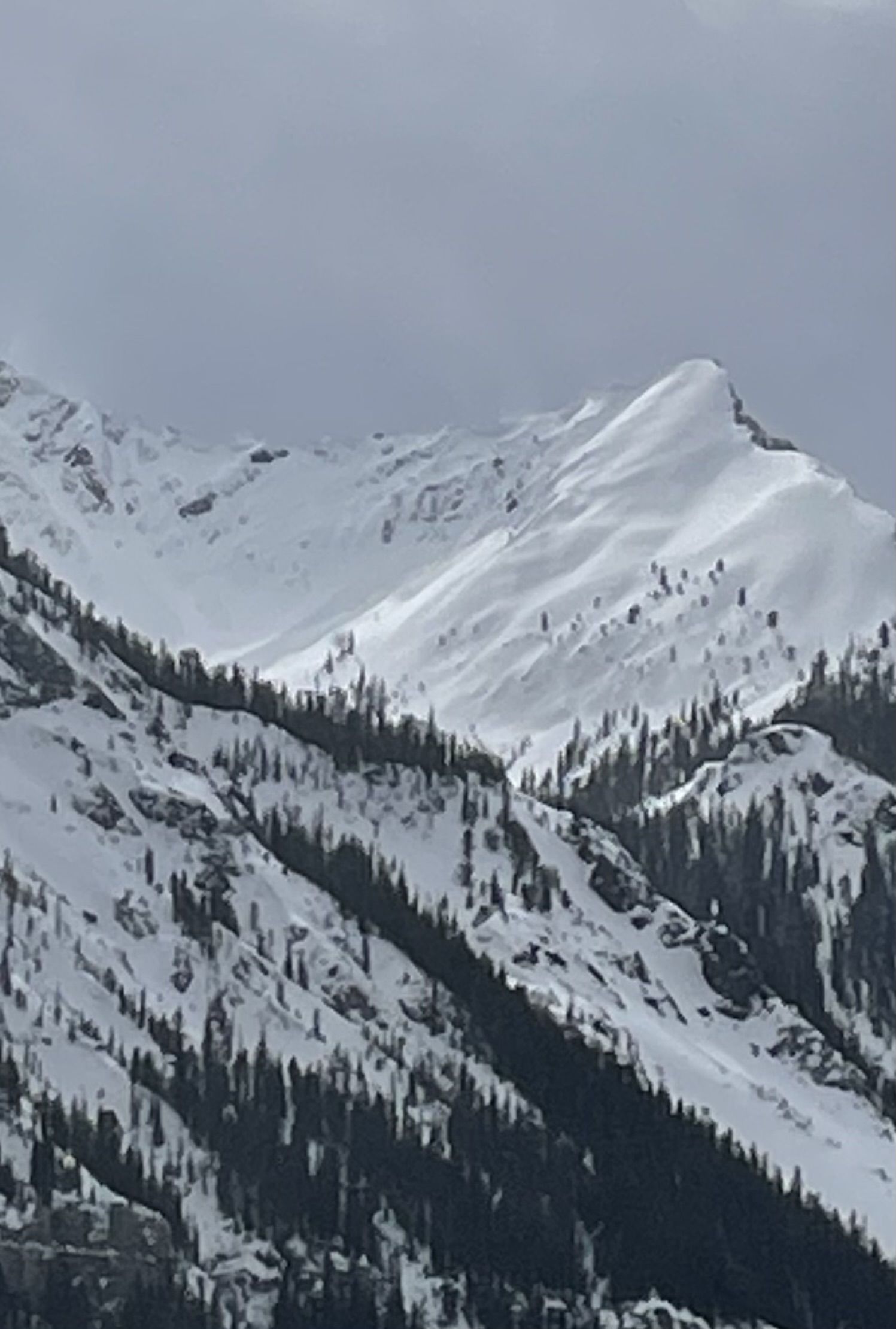
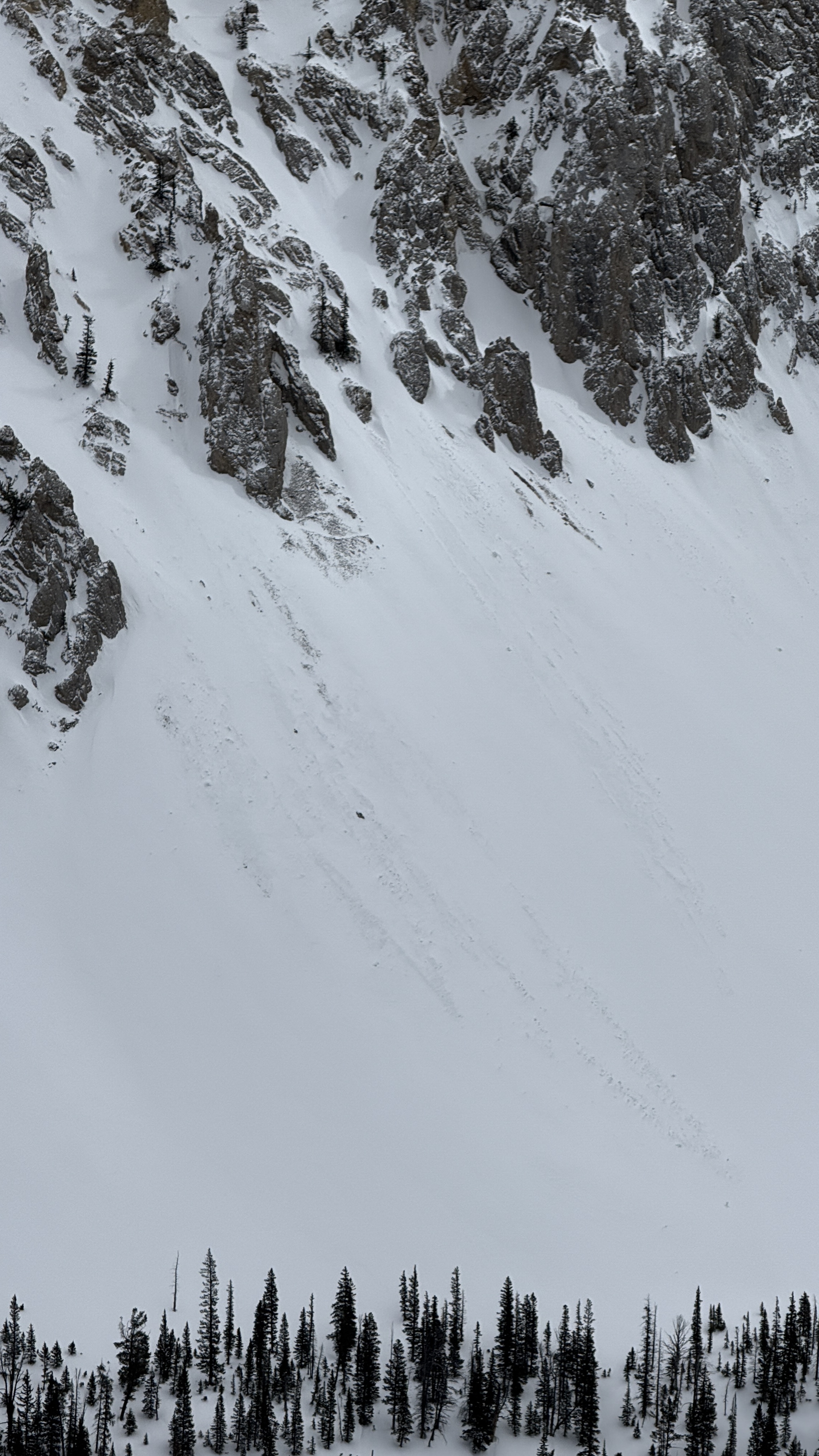
Photo of a recent natural avalanche north of Cooke City, observed today. A S, SE aspect in Sheep Creek at about 9000'. Seems like it likely occurred yesterday.
Estimated to be about 2' deep at 250' wide.
Full Snow Observation Report
Winds were ripping on the hike to Saddle Peak - almost knocking us over. If they had been just a few mph stronger, we would have been crawling. They were still finding snow to transport, and there were obvious plumes at discrete points along the ridge. Much of the snow was being blown to North Dakota while loading only in isolated places.
As soon as you got off the ridge, winds dropped to almost nothing, and we didn't find any wind slabs as we descended off the nose of Saddle into the North Central Gully. The skiing was excellent.
Further south, the bare rock area north of Bridger Peak had grown significantly as winds scoured a much larger area down to rock.
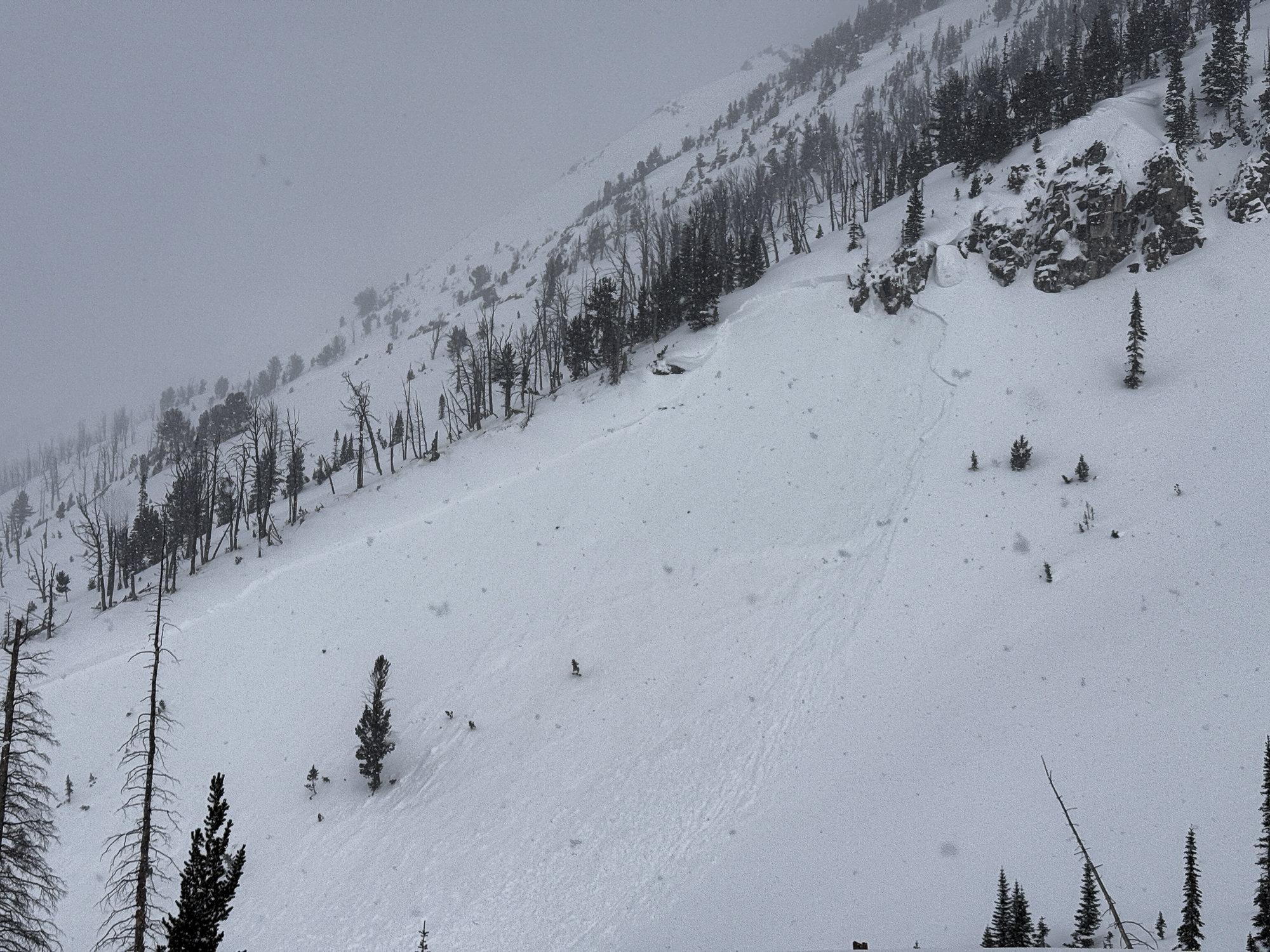
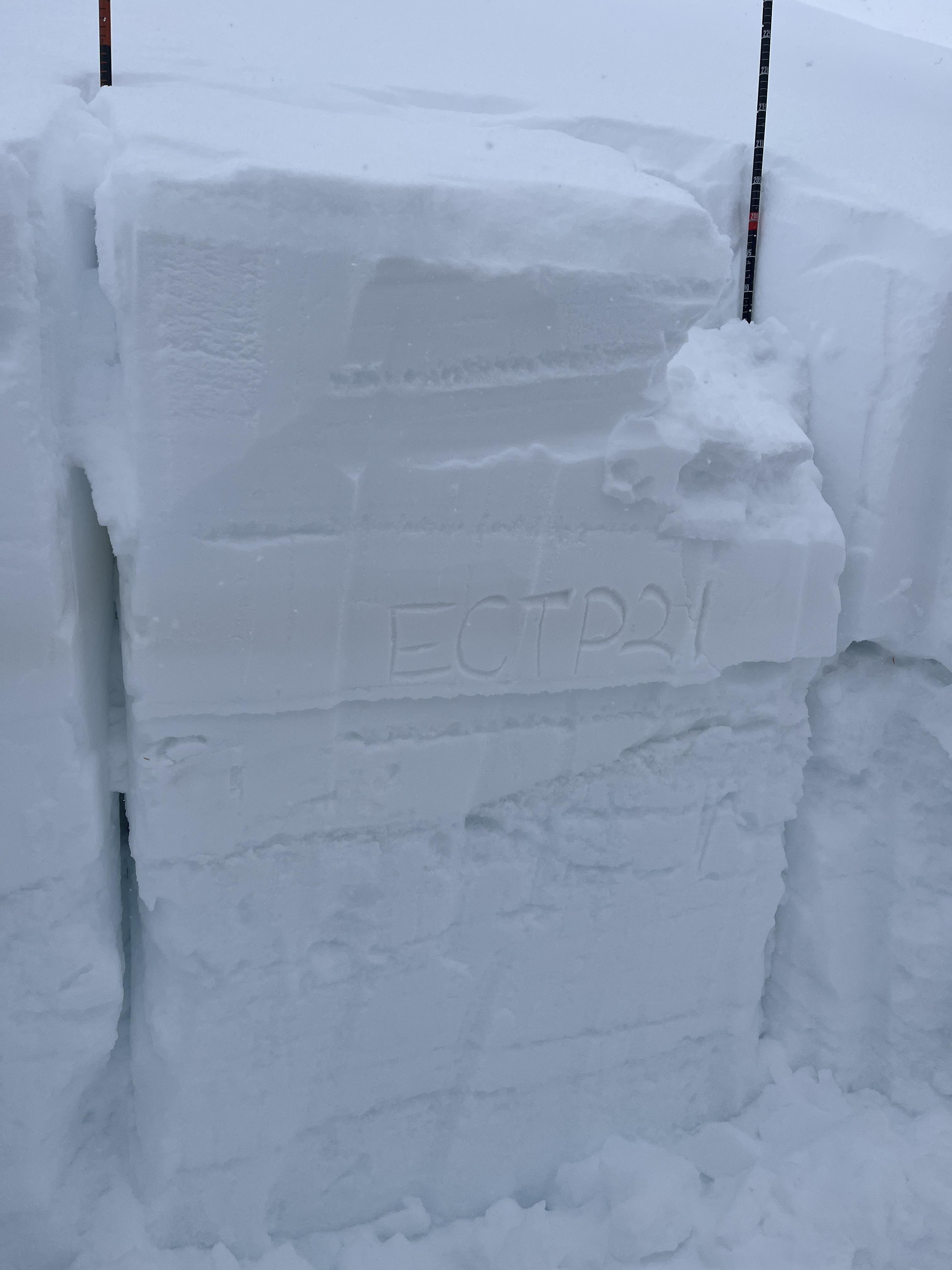
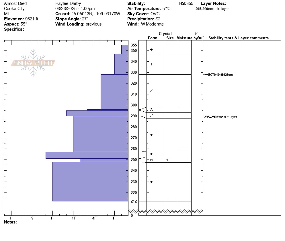
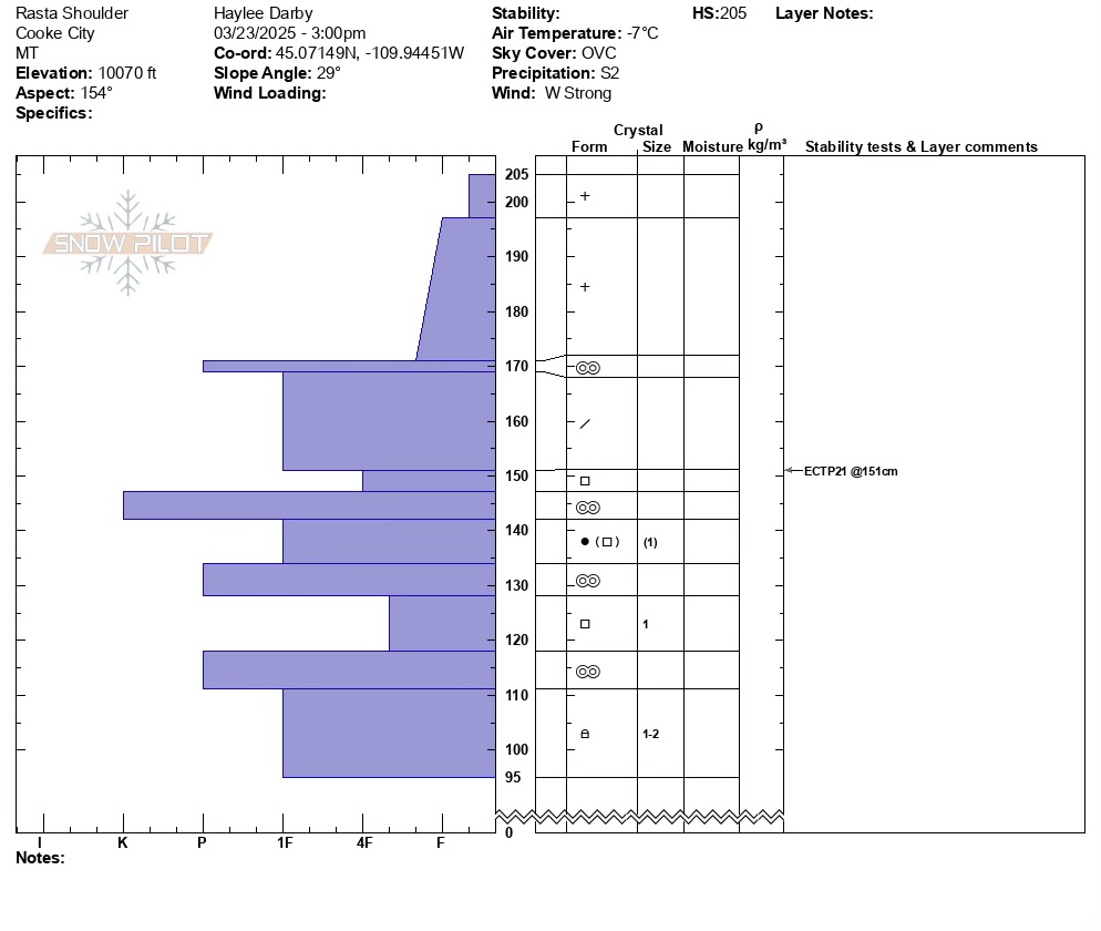
Full Snow Observation ReportWe rode up to the east Henderson Bench and back around to Scotch Bonnet and the Rasta Chutes. There was 5" of low-density new snow throughout the day and strong winds were actively drifting snow. Instability in the upper few inches was evident, with shooting cracks and small avalanches on steep drifts. In terrain unaffected by the wind, loose snow avalanches in the top few inches slid easily.
We dug on a northeast-facing slope ("Almost Died"), and two on southeast-facing slopes at two elevations in the Rasta Chutes. There was a recently buried weak layer 20-30 inches deep in all the pits that failed and propagated in two out of three--both the SE Rasta Pits (ECTP21 & ECTP25). I don't think we'll see a widespread avalanche cycle on this layer, but it is worth digging for and assessing before considering steep terrain. We saw Beau Fredlund at dinner and he came across an avalanche in Sheep Creek that broke 2-3 feet deep and 300 feet wide. I suspect it was this layer; however, the slope that avalanched was different in that it was a thin snowpack with some grass poking out. Our pits were 250-350cm DEEP!
The bottom line:
- Significant amounts of recent snow and strong wind this afternoon, and more snow forecast for tonight. Avalanches on wind-loaded slopes are likely to very likely. Currently, I would avoid all the big, heavily wind-loaded terrain in Cooke City. This is were you'll trigger a slide and it has the potential to break a few feet deep.
- Dig down three feet to test for instability before skiing or riding steeper non-wind-loaded terrain.
Full Snow Observation Report
Unless it becomes calm overnight and stops snowing, the danger should rise to at least CONSIDERABLE/MODERATE. If the snow really stacks up, a HIGH/ CONSIDERABLE split would be reasonable.

We got an ECTP18 result on a north aspect at 8600’ in the absarokas. It propagated on a small layer of facets 30cm down. We did not get any collapsing nor see signs of naturals or other activity on this layer, but we stuck to non-wind loaded slopes in the trees.
Full Snow Observation Report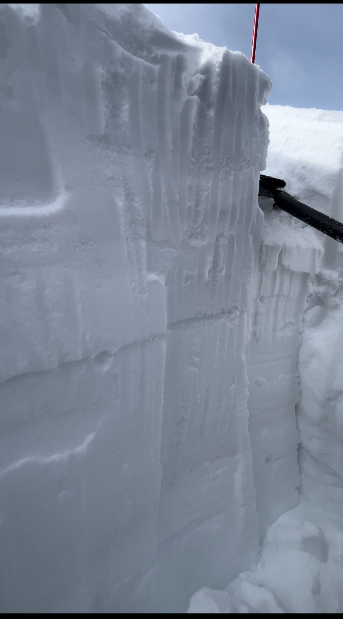
Skied south of Cooke today. Got an ECTP28 down 80cm on small facets above a MF crust that was buried on March 14. West aspect at 9500'. While filling in the snowpit I got a large collapse. This is the same layer we were getting ECTP results on earlier this week north of town.
Full Snow Observation Report
We rode into all three Yellow Mule drainages and the head of Muddy Creek. It was snowing hard and wind was blowing strong this morning. In the afternoon, clouds lifted and snow let up. Skies remained mostly cloudy, but with high clouds there was decent visibility at the end of the day. There were 10-12" of new snow since last weekend, 2-4" low density fell this morning.
There was a small wind slab avalanche in McAtee (Photo) and a small wind slab in Beaver Creek.
We dug four snowpits, northerly aspects (one in each Yellow Mule), and one on a southeast aspect on the west side of the Second Yellow Mule. We did not find any unstable test scores or concerning layers. ECTNs within the new snow and ECTXs in some cases. In the southeast facing pit there was one .5" thick crust below this week's snow and a crust 2" thick below last weekend's snow (photo). Most pits had a dirt layer from last Sun/Mon strong-extreme winds, 10-12" deep. Total snow depth was 6-7 feet.
Full Snow Observation Report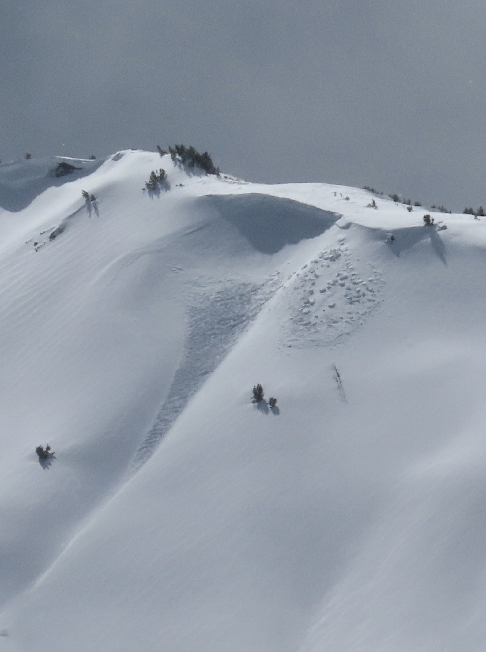

Snowmobile triggered slide in Taylor Fork today from above cutting across. Nobody caught. 2.5 feet deep 150 feet wide
Full Snow Observation Report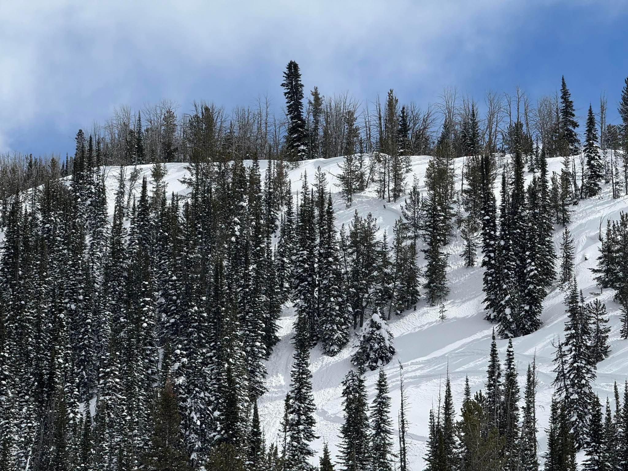
Took a quick trip up Beehive Basin to the prayer flags, down into the meadows towards Bear Basin and returned the way we came.
Found around 4" of new snow from yesterday. There were scoured areas near the ridgeline on the west face, but we didn't find any cohesive wind drifts.
We dug two quick pits on the east facing terrain dropping towards Bear Basin. In our upper pit (NE aspect, 9200 ft), we found a layer of small facets (1 mm) buried a foot down, under the snow that has fallen in the past week. It didn't react in our Extended Column Test (ECTN25), but we hadn't had any reports of these facets previously, so it was a little bit surprising. We dug again, a little lower (~8900) to see if we would find it again, but it didn't exist in that location (instead there was a stout melt-freeze crust under this weeks snow).
There was a thin, breakable, melt-freeze crust under yesterday's 4" of new snow on any slope that wasn't a little shaded. Slopes with a northward tilt, or in the shade of trees, didn't have the breakable crust.
Despite high clouds, the snow surface was starting to get damp in the early afternoon and there were roller balls beneath our ski tracks. We saw a fresh wet loose slide on an low elevation west facing slope in Bear Basin.
Otherwise, we saw no signs of instability.
Full Snow Observation ReportDanger was LOW where we traveled today, since we didn't find a windload. CONSIDERABLE on windload may have been overstated.

From text message: “I was out with a friend and his 2 daughters. We were east of Jefferson 8990’ elevation. East aspect ECTP 22. Down 78cm from surface. Melt freeze layer I would describe as breaking up?? garbage.”
Full Snow Observation Report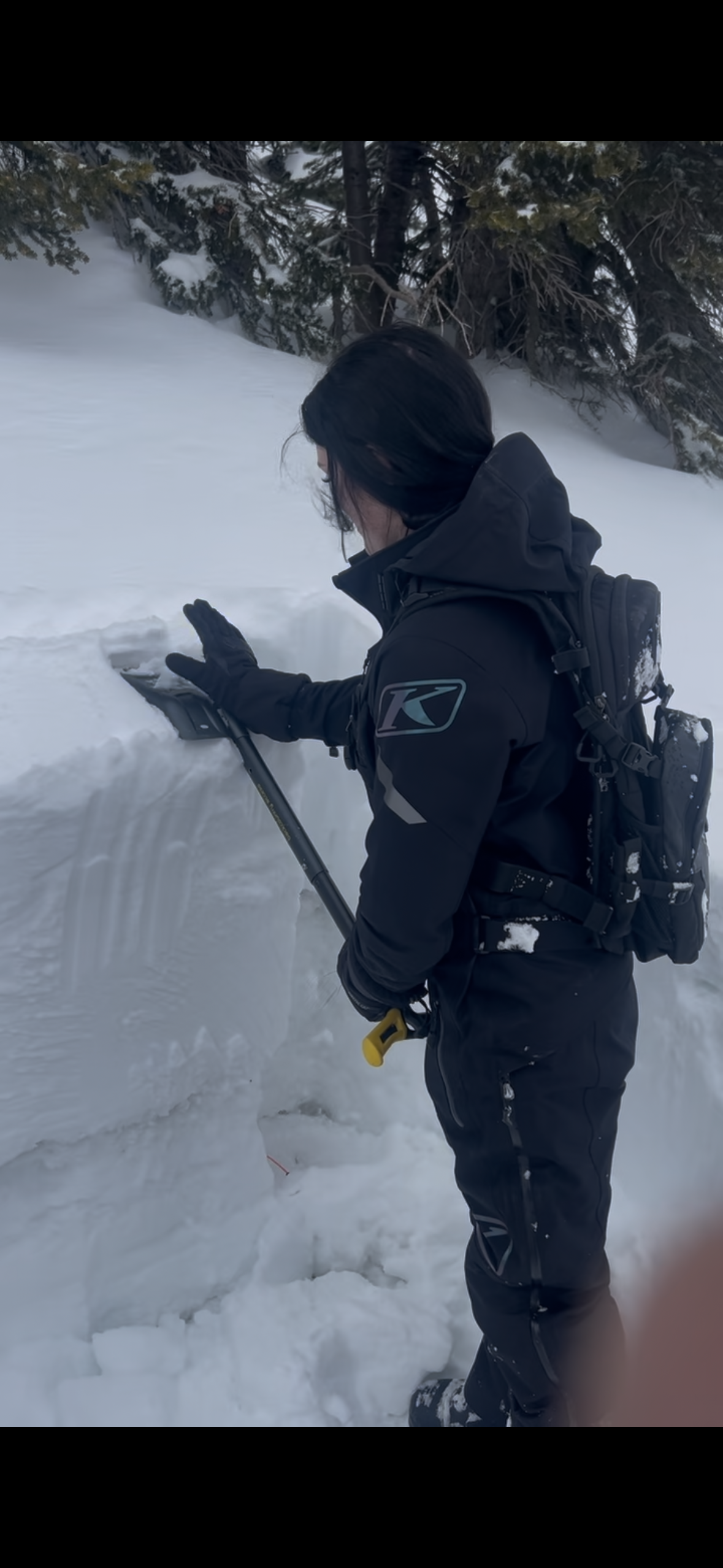
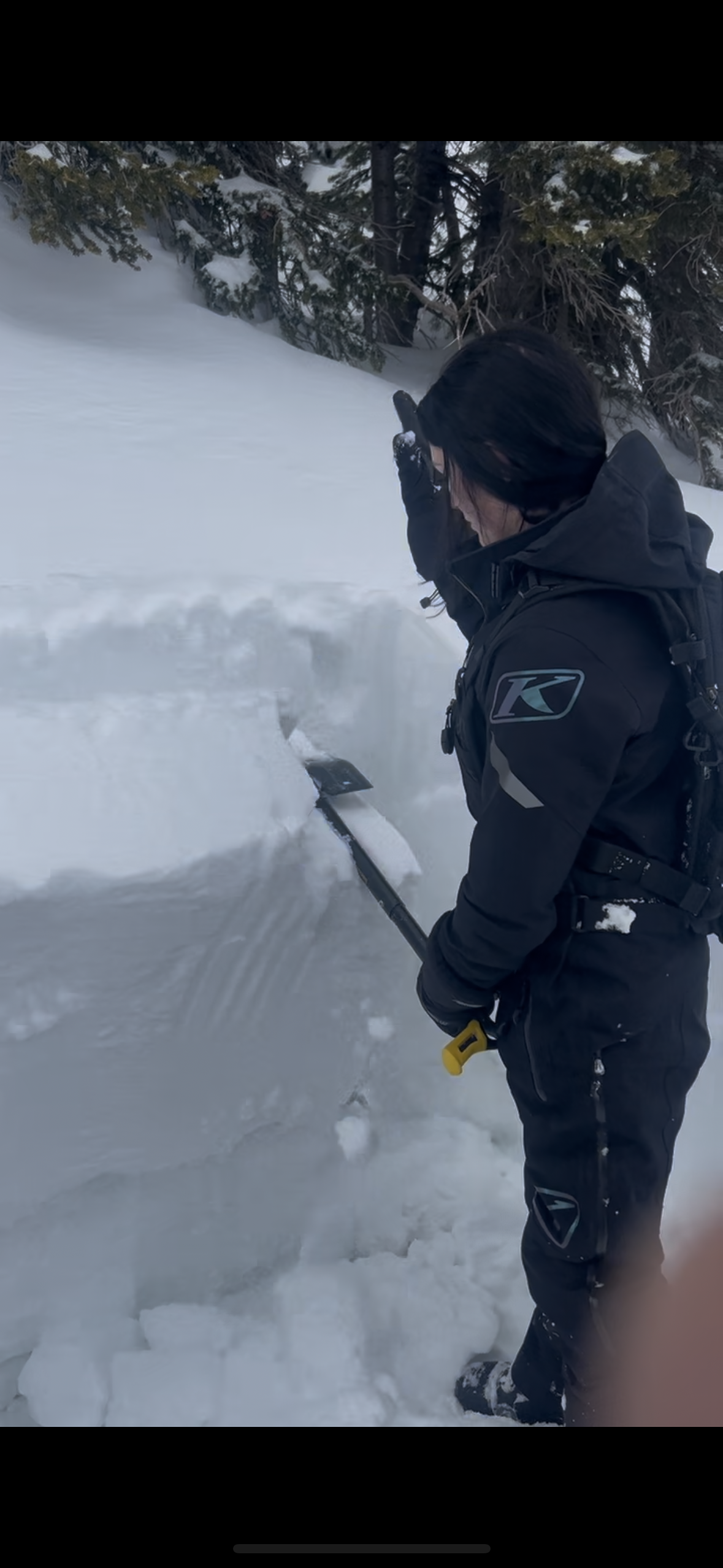
Skied a lap on Texas Meadow north of Bridger this afternoon. There were about 2" of new snow from today and 10-12" settled new snow that fell since last Friday. A few moderate gusts moved snow, but wind was not generally light. There was minimal fresh drifting, limited to ridgelines and openings in the trees.
A lot of ski tracks off the ridge north of the ski area. Only small loose snow slides were triggered from what I could tell, under mostly cloudy skies.
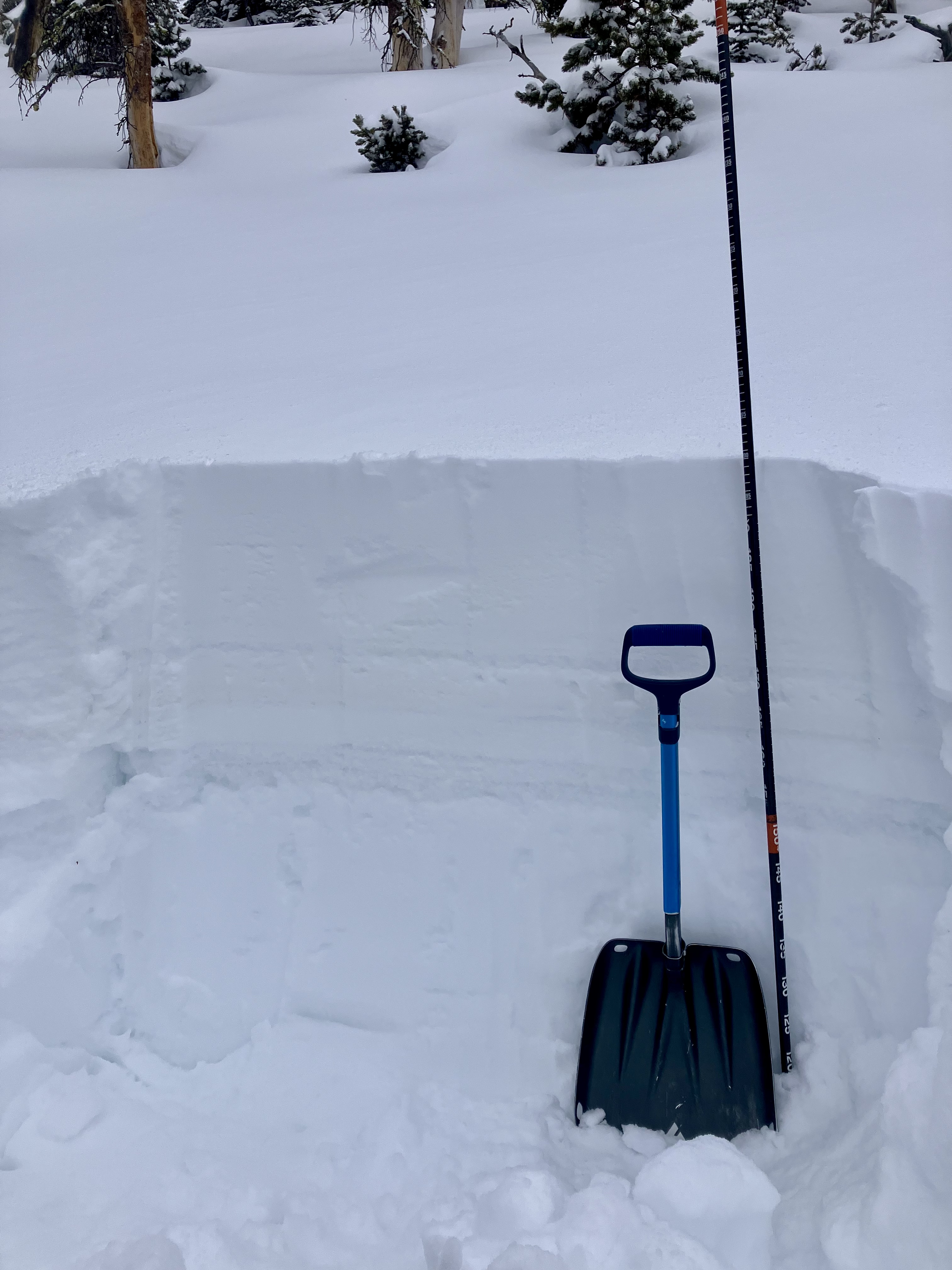
Snowpit at 7700', NE aspect showed a 6 foot deep, stable snowpack (profile attached). New snow creates the main avalanche concern, mainly where it is drifted into stiffer slabs. Dry Loose snow avalanches are a second concern for now.
Full Snow Observation Report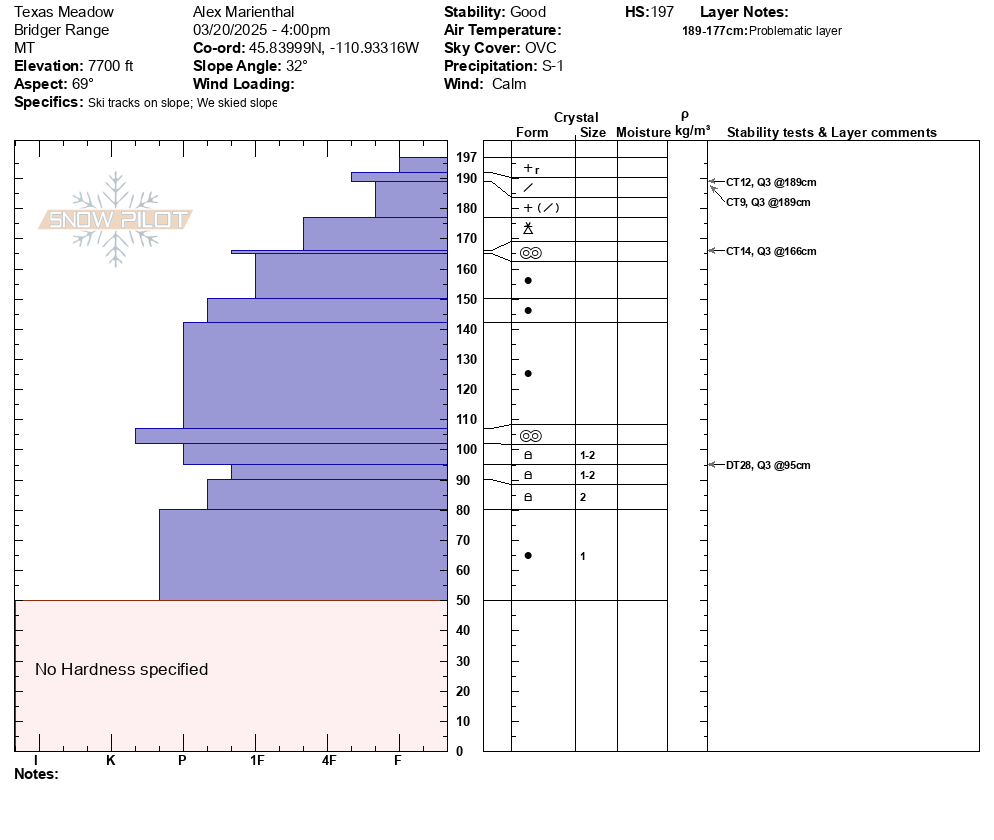
On this first day of spring, Ian and I toured up the northern ridge above Hebgen Lake today looking for weak snow near the base of the snowpack. Throughout the day, it snowed a little over an inch with bursts of sunshine in and out.
From the storm over the weekend, we noted about 1.5" of new and settled snow. We saw no cracking or collapsing or any other signs of instability.
We dug a snowpit at 8900' on a NE aspect (HS: 163), and while we found faceted snow at the bottom of the snowpit, beneath the dirt layer, we were only able to get propagation on this layer after extra hits. We got a few ECTN's (7, 17) higher up in the snowpack.
While we were encouraged by how few signs of instability we saw today, we are not ready to discount the possibility that avalanches could break on these weak layers, especially after seeing the persistent weak layer avalanche yesterday in the Taylor Fork. As always, if choosing to travel in steep terrain, use safe travel practices: one at a time on steep slopes, carry rescue gear, and regroup in safe zones.
Full Snow Observation Report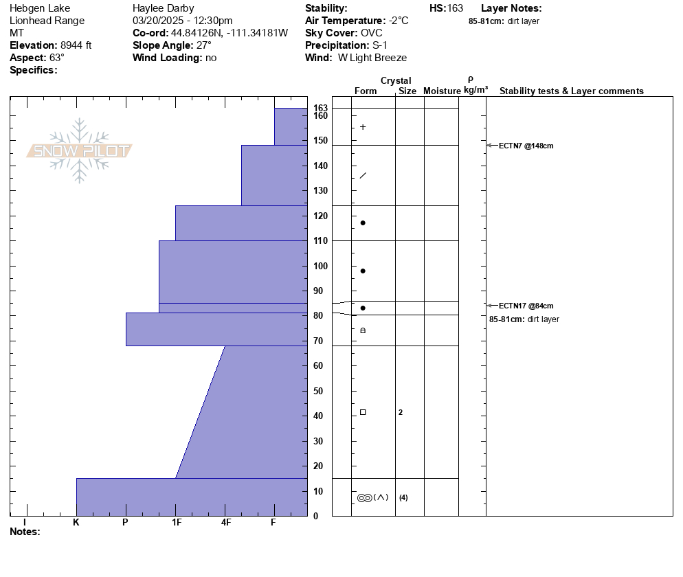

All elevations in Island Park experienced heavy snowfall combined with high winds,this made for unstable wind slabs and cornices.
Full Snow Observation Report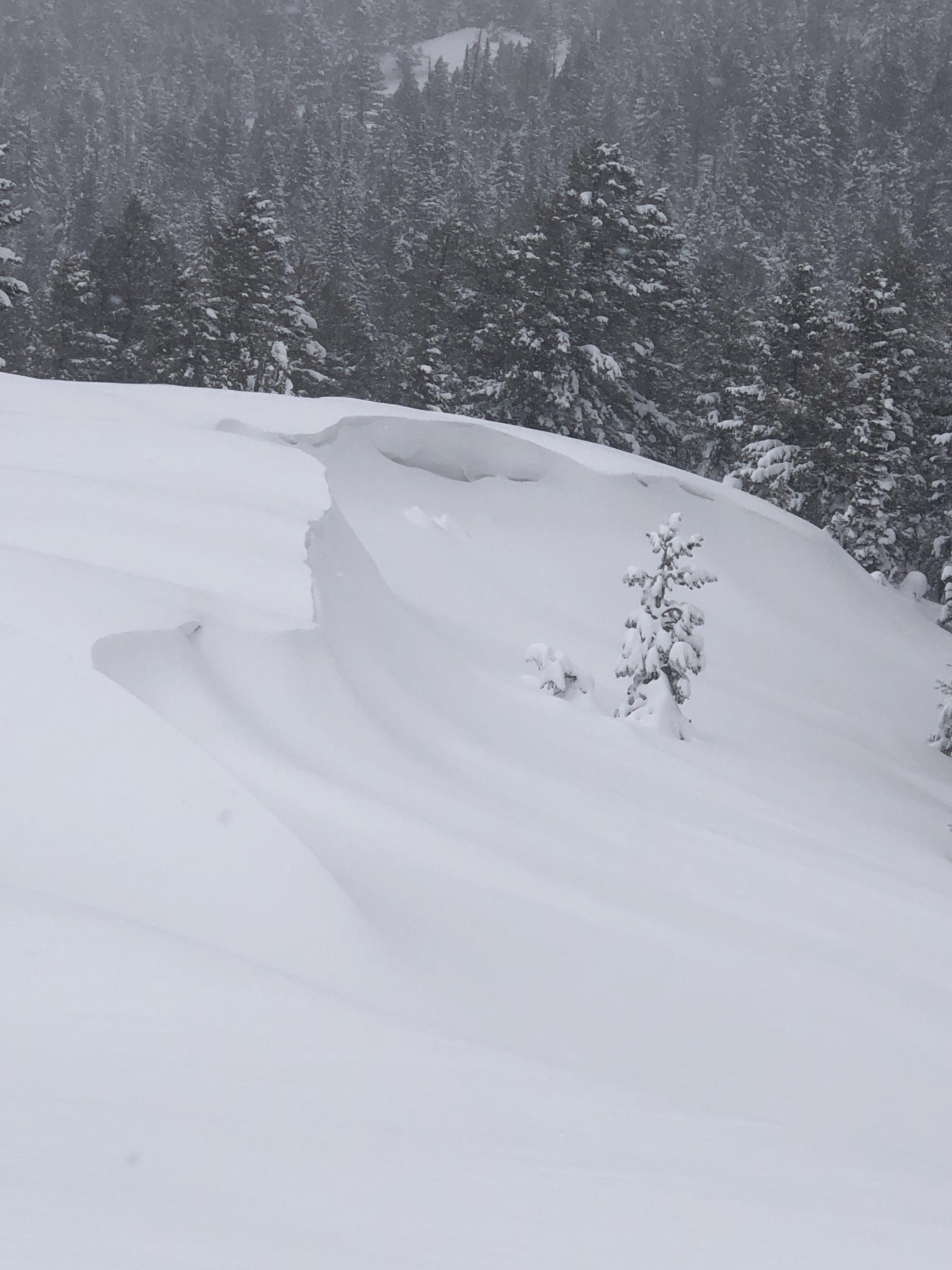
Dug a pit and did a ECT. Stayed off of wind-loaded slopes and found phenomenal skiing. On very steep pitches we found some dry loose activity.
We found 175cm of snow
ECTX4@ 168cm
ECTX24@105cm
35 degree slope. 7150 ft
North facing - 10 degrees
Full Snow Observation ReportIt looked like there were several small wind slabs triggered on Saddle Peak. I was skiing with my family and didnt get a good look or a photo. One appeared to be just off the summit maybe 12" deep and not running very far at all. The other appeared to be near the going home chute even with the cliffs, and this one ran a bit further. These wind slabs looked like something to be looking for but also easy to avoid.
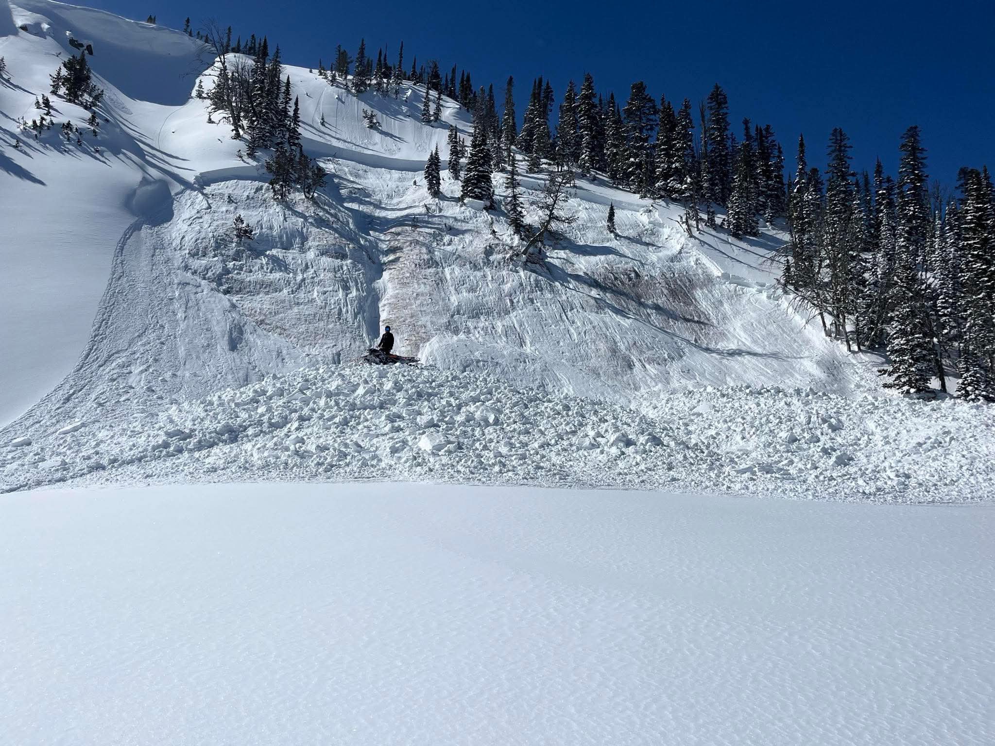
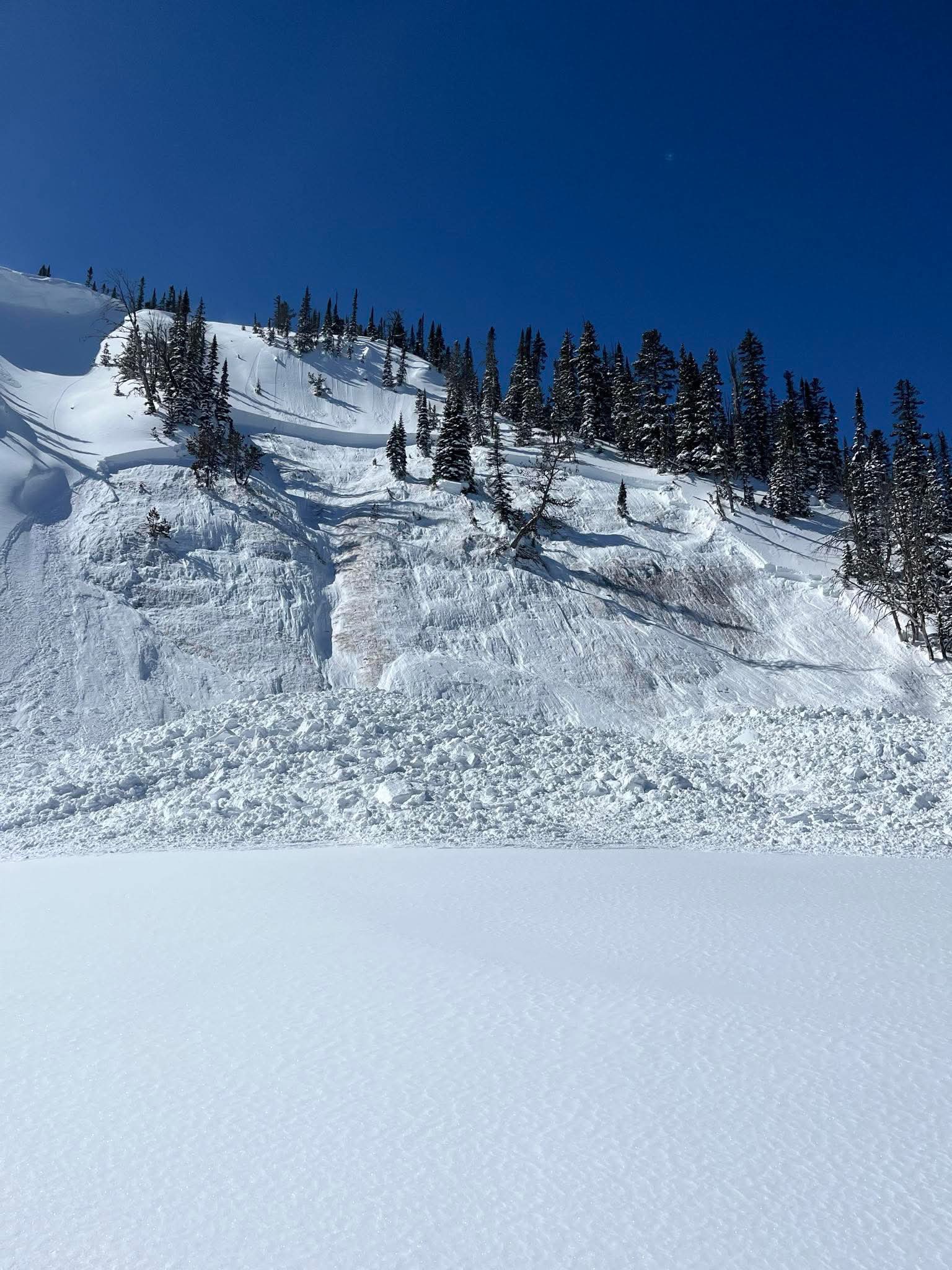
Full Snow Observation ReportToday we saw a D2 slab avalanche at Goose Lake, E facing, 10800 ft. We estimate this avalanche to have ran in the early hours of 3/17. This was the only avalanche we observed in the past 4 days.
Full Snow Observation Report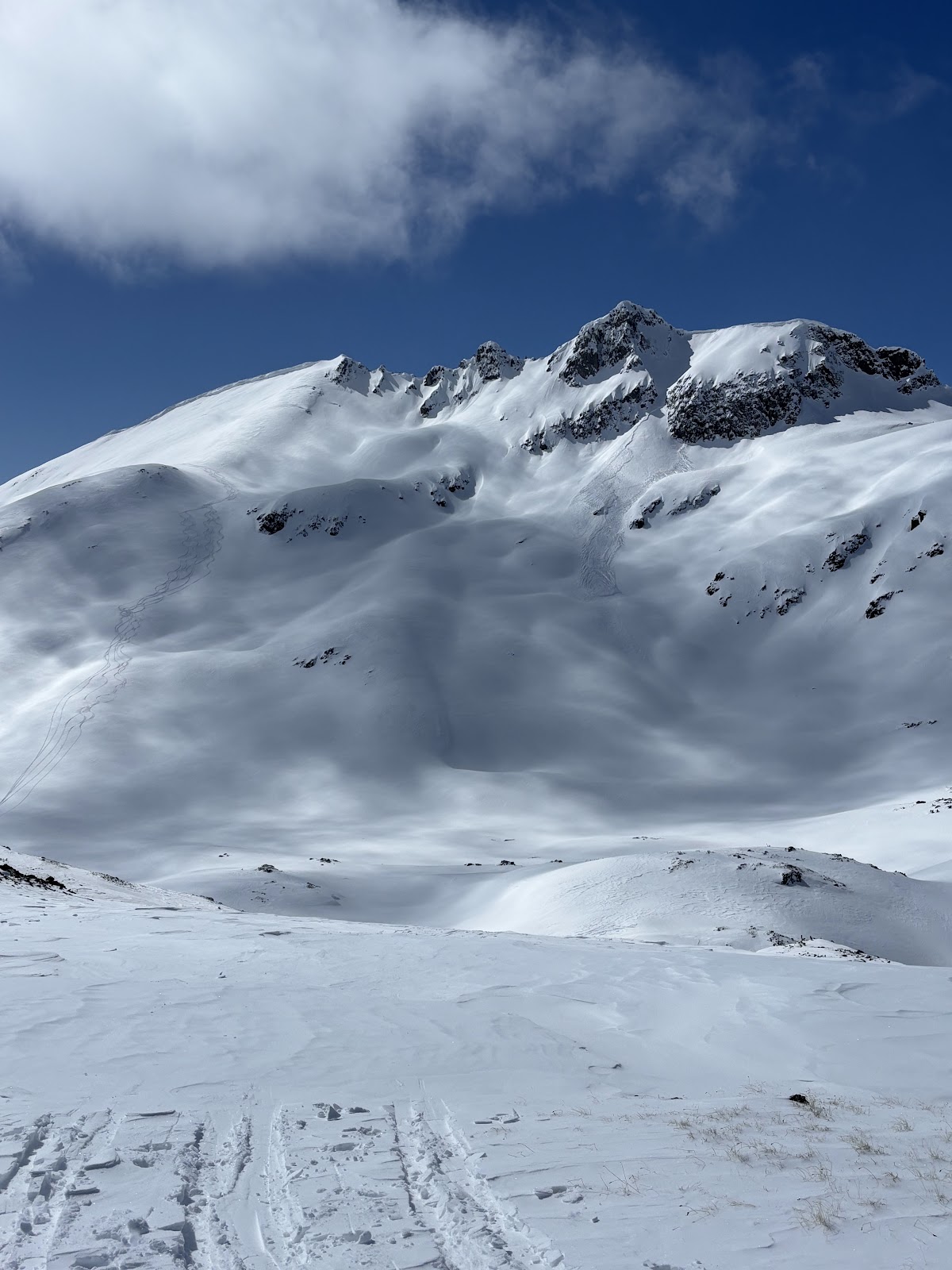
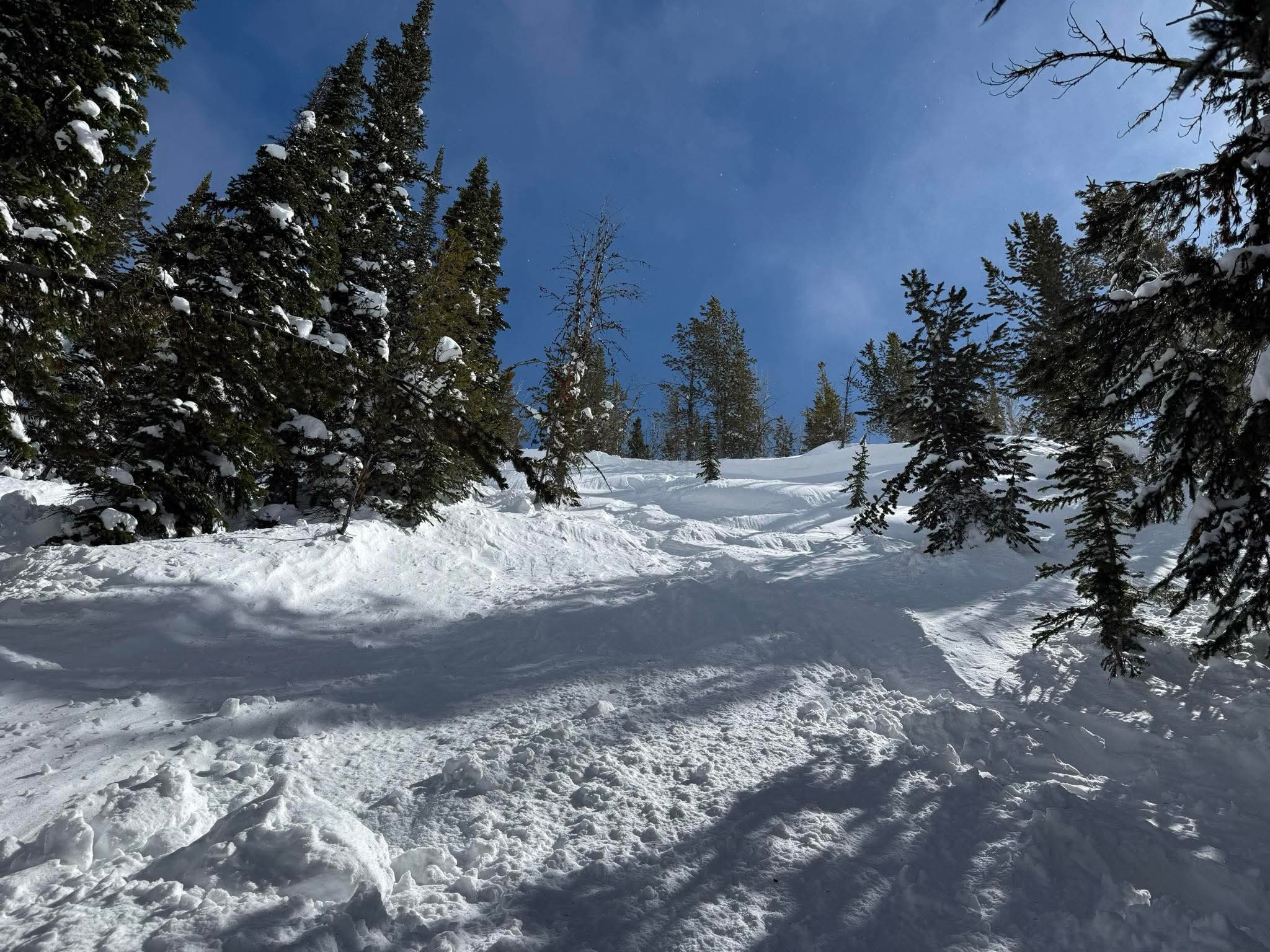
We rode the motorized zone today with Bill and noticed two slides. One on the SE face of Scotch Bonnet in Tragenic Bowl and one on the NE face of Wolverine. They both broke 2-4’ deep. The avalanche on Wolverine slide aprx 1500’. Both were in wind loaded areas at upper elevations. Ski cuts with snowmobiles were not producing avalanches in protected areas.
Full Snow Observation Report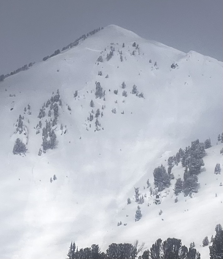
From FB message. Today (3/19) in Taylor Fork
Full Snow Observation Report