Snow Observations List
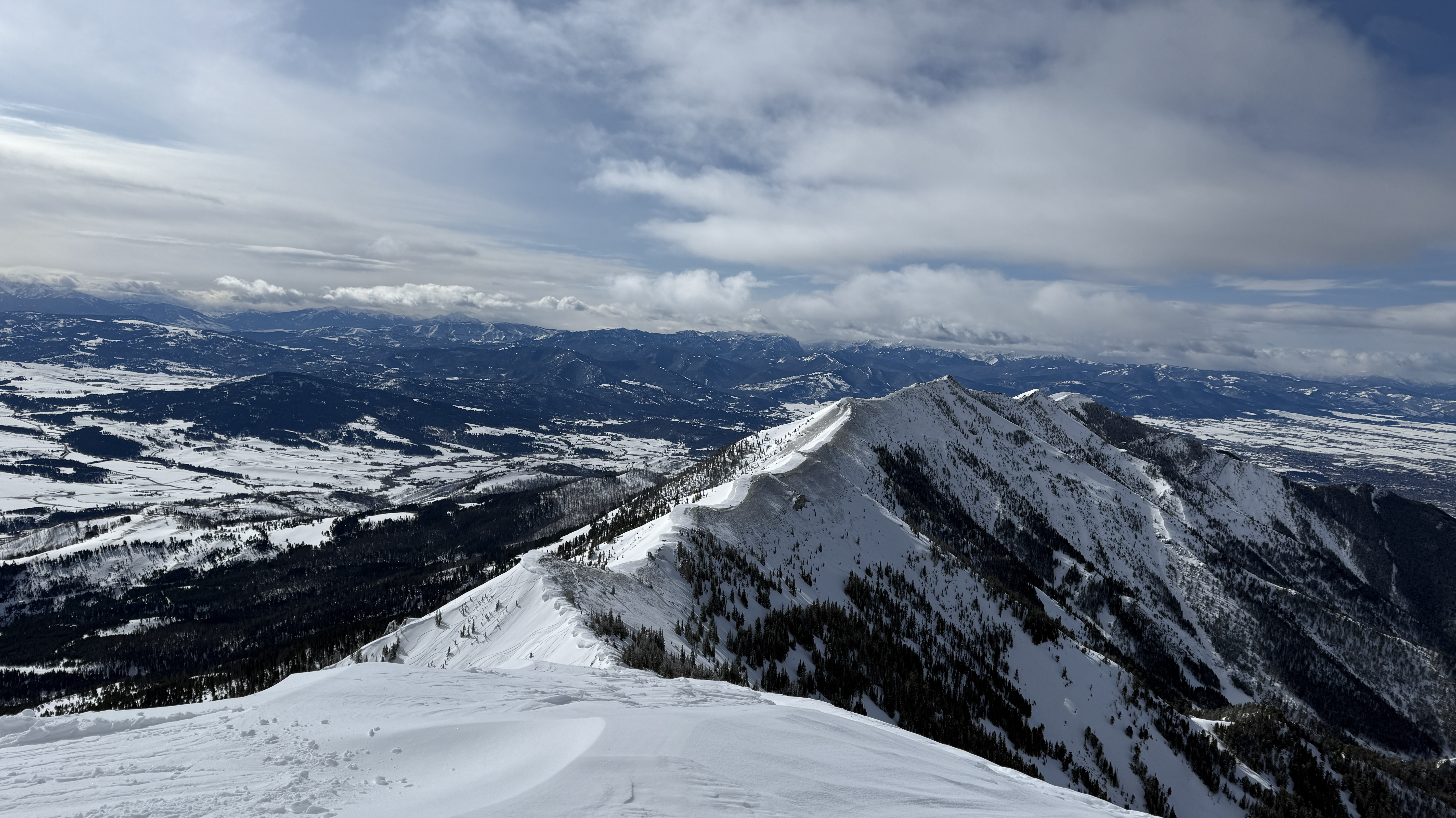
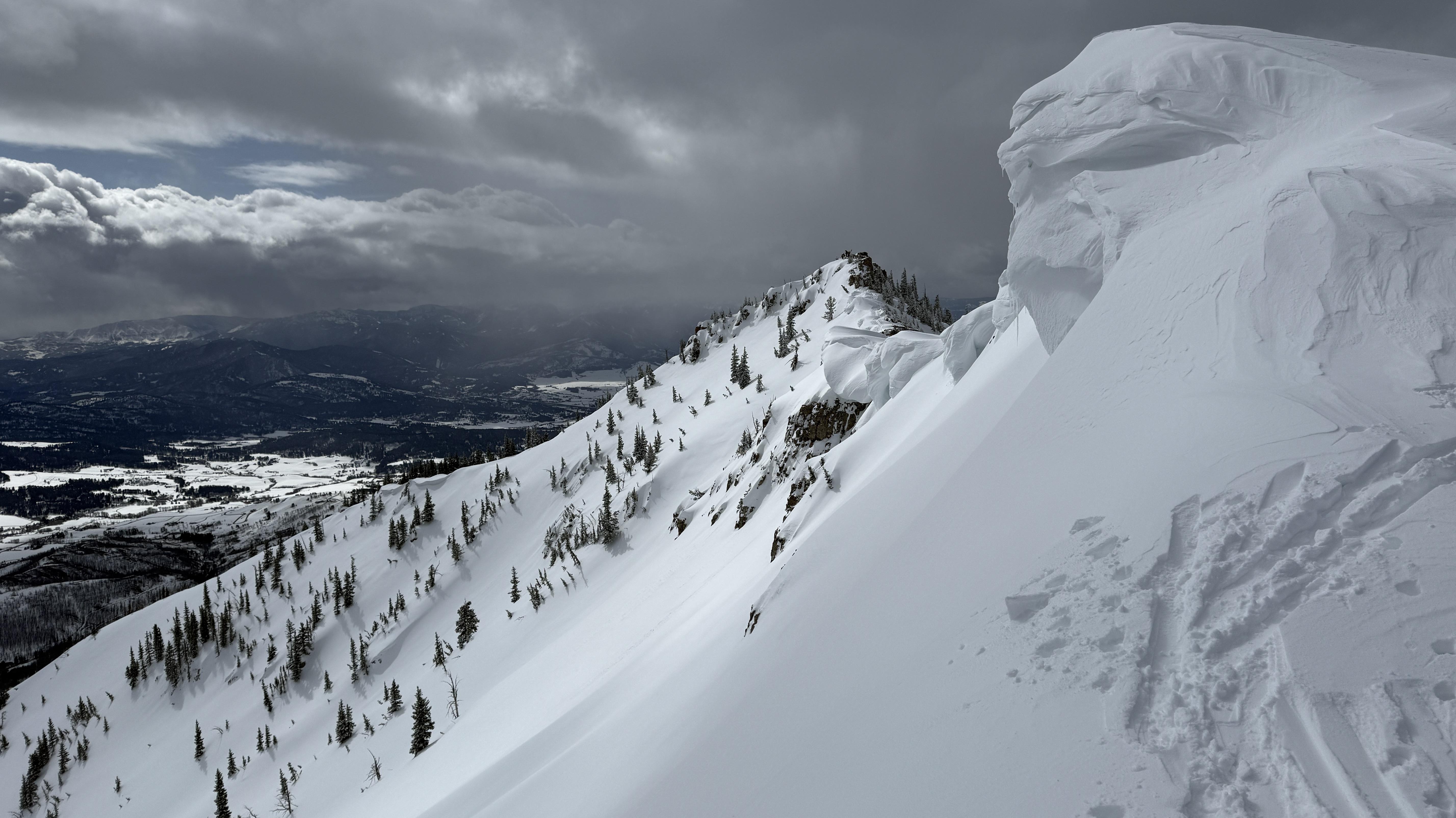
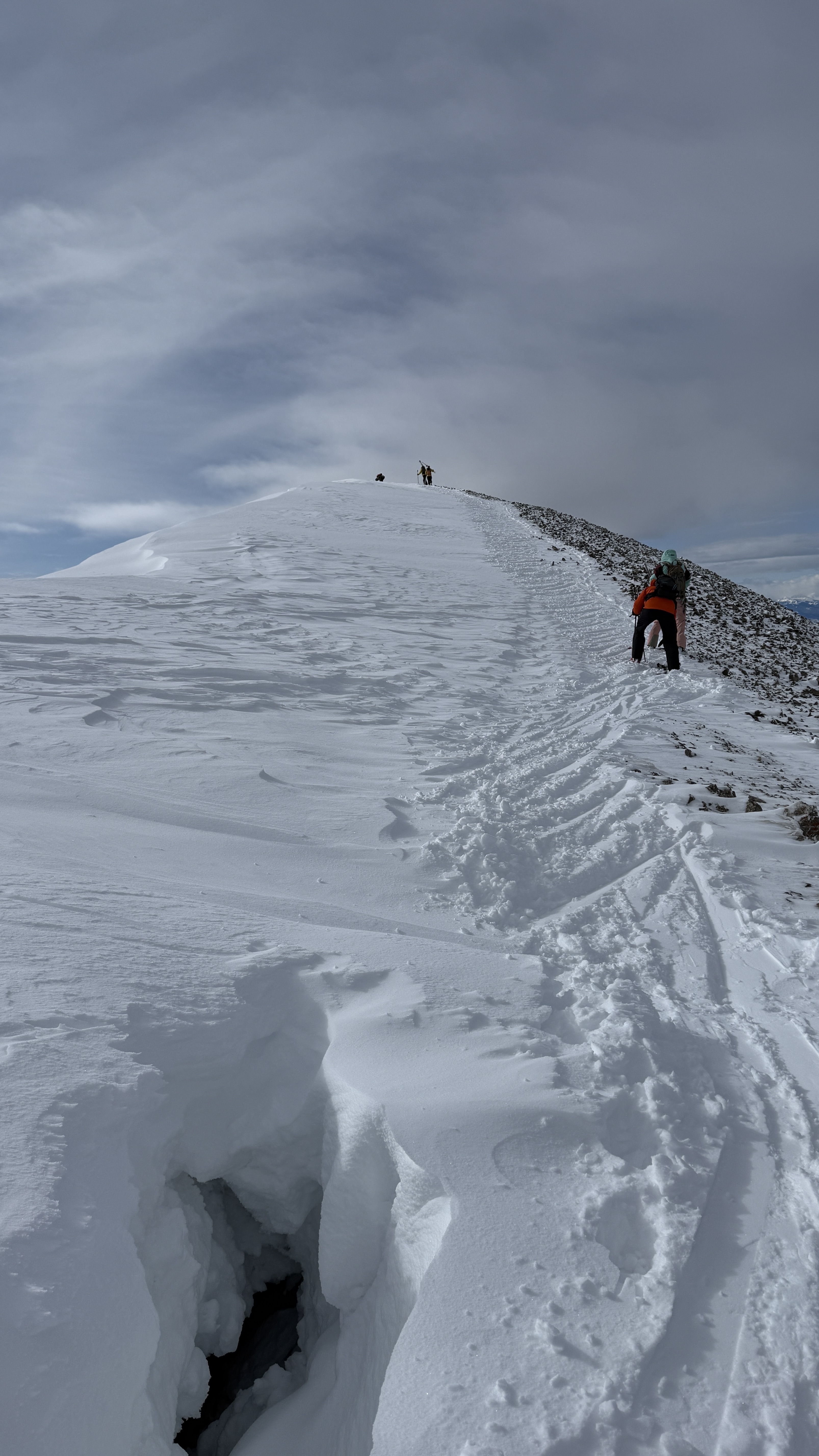
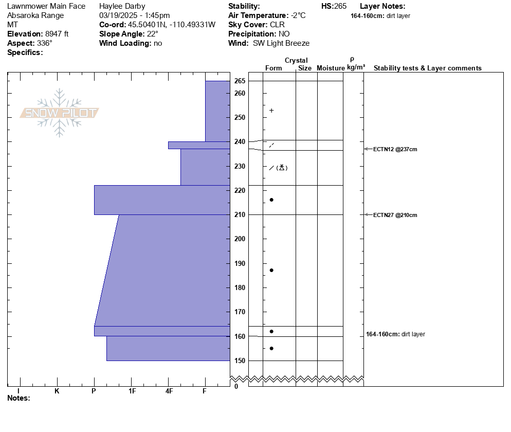
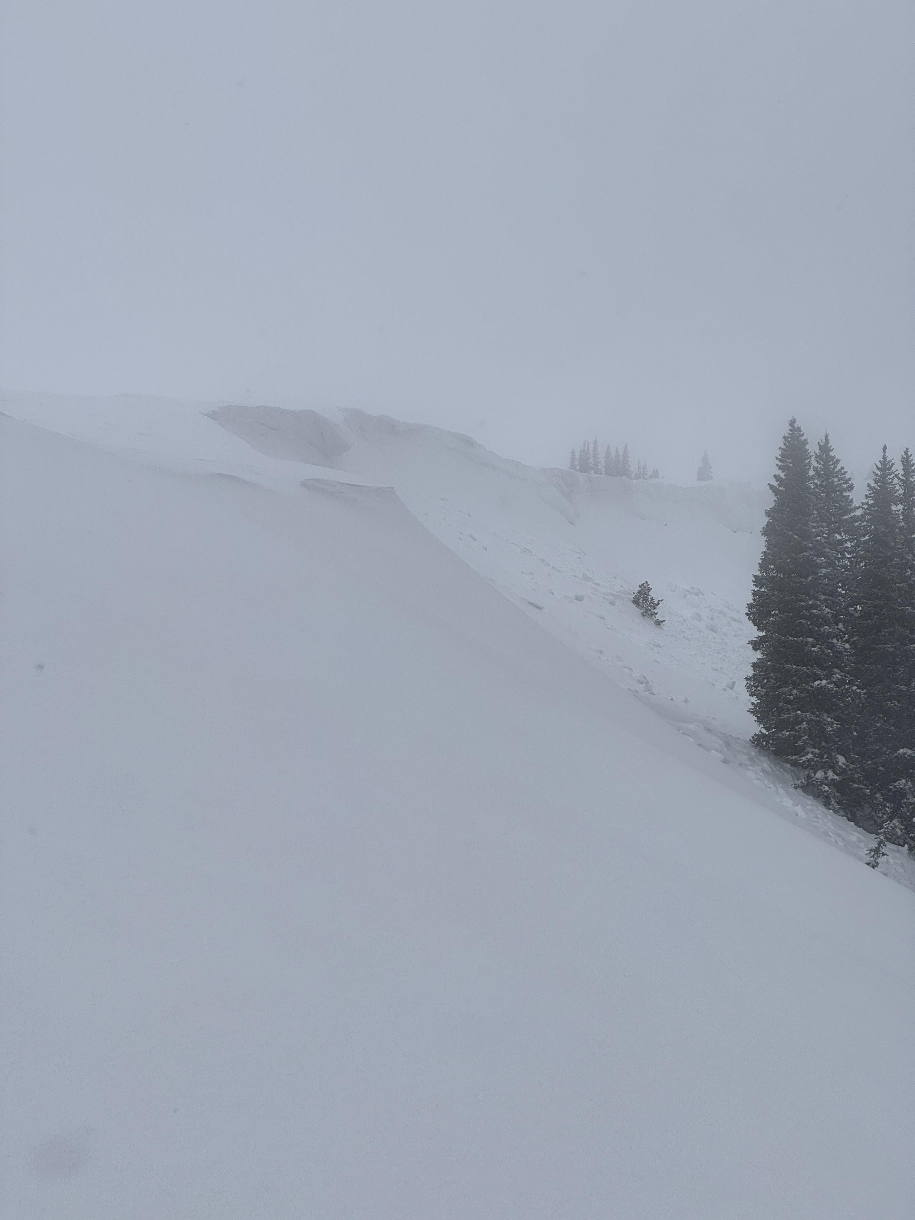
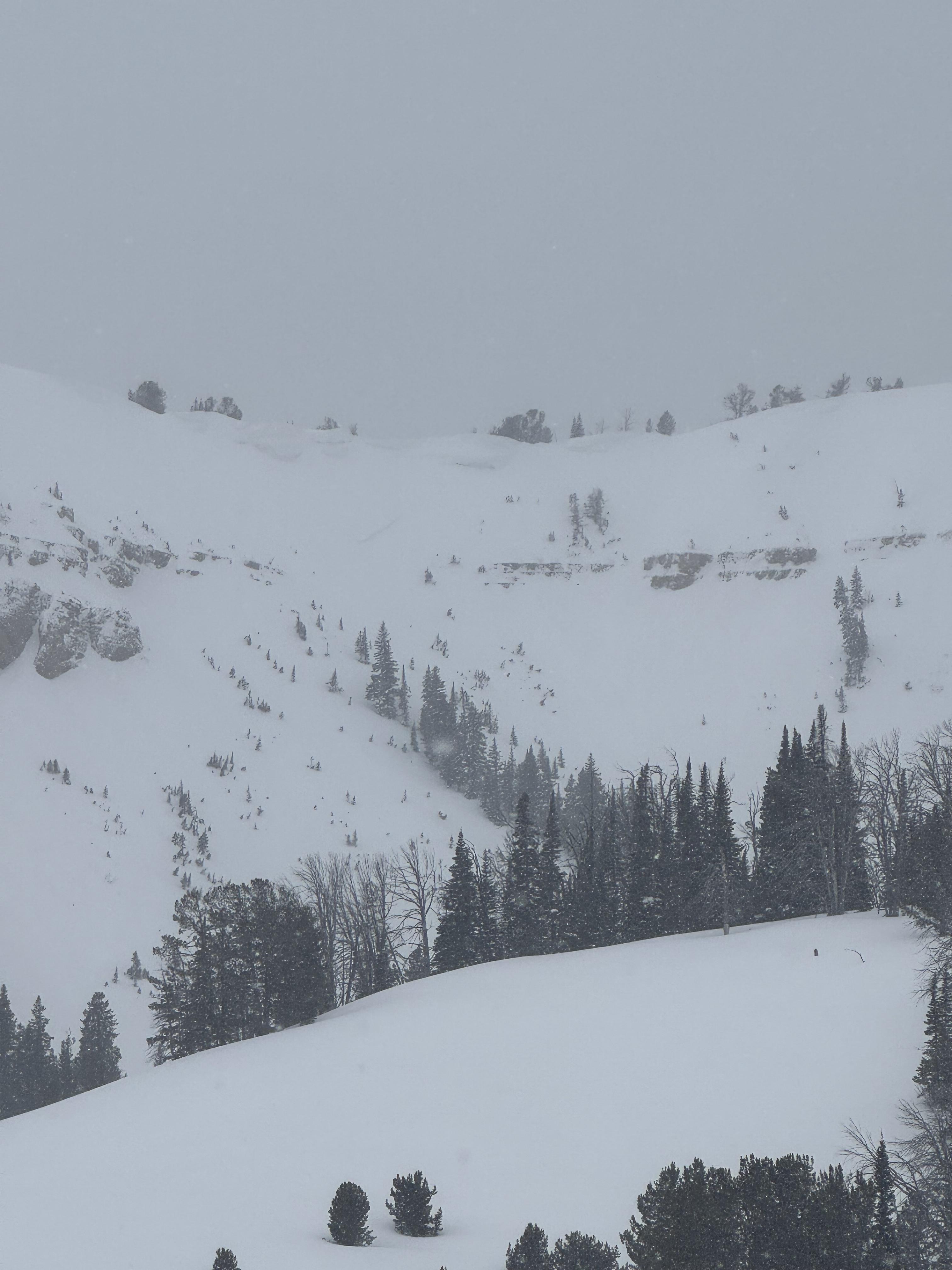
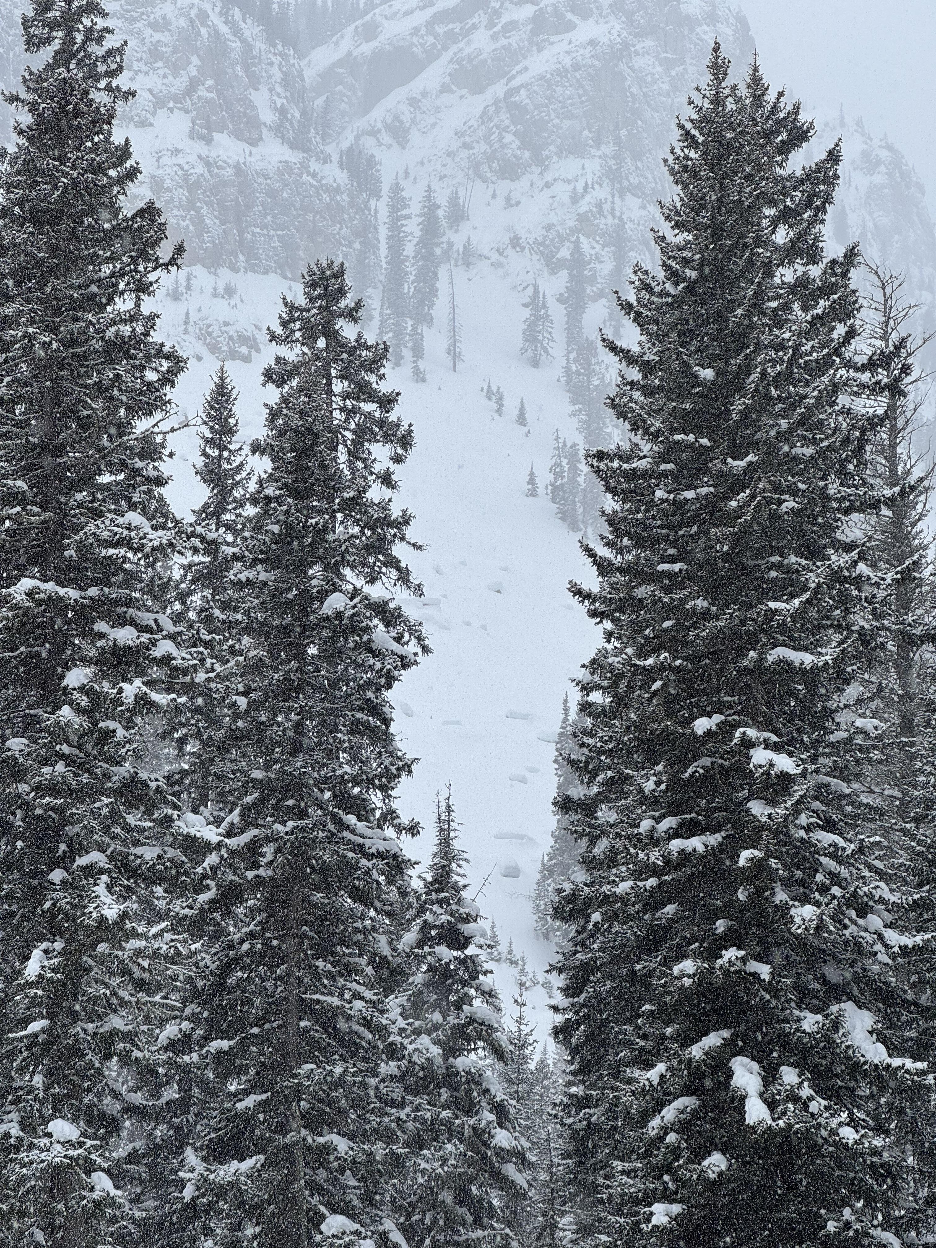
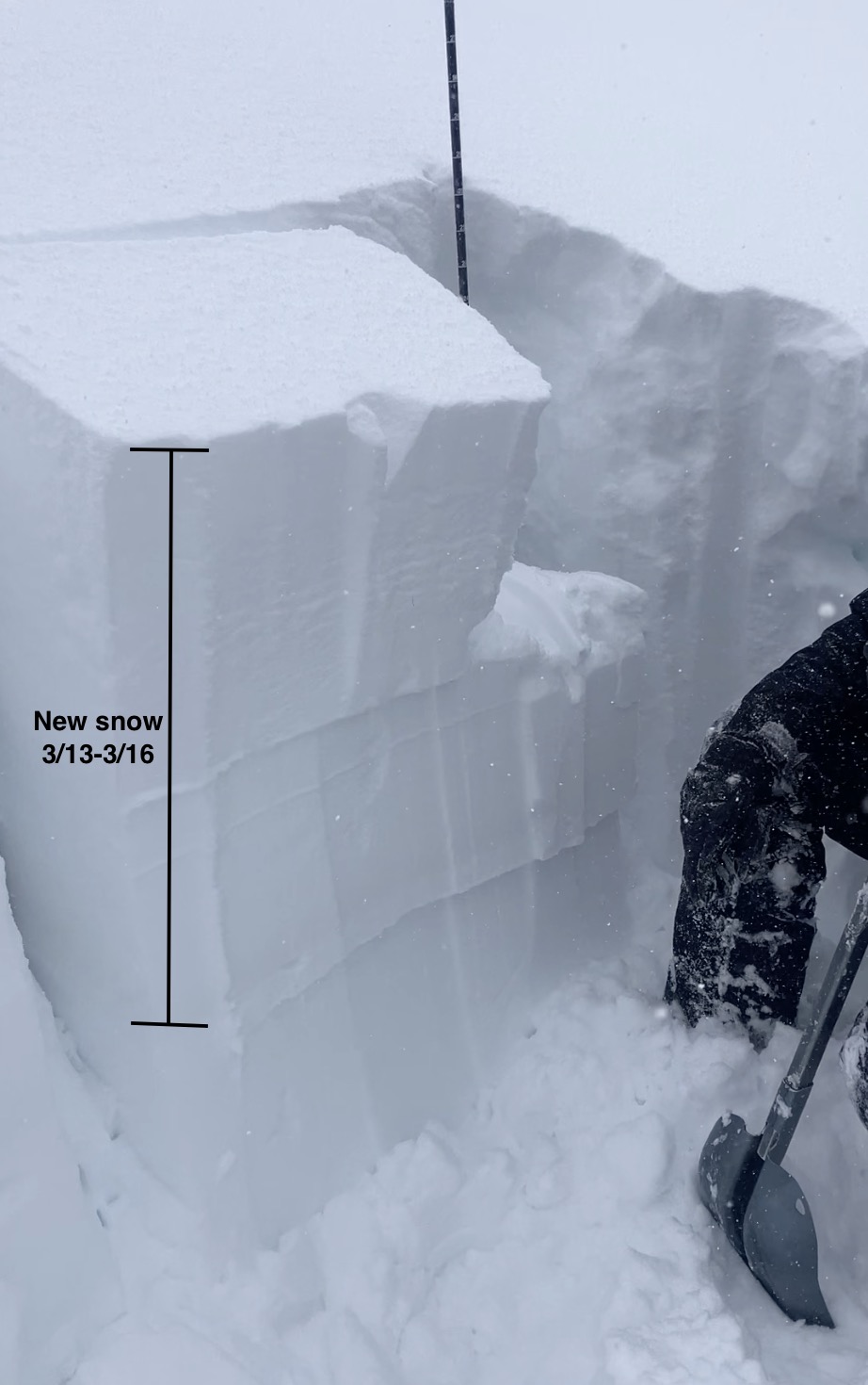
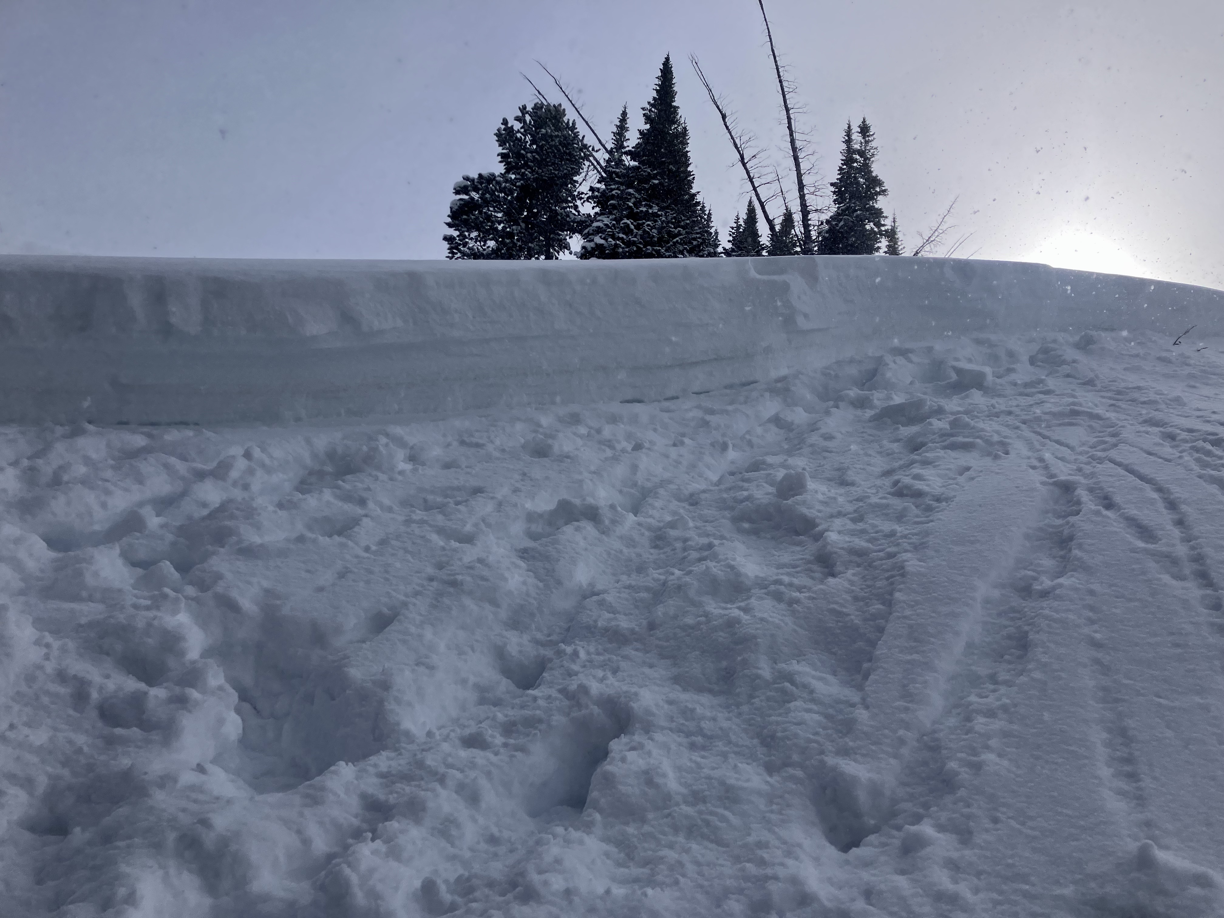
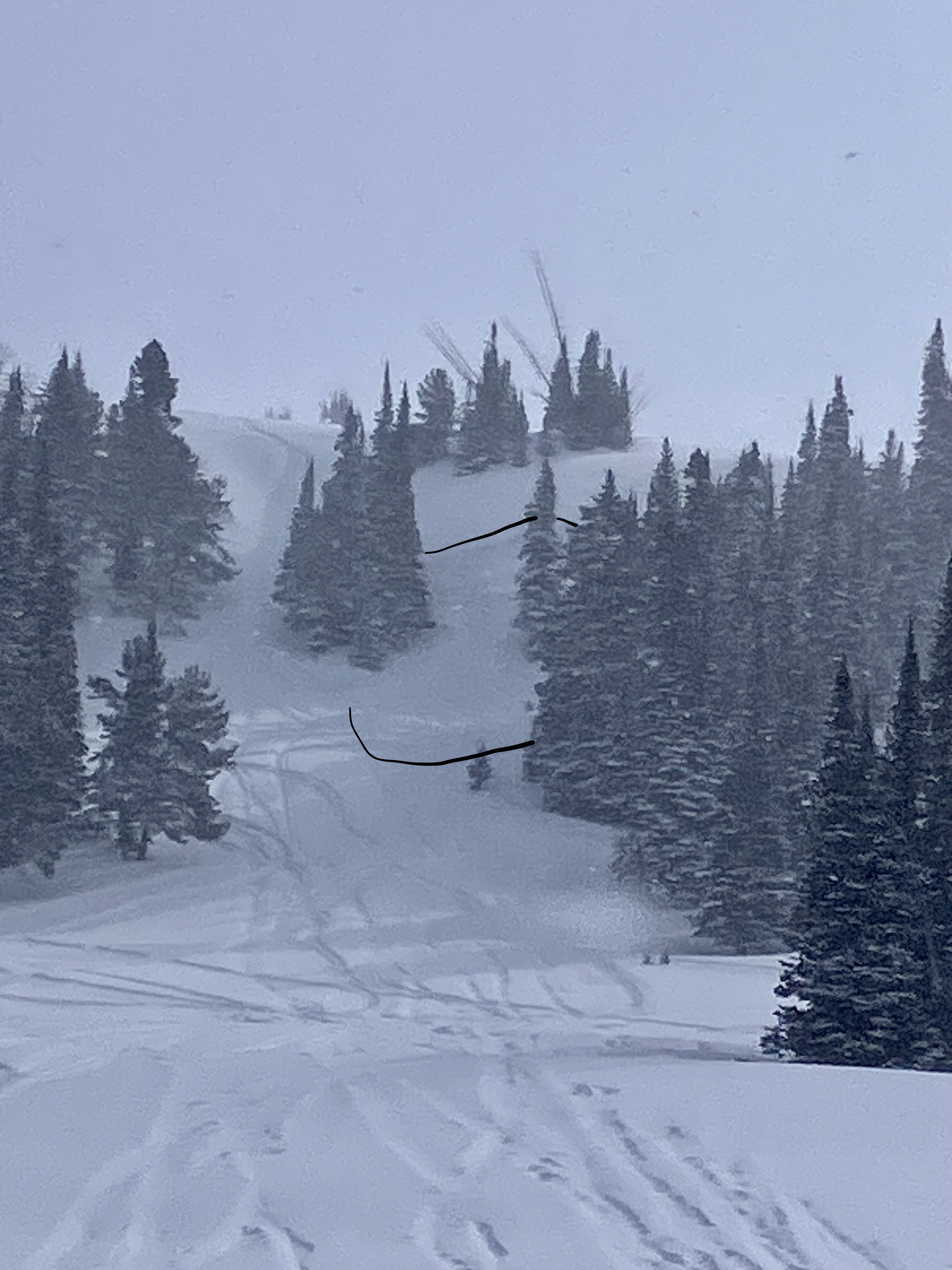
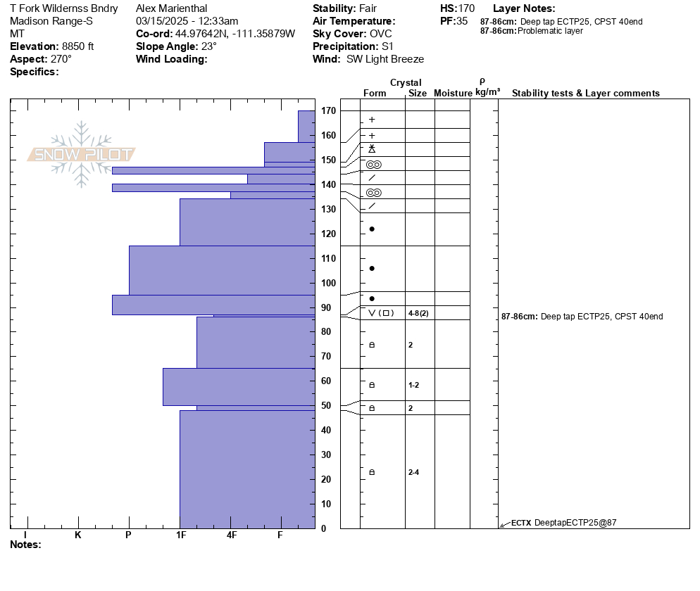
We went into the Lawnmower in the Deep Creek area. Although Kyle and Haylee had skied in the zone, this was my first time there. For me this was a terrain and snowpack familiarization day. First impressions, that is a scary piece of avalanche terrain and a beautiful area. We skinned up the northwest ridge system and dug two-thirds of the way up and again at the top. In our snowpits, we tried to capture a good picture of multiple elevation bands that encompass the potential starting zones of the run and develop a picture of what we might encounter. Snowpits were 190-265 cm deep and largely resembled what I have seen in the northern Gallatin Range. From my understanding, this is an unusually deep and strong snowpack for the area. The basal facets were the most concerning layer in our 190cm pit (1000' vertical below the top). These were 1 Finger minus to 4 Finger plus hardness and rounding. We just dug to the dirt layer on our upper pit. There was 50-70 cm of settled new snow from this weekend's storm cycle. We got ECTN15 results at the interface below the recent snow (see attached snowpits).
With no signs of instability, a strong snowpack structure, no recent avalanche activity in the visible terrain around us, calm conditions/ no wind-loading, and stable results in our snowpits, we choose to ski the main run. We did discuss that due to the nature of the terrain, each skier would be effectively solo for periods of time because there are limited areas to stop that aren't exposed to the avalanche hazard.
One skier triggered a very small loose snow avalanche that ran 50 vertical feet at the top of the run. Other than that, the descent was uneventful.
Temps at the car when we got back at 3 PM were 37 degrees. With sunny skies, the snow on south and west-facing terrain was getting moist and sticky, but we did not observe any wet snow activity.
Full Snow Observation Report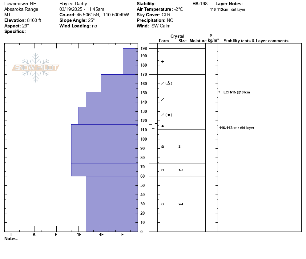
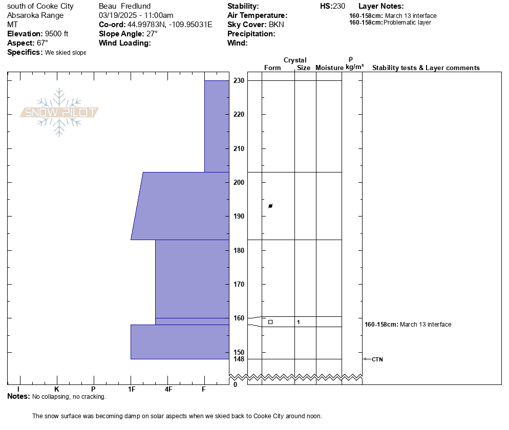
We were split boarding south of Cooke City today, up to terrain around 10'000', and finding good snow stability.
Weather was mostly cloudy in the am, partly cloudy in pm. Light winds from the SW.
No fresh avalanche activity observed. Attached is a photo of the only sign of a recent avalanche we could find. (an old crown on an East aspect at 9600').
No collapsing no cracking.
Storm snow: was measuring the HN to be around 50cms at 8500', and 70+cms at 9500'.
With a snowpit attached from a E, NE aspect around 9500'. CTN.
Wind effect: significant in localized places, from the St. Patrick's Day event. Wind drifts were not sensitive where we were traveling.
Full Snow Observation Report
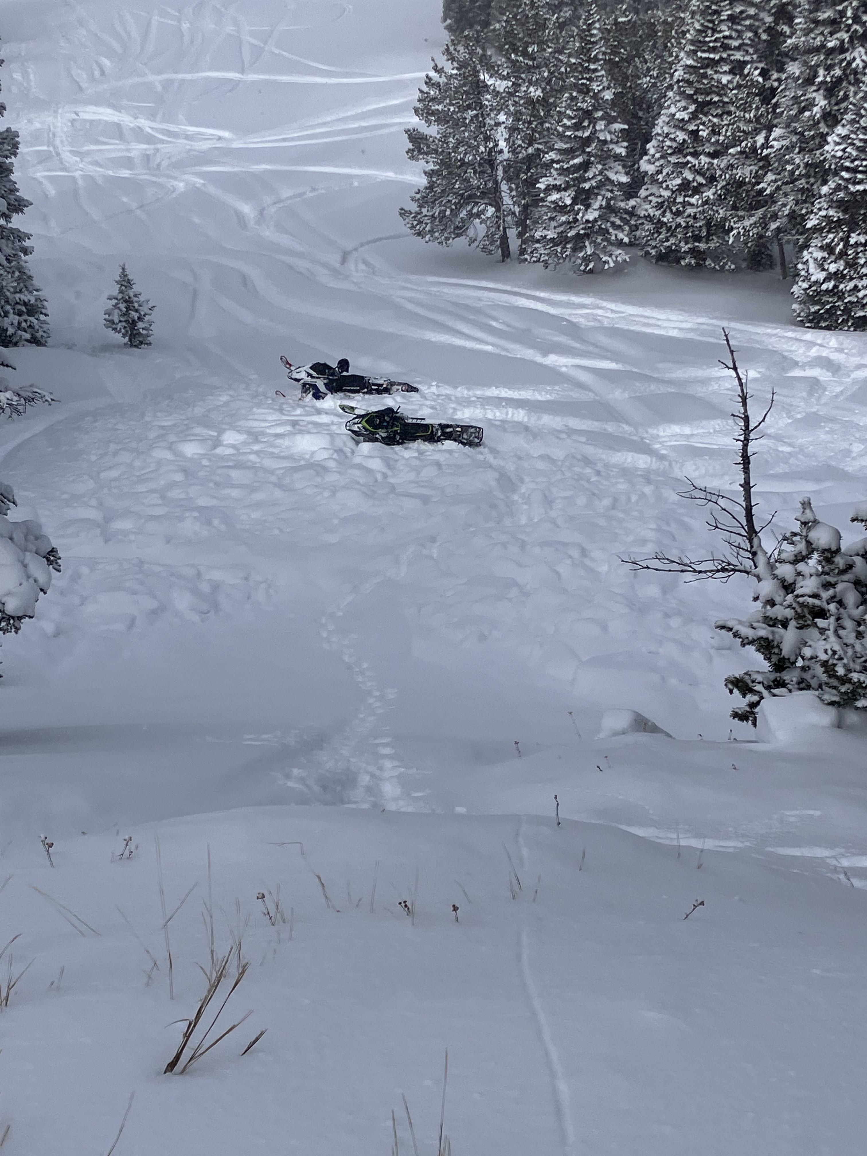
Skier caught and carried approx 100 yards thru pinch of main pinnacle chute. Skier was not buried but did lose ski. Suspected culprit of avalanche was cornice drop or skier above sliding down into us. We observed little to no movement or activity before dropping into line besides prior day cornice drop slides. Slide footage can be found @0:55 mark of linked video
https://www.instagram.com/reel/DHZhI6DMGse/?igsh=YWgxd3cyaGpzY3F5
Full Snow Observation ReportLocation: Mount Maurice
Aspect: N
Elevation: 7,600'
We found a 100cm deep snowpack. In our pit, we got an ECTn13 at 65cm on a melt/freeze crust. We found a layer of facets at the ground that was 5-10cm thick, but we were unable to impact that layer in our tests. We noted other melt freeze crusts and the Feb 4 dirt layer between the new snow on the surface and the layer of facets at the ground.
Full Snow Observation ReportToured into Frazier basin today. Saw cracking in wind drifted snow near a ridge top at 8500’. The cracks were about 15 ft across. The drifted snow was about 1-1.5ft thick and still pretty soft. New snow depths varied, some areas were completely scoured.
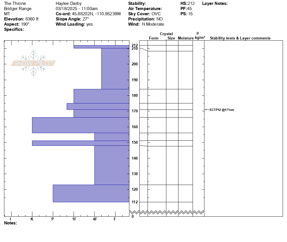
Full Snow Observation ReportAfter a weekend of stormy weather, dropping about 1 foot of snow (~1" of SWE) on the ground, we toured out to the Throne today to see how the new snow had settled and what the winds had done to it. As we approached the main face, we noted swirling winds transporting a fair amount of snow. Generally, winds blew out of the north with gusts from all sorts of directions throughout the day.
Despite the active snow transport, east facing snow surfaces were still soft with minimal to no slab development. We did not note any signs of instability as we traveled up the face. As we neared the ridgeline and shifted to a more southerly aspect, we noted scalloped and scoured snow surfaces and the development of thin wind skins and a few 1-2" wind slabs. We dug a snowpit on a southerly aspect at 8360' (HS: 212) and got an ECTP12 on an 18" wind slab. This test result, as well as the few small wind slabs we noted were the only signs of instability seen today. We chose to stay off of steep southerly terrain and traveled back to the main face where winds had minimally impacted snow surfaces.
On the ride out, we had great views of the Bridger Ridge and did not see any signs of new avalanches across this broad area.
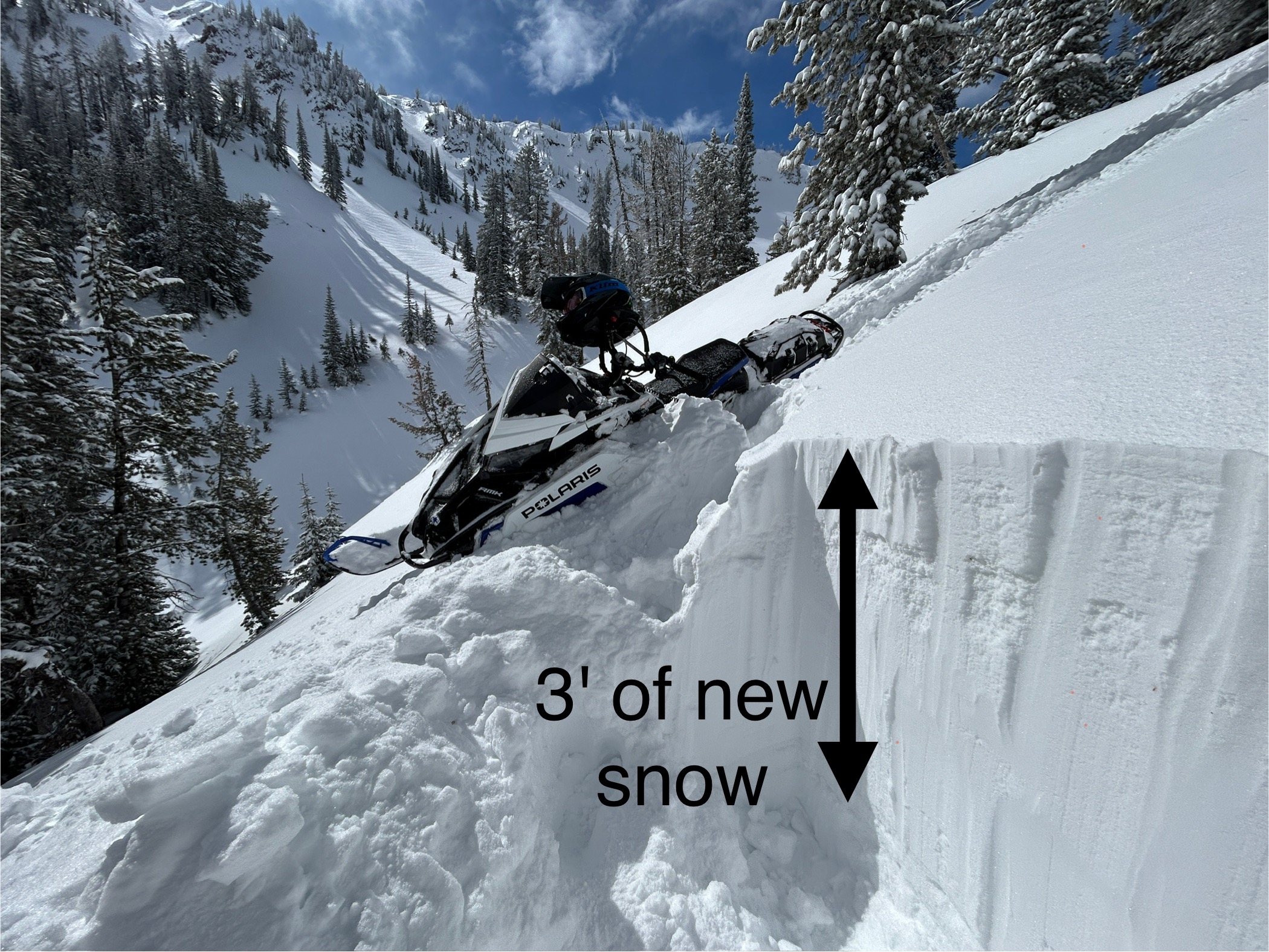
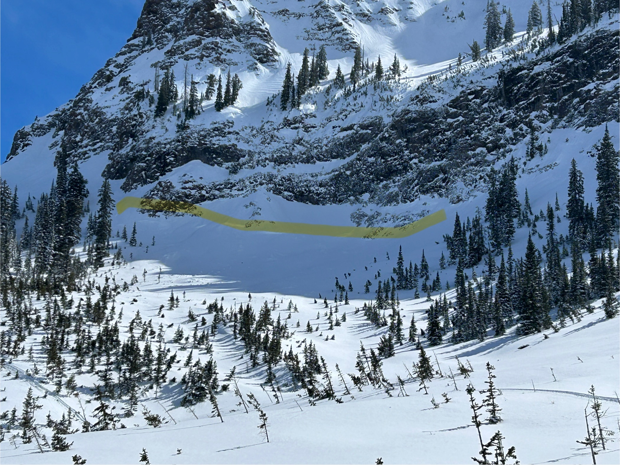
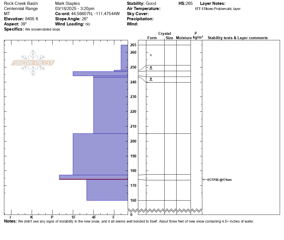
Full Snow Observation Report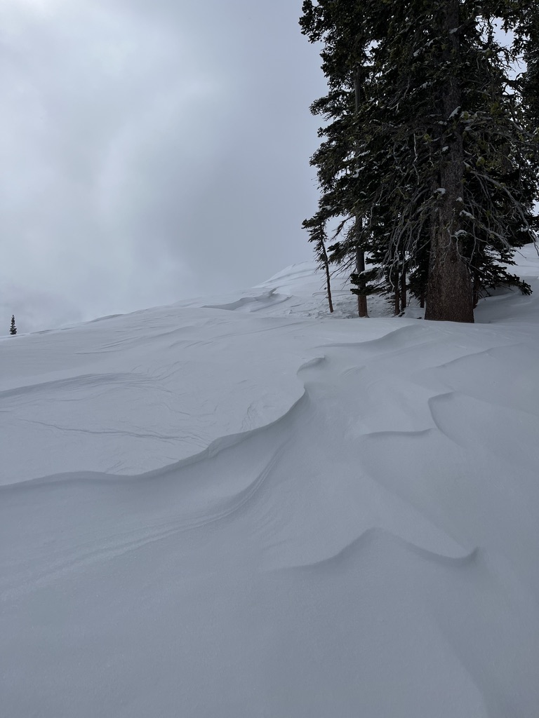

In the last five days, this area has received snowfall containing 4.5-5.3 inches of water which has settled to about 3 feet of new snow. Winds last sunday night from the southwest reached speeds up to 80 mph before easing, but then they blew from the north today.
We saw a handful of avalanches above treeline terrain that seemed to be wind slabs. However wind and snow had obscured them and I suspect there had been a lot more.
No cracking in the new snow and one possible collapse. Interestingly - My stability test scores had actually improved since Friday when there was less new snow. They broke and propagated just under a crust under the new snow. ECTP12's on Friday. ECTN & ECTP25 today. The reason is that they have been breaking on old, broken snowflakes....not facets.
Key points
- The new snow seemed mostly stable on sheltered slopes
- Wind loading is the main issue.
- With this kind of loading, it often finds weaknesses in the snowpack. I don't expect any moster slides, but also wouldn't be surprised to hear of one being triggered if tomorrow were a busy weekend day with lots of people out
- Avoid alpine terrain above treeline where winds have drifted lots of snow. Avoid hanging out in runout zones of big paths
Full Snow Observation Report

Toured up to the meadows below Ross Peak today. Didn't see much cracking within the new snow (mostly just directly under our skis). At around 8000' we found a foot of right side up snow above a crust. I dug a hand pit below the crust and didn't get any planar failure. On our way down we started to see the surface snow getting heavier as it warmed up.
We were in a fairly protected zone but saw a few small patches of soft wind slab and noticed snow being transported over the ridge above us when visibility was good.
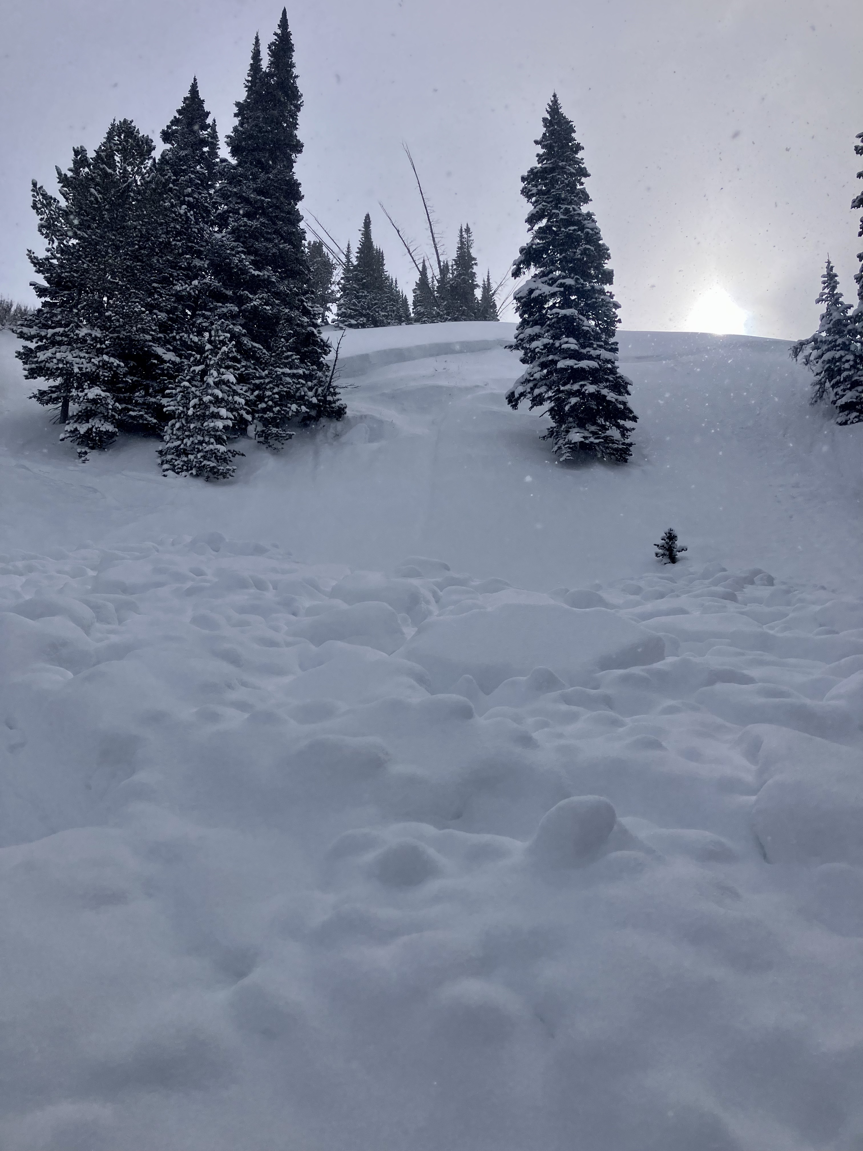
Full Snow Observation ReportThe snow ranger crew was riding around the Bridgers today and we spotted this slide in the bowl to the south of Hardscrabble peak. It looked fairly recent (last 2 days) but a little hard to tell due to the new snow since yesterday and blowing snow today. It seems likely that it is one of the slides reported in an observation yesterday. We had a nice view of it as we rode out so I figured it was worth a picture.
As for the riding, there seemed to be about 8-12" of new snow that was bonded to the old surface pretty well. Best riding was anywhere you could get out of the wind, so sheltered bowls or in the trees.
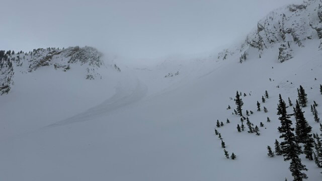
Full Snow Observation Report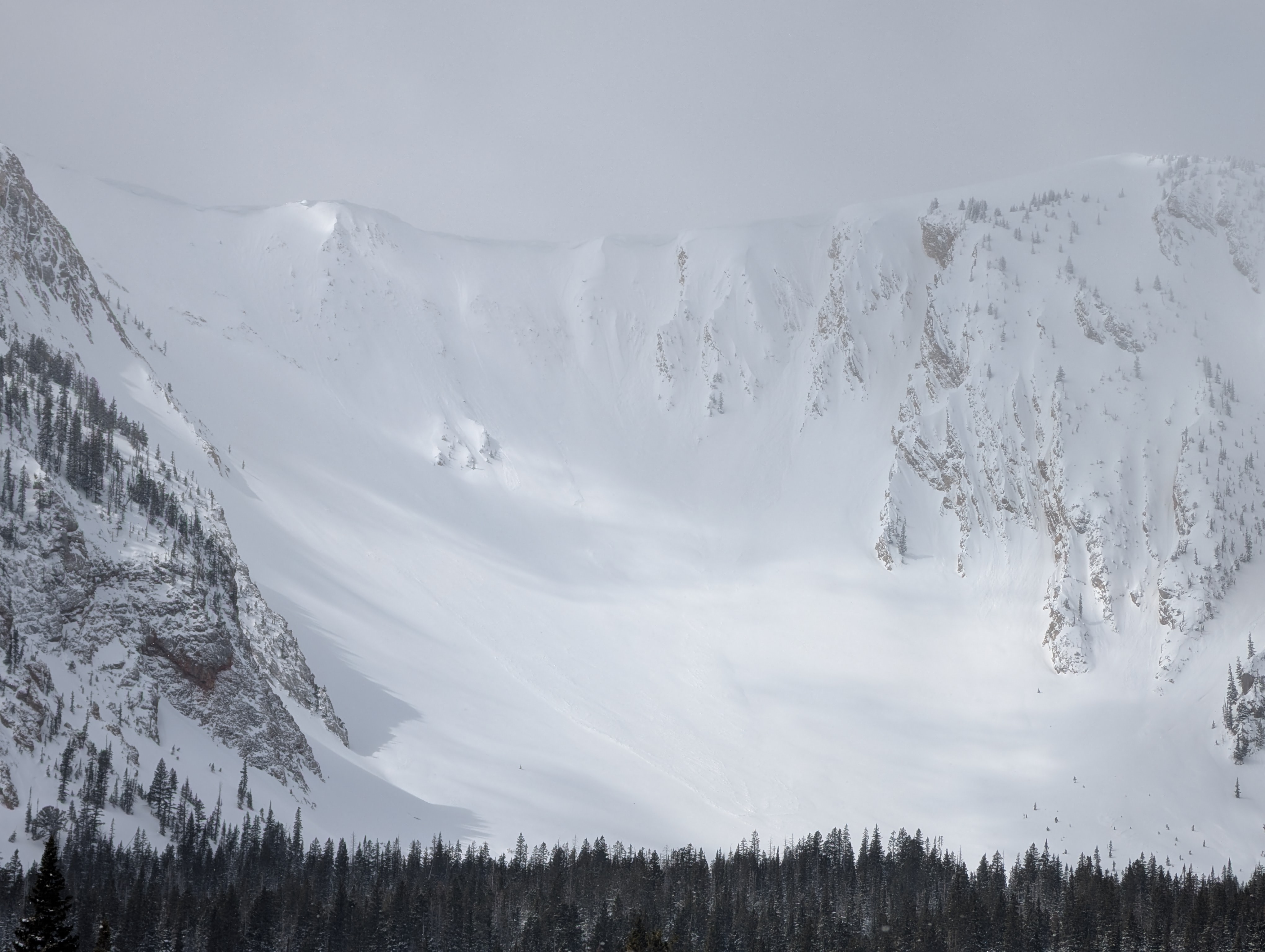
From IG: Nature or cornice triggered slides in Arrowhead and Hardscrabble Bowls.
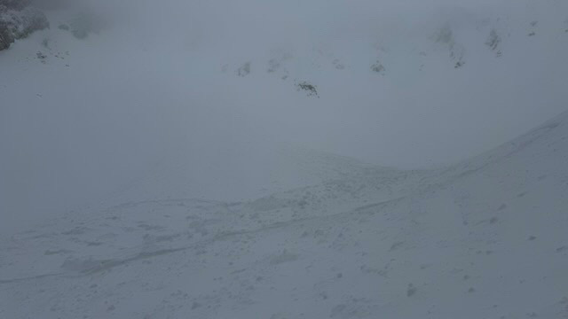
Full Snow Observation Report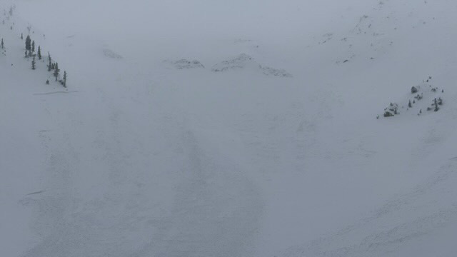
We skied north of Cooke today. The storm snow is upside down with a wind slab sitting on top. There is also a new dust layer that came in last night with the extreme winds. We had two collapses while skinning and ECTP13 down 60cm at the new/old interface on top of a crust, SE aspect at 9700'. Winds were L-M out of of the W and S2 snowfall all day with 8" new during the day.
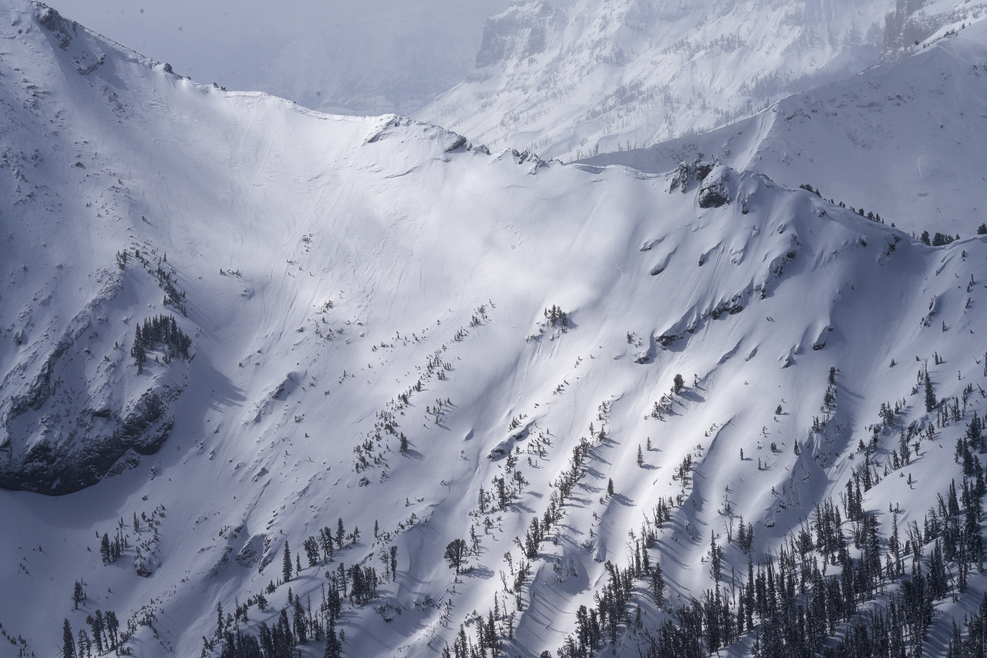
Full Snow Observation ReportI rode into Lionhead head with Ryan, Aaron, and Omar on an avalanche warning day. We went straight to Ski Hill and dug a pit there. With better visibility than I anticipated we dropped down to Denny Creek, travelled up and around to the head of Targhee Creek before dropping down through Targhee and back to the vehicles. During the day ~6" of snow fell with moderate winds. Wind slabs were widespread as we rode, and the surface conditions had stiffened in many locations due to the effects of the strong to extreme winds.
We saw many R1-R2 wind slab avalanches below the cornice line. Visibility was limited so I won't estimate the exact number, but nearly every time we had good views of the steep faces, we saw cornice collapses, debris, or small crown lines. There were two slides on east aspects that ran closer to full path and piled debris more deeply. I expect that most of these had run within the last 24 hours, but continuing snowfall and hurricane force winds made precisely dating these a challenge (many trees were blown down during the wind event, these too were already somewhat buried). None of the avalanches broke on persistent weak layers as far as I could tell.
We dug at Ski Hill. Pit results were unremarkable with an extended column test breaking and propagating with an extracurricular ECTP32 on the January facets. The January weak layer was buried a meter deep and was 1 Finger Hardness and had gained strength. However, we wrapped around the corner on our decent and found a shallower slope (1m deep) where Fist Hard facets were capped by a dense wind slab. I did not perform an official ECT, we had undercut the slope with our sleds and were able to knock 5-foot-wide sections of slab off with an arm chop, triggering miniature avalanches that slid easily. This showed us what we needed to know--an avalanche on a steep slope with that structure was likely (see video).
Full Snow Observation ReportThe warning verified well - recent wind slab avalanches and pwl/ slab on test slope. Conditions in the low-angle terrain we traveled in were not showing any dramatic signs of instability - no shooting cracks, etc. It seems like the danger can come down relatively quickly when the storm wraps up. The persistent slab problem is still a factor, but it seems much more isolated than in the recent past as the layer has gained strength on many slopes.

Not much snow on storm castle road until 5500 feet, started snowing at about 6500 feet, wind didn’t start blowing from the south until after 12:00pm Got CT5 on a layer buried 8cm on a North facing slope at about 7200 feet, Another layer broke after just above the ground at CT23. Snow depth was 110 mm.
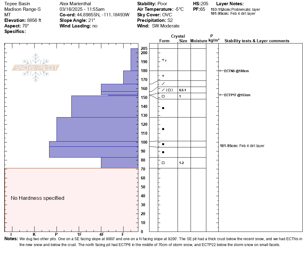
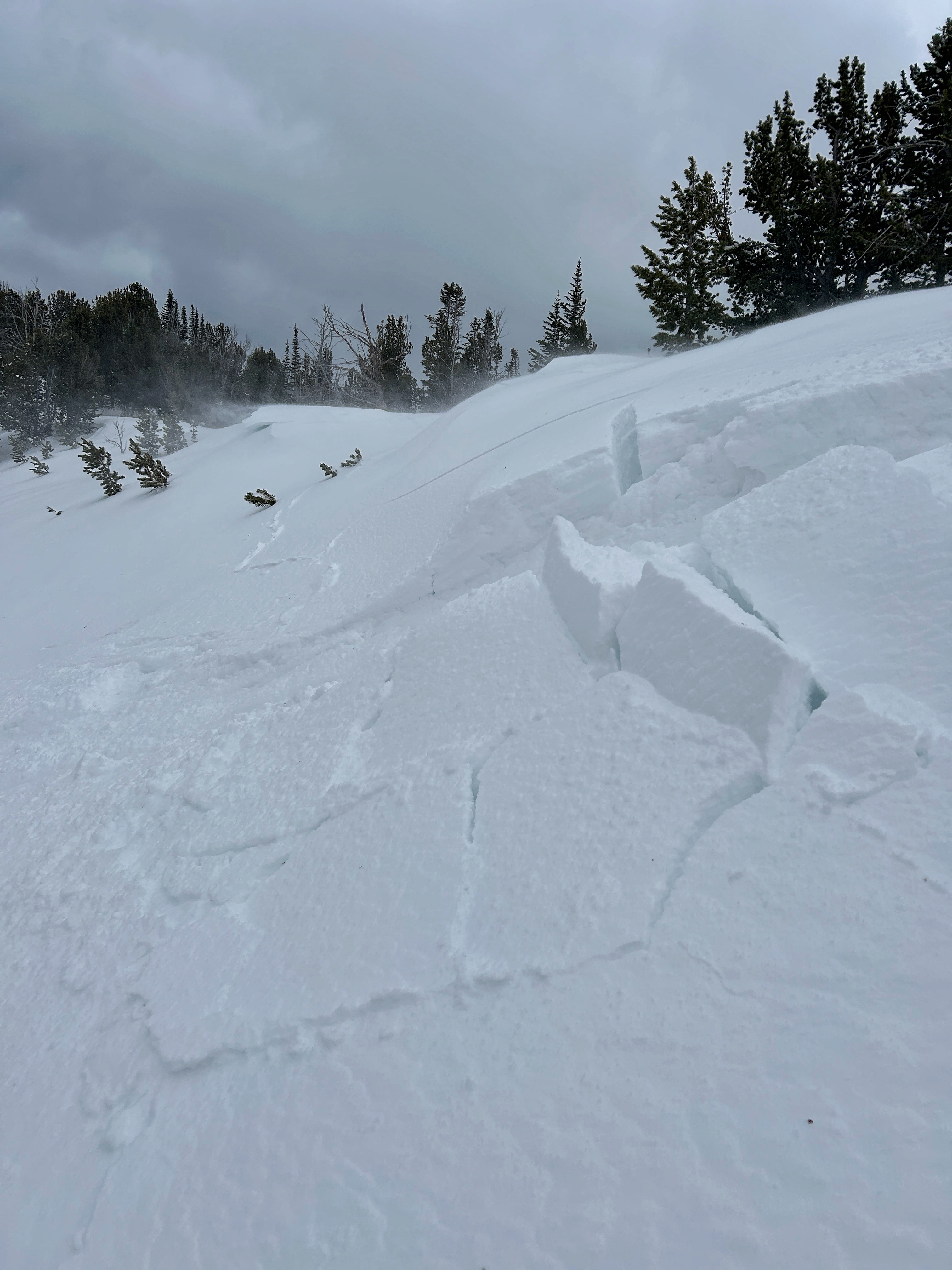
Full Snow Observation ReportWe rode into Tepee Basin and to the north wilderness boundary. It was snowing all day with moderate winds and some strong gusts in more open areas. We could only slightly see the bottom of some avalanche path, but did not see any signs of avalanches (there could have been some higher up in terrain obscured by clouds.)
There was 1.5-2 feet of new snow that fell since Thursday. We dug (3) snowpits on northeast, north and southeast slopes, between 8800'-9200'. The pits on northerly slopes had ECTP 17 and 22 on a thin weak layer below the new snow. We also had ECTP 6 within the storm snow.
There was minimal cracking across the surface in the new snow, but plenty of signs of fresh drifts. It felt likely you would easily trigger storm slab or wind slab avalanches on steep slopes.
Full Snow Observation ReportCONSIDERABLE danger felt correct

From email: Isolated wind slabs today in the southern Bridgers.
Full Snow Observation Report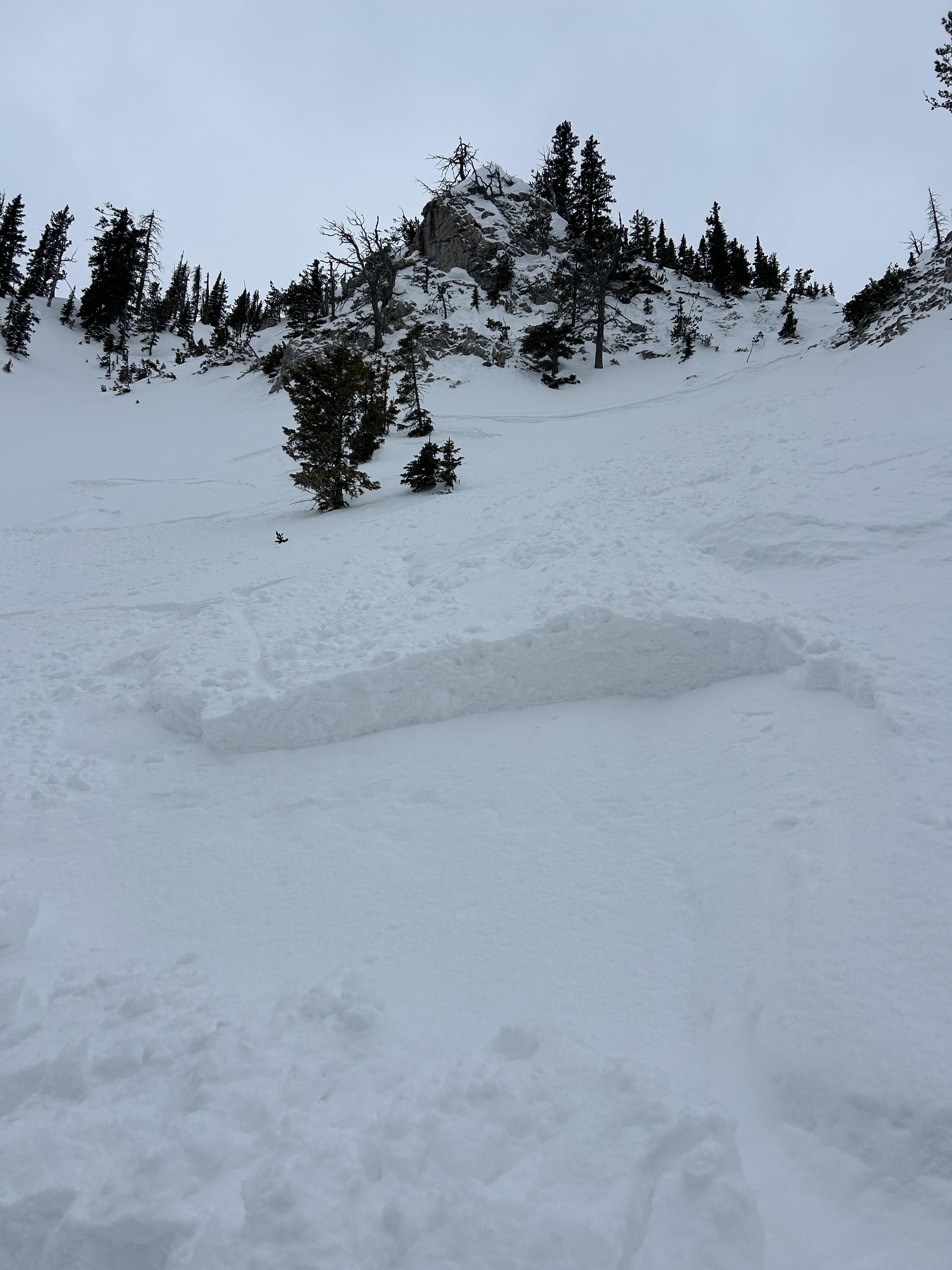
Up to a foot of soft snow which seemed to have included a few inches from last weekend. Winds were transporting snow across Buck Ridge all day long.
We triggered two small and shallow wind slabs that didn't go anywhere, but they were a warning of bigger wind slabs on bigger slopes. We didn't find any faceted or weak layers of concern deeper in the snowpack.
Wind slabs will grow in size overnight and will be the main concern tomorrow. Fortunately they will be easy to see an avoid.
Full Snow Observation Report
MODERATE danger seems appropriate. However it could rise to CONS if winds dramatically increase tonight. Seemed pretty chill today.
Toured into Margaret's Meadow this afternoon. 2" of dense snow over a 1/2 of graupel, on top of a wind crust. Light winds from the SSE. Light wind loading on the N, and NE aspects. No cracking or collapsing, and new snow seems to be bonding (at leas on lesser angled slopes). Skiing conditions were surprisingly good.
Full Snow Observation ReportToday I triggered a D1 dry loose avalanche on a E facing 35 degree slope, 9300 ft on Mt Henderson. The new snow is very low density and is not bonding well to the old interface. I also observed some more dry loose activity/small wind slabs on Sheep Mt, NE facing, 10400 ft.
Full Snow Observation Report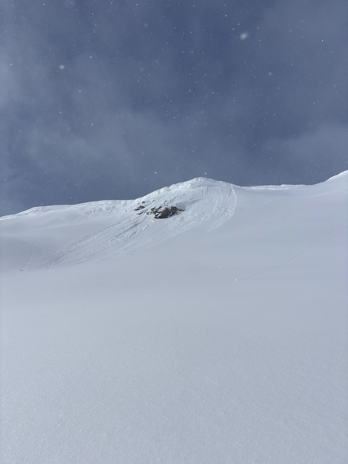
We looked at the avalanche in Sunlight Basin/Taylor Fork that was triggered by a snowmobiler yesterday. It was 50' wide, 100' vertical, 2-3' deep hard slab with 8-9" new snow on top. Broke on weak facets buried in late January. Dirt layer from Feb 4 was visible 6-8" above weak layer. Bed surface was 3" to 1.5' deep of weak, sugary facets. Slope angle was 38-40+ degrees. 8800', WNW aspect.
We also rode to the northwest end of Carrot Basin near the wilderness boundary and dug a pit. Snow depth was 5-6 feet. We found the buried weak layers 3 feet deep. It broke and propagated with many extra hits after an ECTX.
Snow fell lightly most of the day up high while it was sunny in the parking lot. Wind was light with a few moderate gusts. There was minimal signs of recent wind, but forecast is for wind to increase and there is a lot of light snow to drift into slabs.
Full Snow Observation Report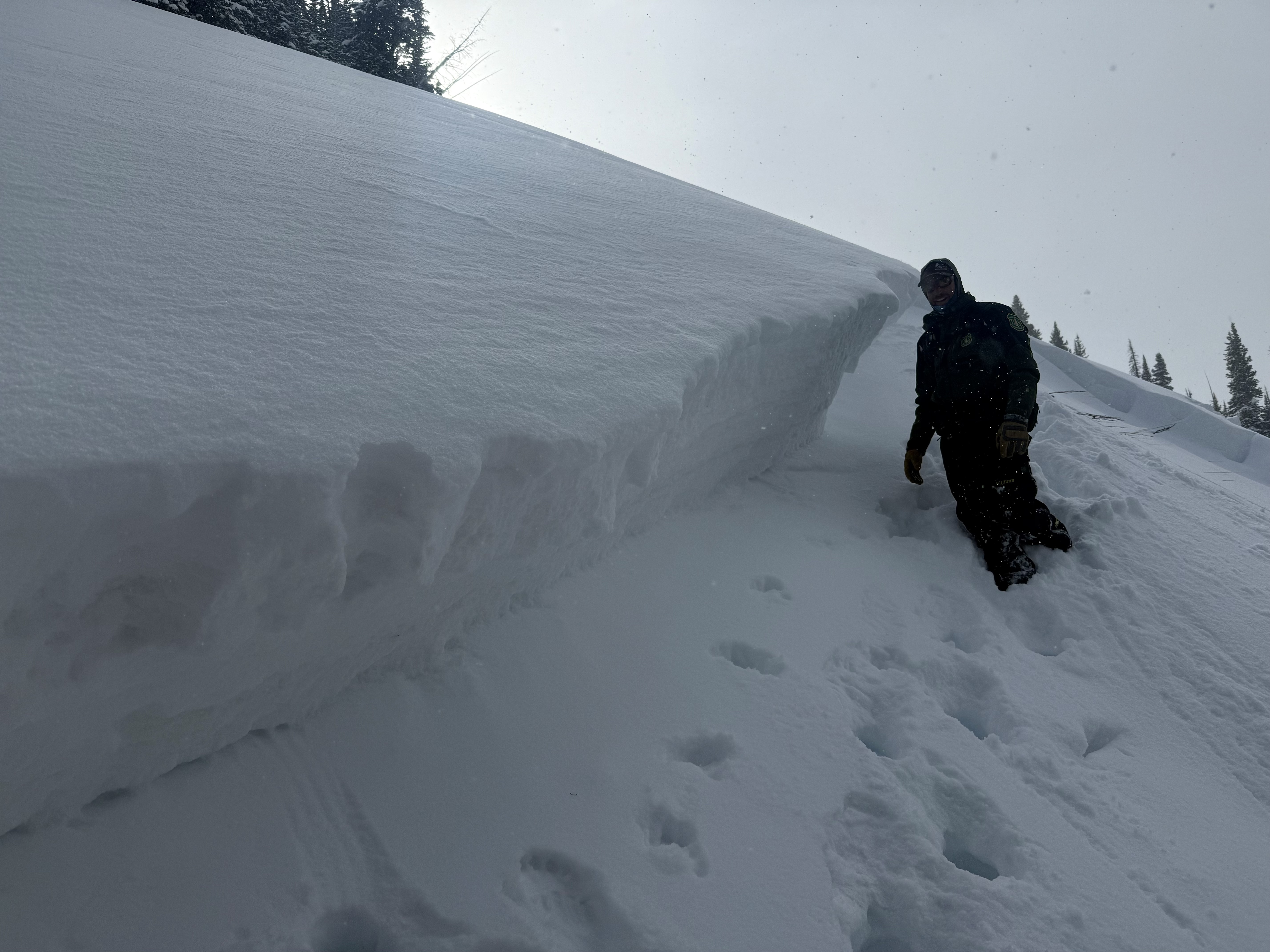

We traversed the ridge south from the Bridger Bowl ski area boundary to Bridger Peak, descended a NE aspect and skinned/traversed back to the ski area boundary. Moderate west winds weren't transporting a significant amount of snow (much of the west side of the ridge was already scoured bare and the remaining snow was already hardened). The sun and clouds were in and out through the day and there were even a few snow flurries, but no accumulation.
Wind Slab avalanches were our primary concern today, but we did not see any as we traversed the ridge and the new snow we encountered was not cohesive.
Dry Loose avalanches (sluffs) ended up being the biggest hazard we encountered. The new snow (approximately 8") was easily sluffing over last weeks crust and was entraining significant volume and running far in steep terrain. It had plenty of power to knock you over or into trees/rocks.
We saw no slab avalanches or signs of instability.
Full Snow Observation ReportMODERATE was great today. Sluffs were predicable and easily managed.