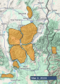
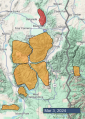
Advisory Archive
There is no new snow. Wind has been out of the southwest at 15-25 mph with gusts of 35-65 mph. Temperatures are low 20s to low 30s F. Today, temperatures will reach mid 30s F, and wind will be southwest-west at 10-20 mph. Snow showers will arrive in the southern half of our forecast area later this morning, and in the north this evening, with 1-3” possible by tomorrow morning.


This morning, there is no new snow, temperatures are teens to 20s F, and wind has been out of the southwest-west at 20-35 mph with gusts of 35-60 mph. Today, under partly sunny skies, temperatures will reach low to mid-30s F and low 40s F in the Bridger Range, and wind will be southwest at 15-30 mph with gusts to 45 mph. No snow is expected until Monday night or Tuesday.


There is no new snow. Mountain temperatures are in the teens F. Winds are generally 10-15 mph gusting up to 25 mph out of the west, but are a bit stronger in Bridger Range and gusting to 70 mph in Island Park. Temperatures will rise into the 30s F in most places and up into the 40s F in the Bridger Range. Winds will generally remain moderate and shift more southwest today. We’ve got another bluebird day in store. The next chance for snow is on Monday.

There is no new snow. Temperatures are in the single digits above and below 0 F. Winds are 5-15 mph out of the west and north. Temperatures today will rise into the high 20s and low 30s F under sunny skies. Light west and north winds will continue today. No snowfall is expected through the weekend.


An inch of snow fell yesterday morning in Cooke City and Island Park before the skies cleared. Wind has calmed with only occasional westerly gusts of 15 mph. Mountain temperatures are 5F and will rise to the high 20’s today under mostly calm and sunny skies. No snow is expected until early next week.


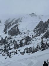
In the last 24 hours 7” fell in the Bridger Range and in Hyalite, 3” around Big Sky, 7” in Taylor Fork and 12+” in Cooke City, West Yellowstone and Island Park. Wind is W-NW at 10-20 mph with gusts of 45 mph. Snowfall has mostly stopped and westerly wind will calm to 10-20 mph. Clouds will diminish today and temperatures will rise from 10F to 25F. Clear, sunny weather is on the menu through the beginning of next week.


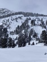
Temperatures are in the single digits above and below 0 F this morning, with 10-25 mph winds from the west to the south. The mountains received 1-3” of new snow across the advisory area, with 5” in Island Park. Today, temperatures will be in the upper teens to low-20s F, with 15-25 mph winds from the southwest to the northwest. By tomorrow morning, the mountains near Cooke City, West Yellowstone and Island Park will have 8-12” of new snow, with 5-8” near Big Sky and the Northern Gallatin Range and 1-3” in the Bridger Range.


Since yesterday morning no new snow has fallen. Wind has been out of the west-southwest at 5-15 mph with gusts to 25 mph. This morning temperatures are below zero to single digits F, and today they will reach teens to low 20s F. Wind will remain west-southwest at 10-20 mph. Snow showers are possible in the southern part of our forecast area today, with snow throughout the forecast area tonight and tomorrow. By tomorrow morning most areas will receive 1-3” of snow, and near Cooke City 3-5” is possible.
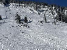

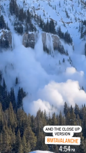
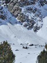
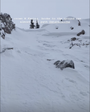
In the Bridger Range it is snowing hard this morning and 20-25” of snow fell since yesterday morning. Elsewhere received 5-8” of dense new snow. Temperatures are zero to teens F. Wind has been out of the west-southwest at 15-30 mph with gusts of 30-60 mph. Today, temperatures will reach teens to low 20s F, and wind will be westerly at 10-20 mph. Light, scattered snow today and tonight could drop 1-2” by tomorrow morning.


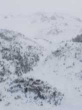
There are 6-10” of new snow around Island Park, West Yellowstone and Cooke City, much of which fell overnight. 2-6” fell around Bozeman and Big Sky as snowfall ended yesterday morning. Temperatures are in the 20s F this morning. Winds are 10-20 mph out of the southwest to southeast with 20-30 mph gusts, except near Island Park where it is blowing 30-45 mph out of the west with gusts up to 88 mph. Winds will remain strong today. Temperatures will rise into the high 20s and 30s F. Another 7-10” will fall today around Island Park, with 6-8” near West Yellowstone and Cooke City, and 2-4” around Bozeman and Big Sky.