This is Mark Staples with the avalanche forecast for Thursday, February 20th, at 7:00 a.m. sponsored by Cooke City Super 8/Bearclaw Bob’s and the Idaho State Snowmobile Association - Avalanche Fund. This forecast does not apply to operating ski areas.
This morning temperatures are in the low 20s to high teens F, about ten degrees warmer than yesterday morning. Ridgetop winds in the Bridgers and Hyalite are blowing 10-14 mph gusting 20-32 mph from the W. In all other areas, winds are blowing 5-10 mph from the W & NW. An inch or two of snow fell overnight.
Today expect mostly cloudy skies this morning with a few snowflakes in the air and maybe a little clearing this afternoon. High temperatures should be mostly in the mid 20s F. Winds will be light in most areas but will blow a bit stronger in the mountains near Bozeman this morning.
Note about winds - Friday should have mostly light winds. On Saturday, winds pick up in the mountains near Bozeman, and on Sunday winds from the SW crank up for most areas. There is tons of soft snow available for the winds to transport
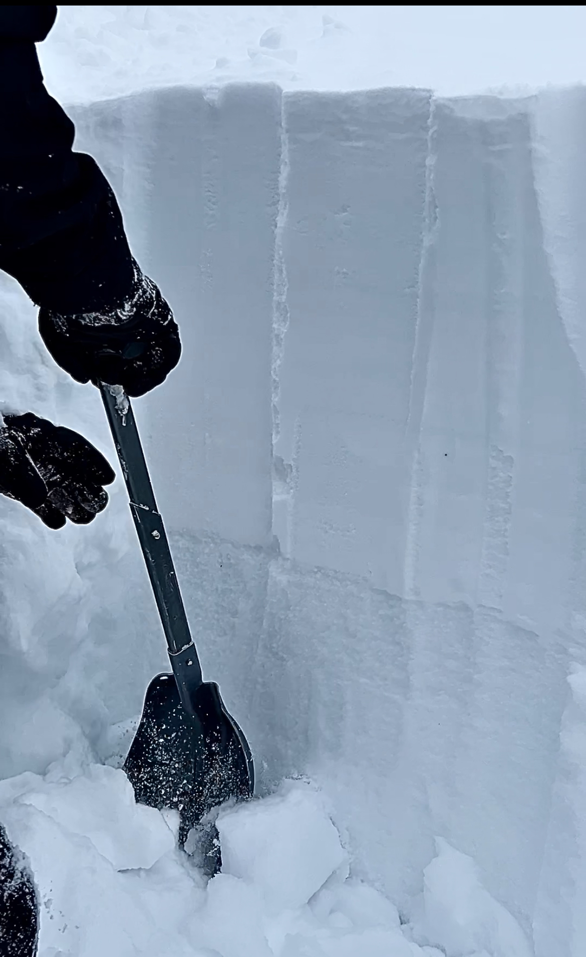
Persistent slab avalanches - Dave and I remotely triggered (from a distance) one of these slides on Lionhead yesterday 1-3 ft deep and 200 ft wide that broke on a weak layer of facets that formed on the snow surface in late January. This layer is easy to see in a snowpit wall. Another large avalanche was triggered remotely yesterday east of Island Park in the Black Canyon area which is outside our forecast zone. It sounds similar to the one Dave and I triggered.
The challenge is that these avalanches will happen well below treeline where the snow is relatively thinner and weaker. These areas can seem safer than higher elevations, BUT THEY ARE NOT. The other challenge is that this weak layer is not necessarily everywhere as Ian didn’t find it yesterday skiing in Bacon Rind. In popular riding areas, some slopes don’t have this weak layer because they were covered in wall-to-wall tracks in late January when that layer formed.
Wind slab avalanches - Wind slabs should be less sensitive today, but I bet you could still trigger some soft pillows of wind-deposited snow at upper elevations below cornices and ridgelines.
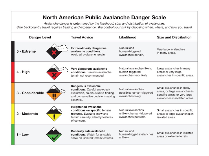
Conditions are dangerous and tricky today. Avalanches will be easy to trigger, and the avalanche danger is CONSIDERABLE.
With so much new snow (2-4 FEET of snow in the last week), even light winds have plenty of snow to transport.
Wind slabs - Winds bumped up a bit midday yesterday at upper elevations and likely transported more snow, and local ski patrols have triggered fresh wind slabs nearly every day for about the last week. Skiers in the northern Bridgers spotted at least half a dozen slides in Frazier Basin and active wind loading. They bailed on their original objectives and enjoyed great snow on slopes untouched by recent winds. Also yesterday, skiers triggered a cornice collapse on Saddle Peak which then caused a dry loose avalanche (sluff) to rumble over cliffs and create a large powder cloud.
Storm slabs and dry loose sluffs - The likelihood of triggering a soft slab or dry loose avalanche on non-wind loaded slopes is quickly going down, but the large sluff on Saddle Peak illustrates the potential.
Wet snow - Loose wet avalanches will be likely the first time all this powder is hit with warm temperatures and direct sunshine (Ian describes it well in this video). Low elevations should see temps above freezing today, but clouds are supposed to limit the sunshine, so these wet slides may not be an issue until Friday.
Triggering a wind slab remains likely on wind loaded slopes where the avalanche danger is CONSIDERABLE. Non wind loaded slopes have a MODERATE danger with a decreasing potential for dry avalanches, but sometime maybe this afternoon or tomorrow an increasing potential for wet avalanches at low elevations.
Special Note - Roof avalanches
Many roofs have lots of snow on them that may come crashing down as a roof avalanche during the first big warm-up with strong sunshine. Avalanche fatalities from roof avalanches are not uncommon. Kids are especially vulnerable because they often play near houses while no one is watching.
Upcoming Avalanche Education and Events
Our education calendar is full of awareness lectures and field courses. Check it out: Events and Education Calendar
TODAY, February 20, 4-7 p.m. Beacon BBQ at Uphill Pursuits in Bozeman. Come try out different brands of avalanche transceivers (or practice with your own!) with coaching from Friends of GNFAC instructors and free hotdogs.
February 28 - March 2, Bozeman Splitfest 2025 - Celebrate all things Bozeman backcountry and raise funds for GNFAC. Enjoy demos, clinics, free food and beer from MAP. Connect with fellow outdoor enthusiasts and soak up the winter stoke.
Every weekend in Cooke City: Friday at The Antlers at 7 p.m., Free Avalanche Awareness and Current Conditions talk, and Saturday from 10 a.m.-2 p.m. at Round Lake Warming Hut, Free Rescue Practice.