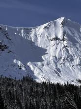


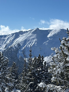
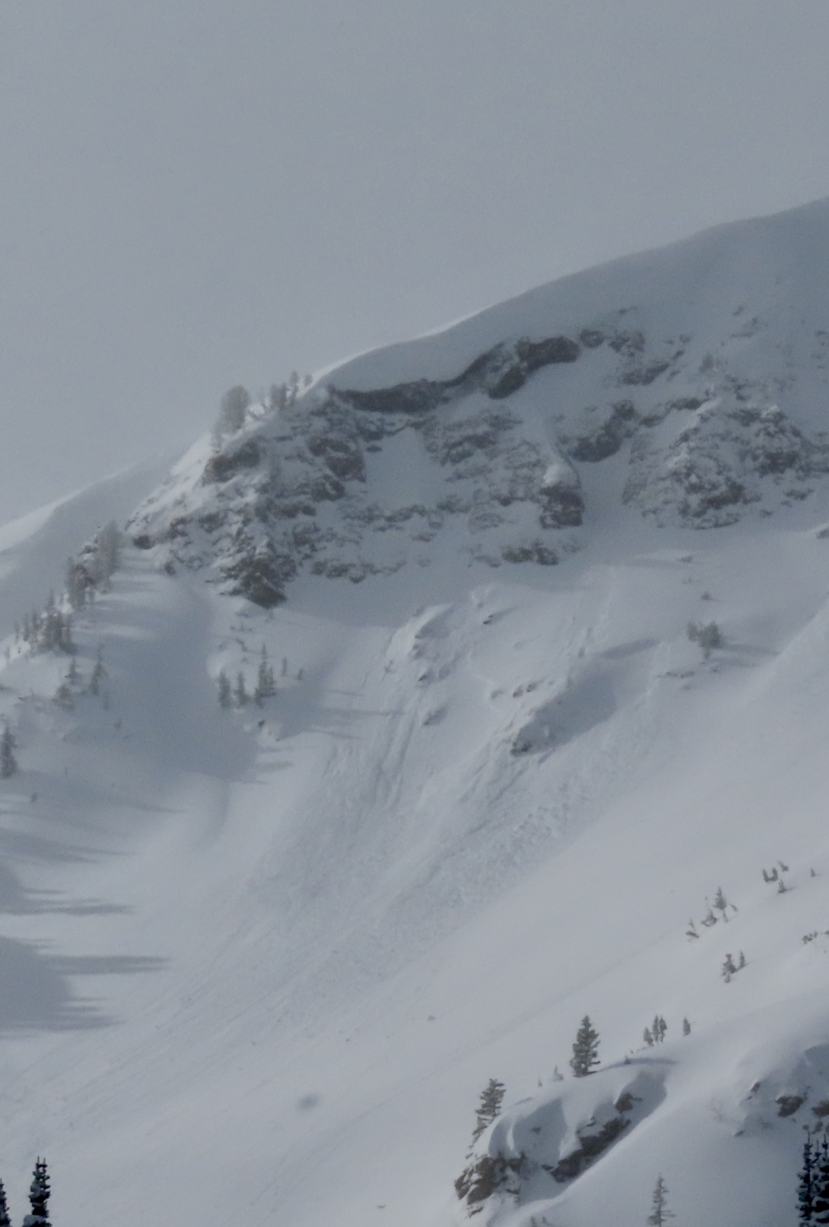
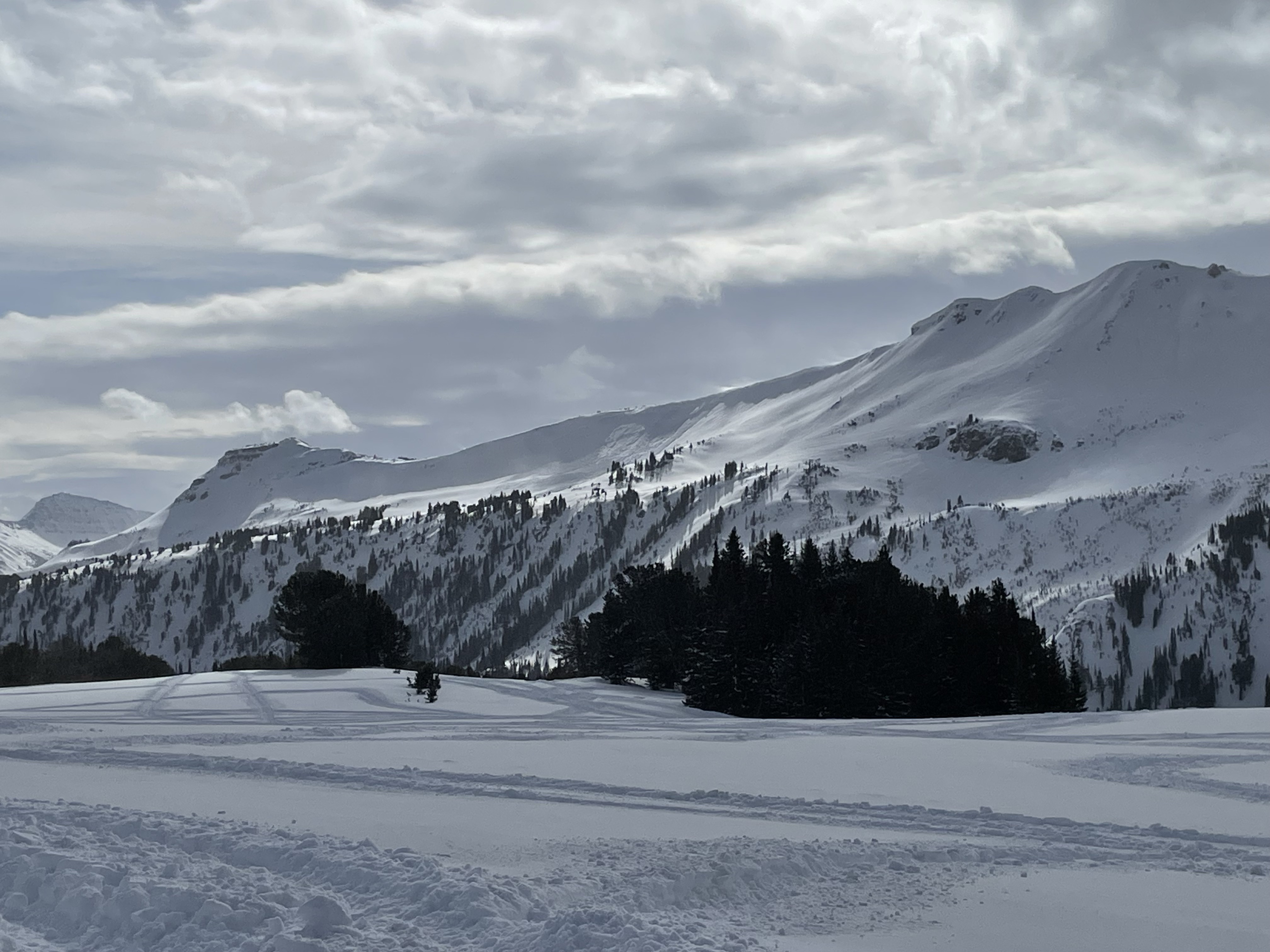
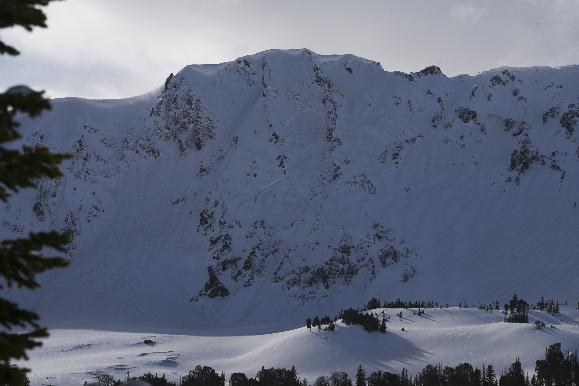
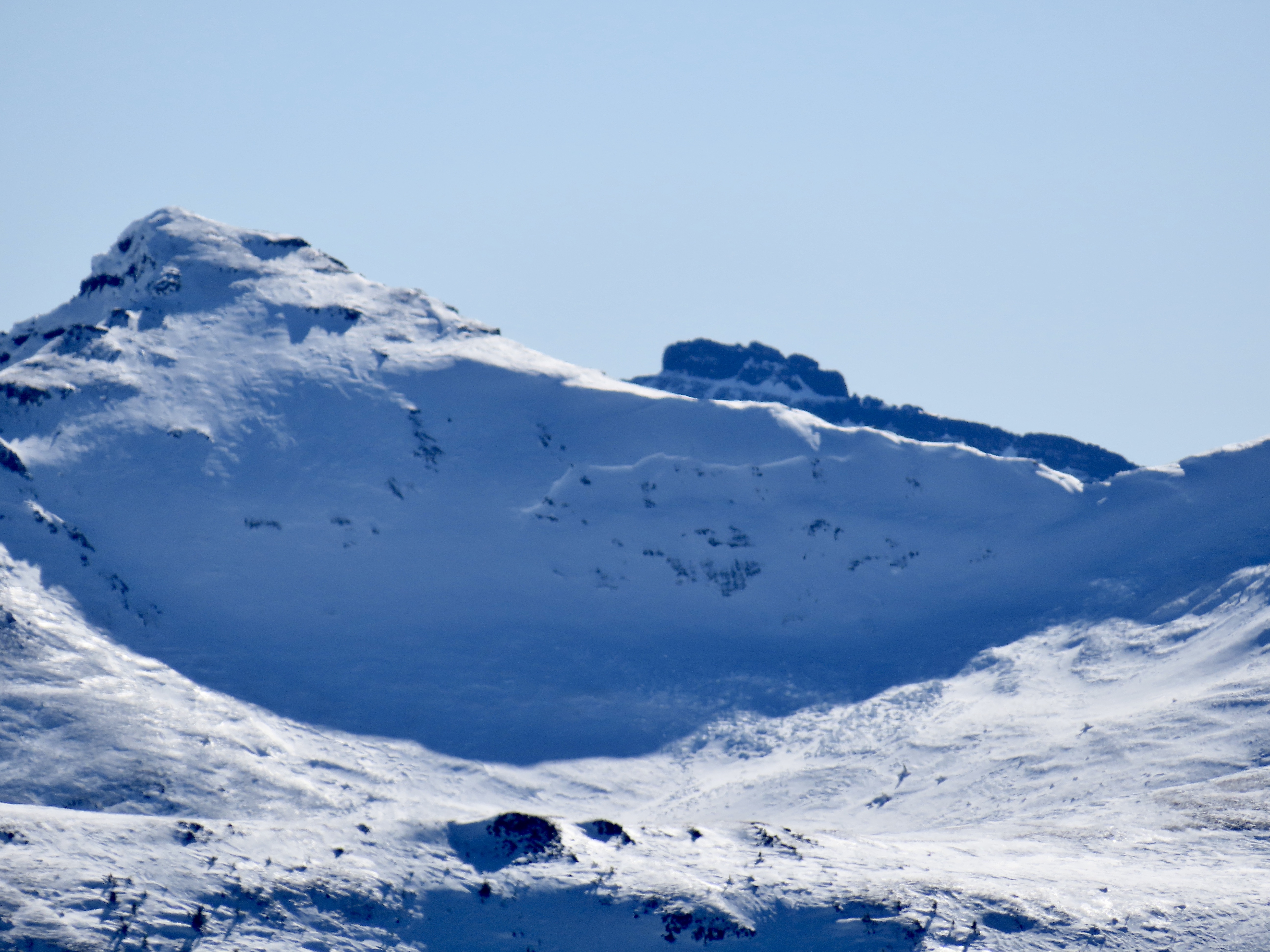
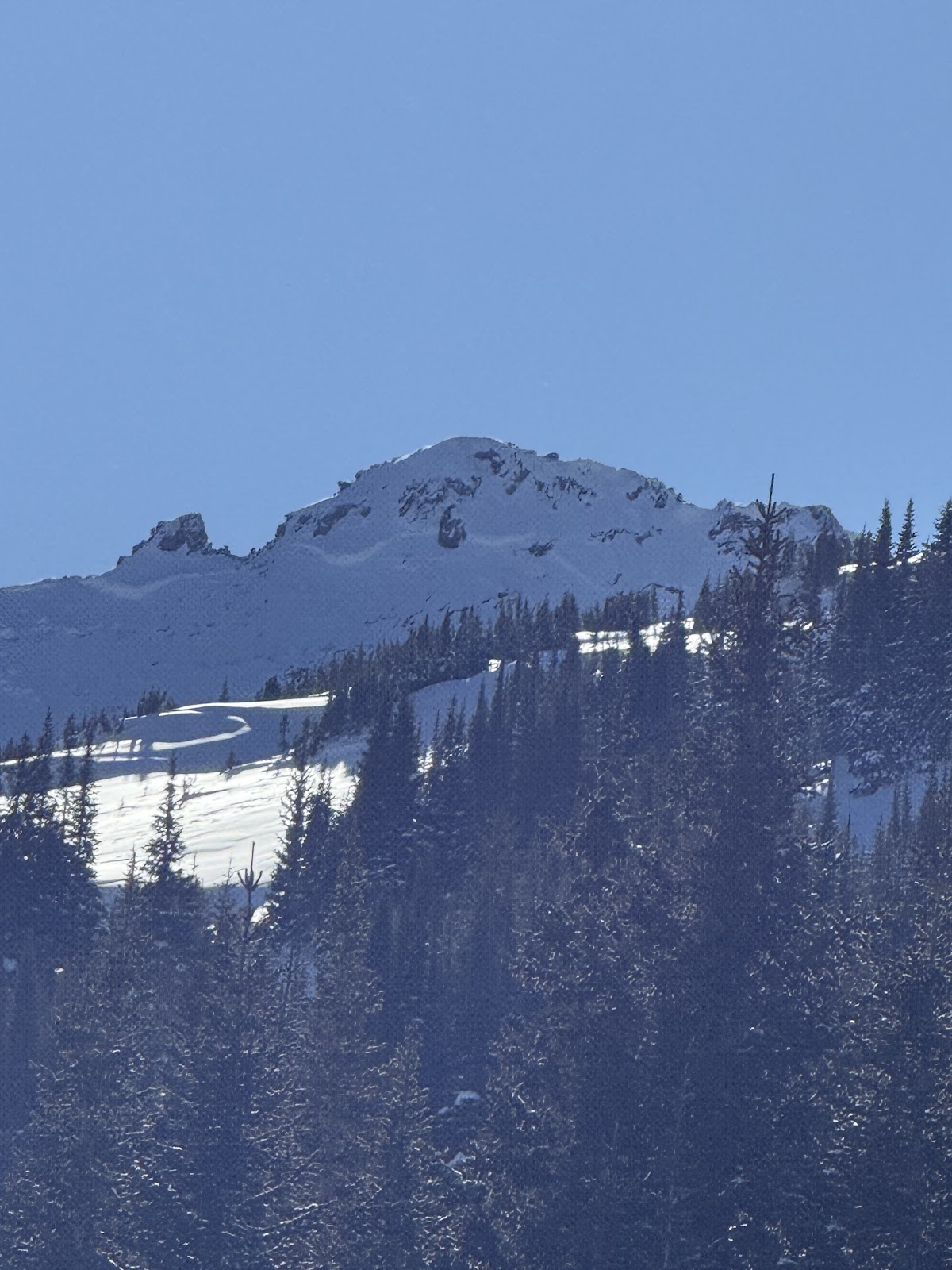
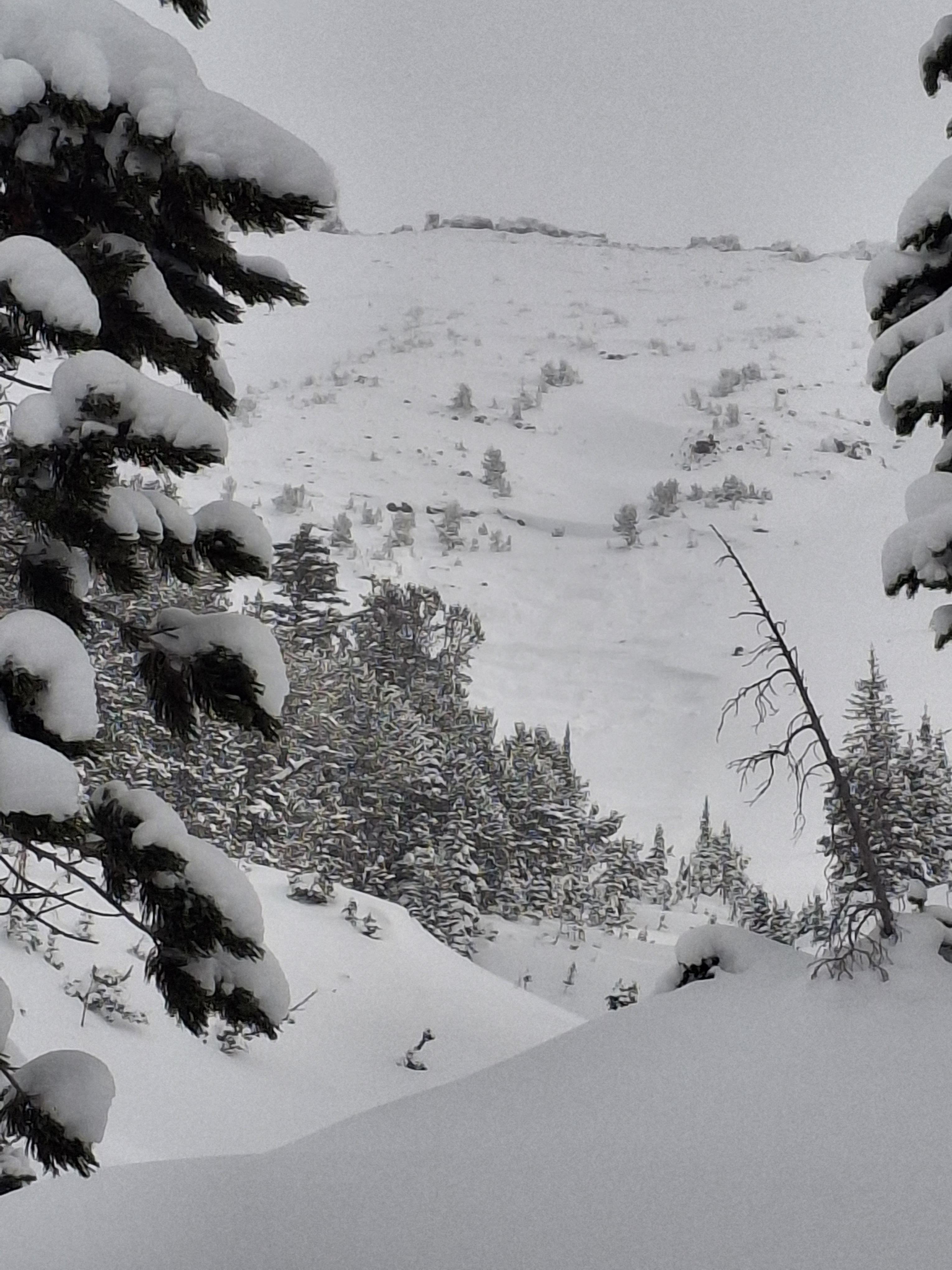
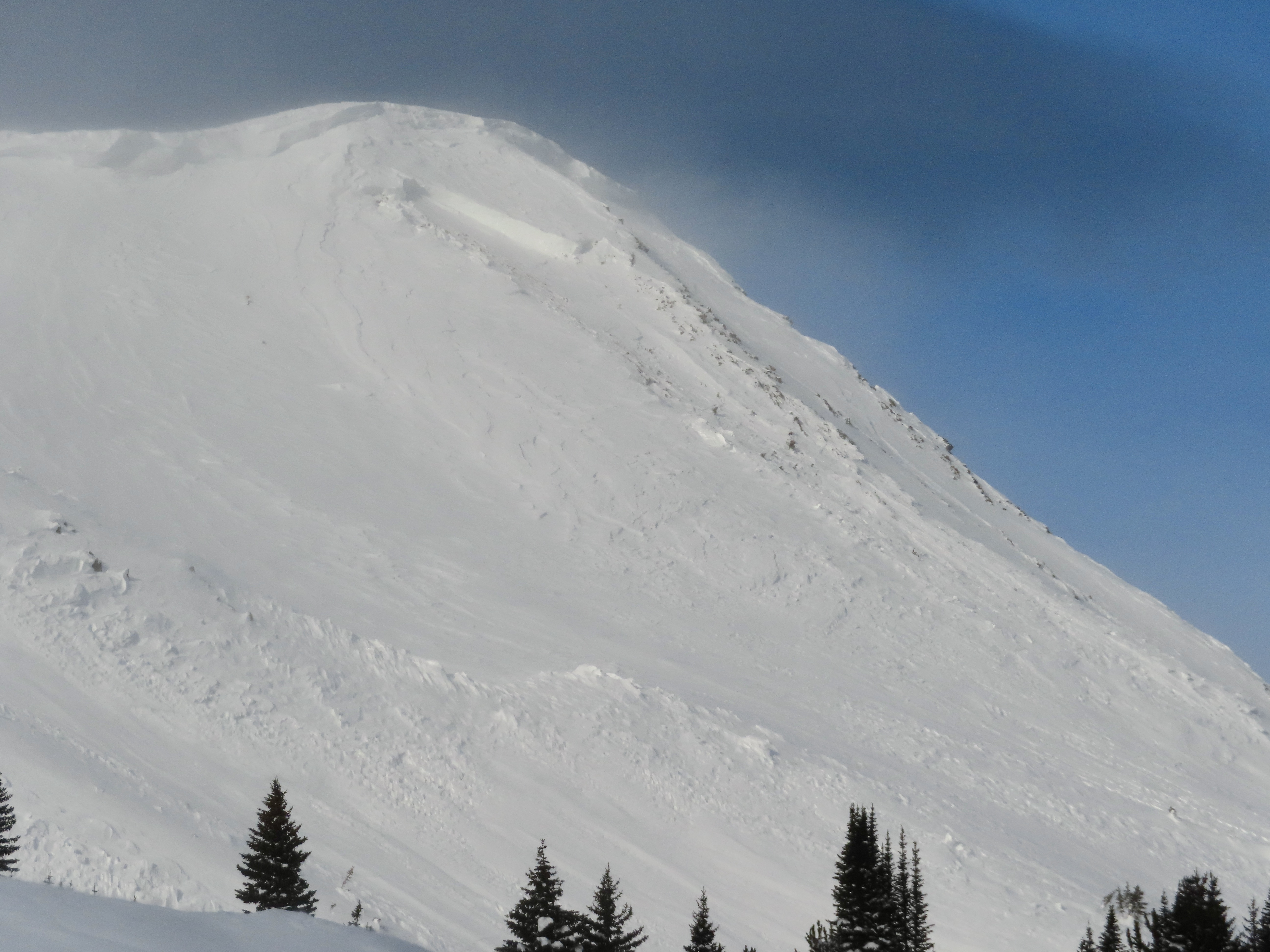
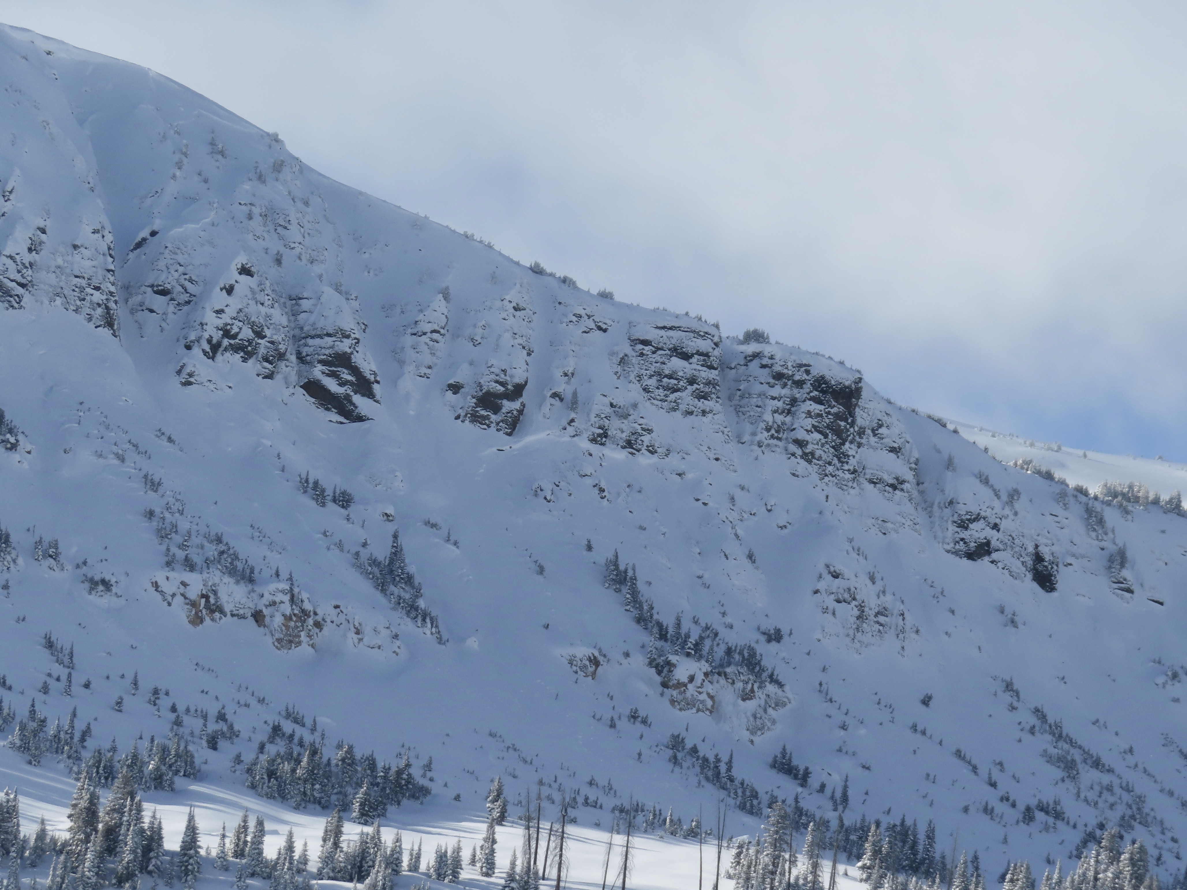
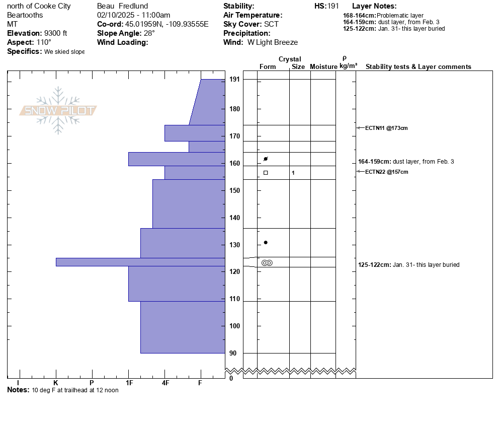
Noticed a large cornice triggered avalanche on Mineral Mtn today. Likely broke on 2/12 or early am 2/13. E aspect ran almost to the valley floor. Photo: BPG
Trip Planning for Cooke City Area
Primary Problem: Wind Slab
Bottom Line: Look out both for thin fresh drifts and somewhat thicker older drifts that formed during the high winds mid-week. Persistent Slab avalanches are the wild card. There hasn’t been a ton of activity on the weak layer that formed towards the end of January, but there has been some. If you do trigger one of these slides it’ll break deeper, wider and be more dangerous. Past 5 Days
Tue Feb 11

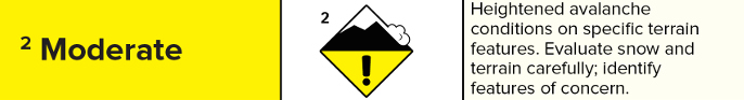
Moderate
Moderate
Wed Feb 12
Moderate
Moderate
Thu Feb 13
Moderate
Moderate
Fri Feb 14
Moderate
Moderate
Today
Moderate
Moderate
Relevant Avalanche Activity
Cooke City
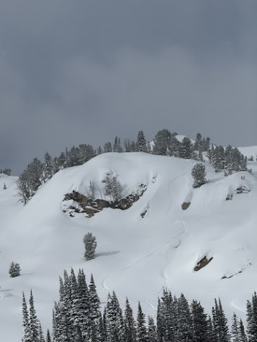
Mineral Mountain
Cornice Triggered Avalanche on Mineral Mountain
Mineral Mountain
SS-NC-R3-D2
Elevation: 10,400
Aspect: E
Coordinates: 45.0303, -109.9980
Caught: 0 ; Buried: 0
More Avalanche Details
SS-NC-R3-D2
Elevation: 10,400
Aspect: E
Coordinates: 45.0303, -109.9980
Caught: 0 ; Buried: 0
Noticed a large cornice triggered avalanche on Mineral Mtn today. Likely broke on 2/12 or early am 2/13. E aspect ran almost to the valley floor. Active Loading today with Strong Gusts from N-S. There were some other small cornice avalanches to the north of this slide that did not trigger larger avalanches.
More Avalanche Details
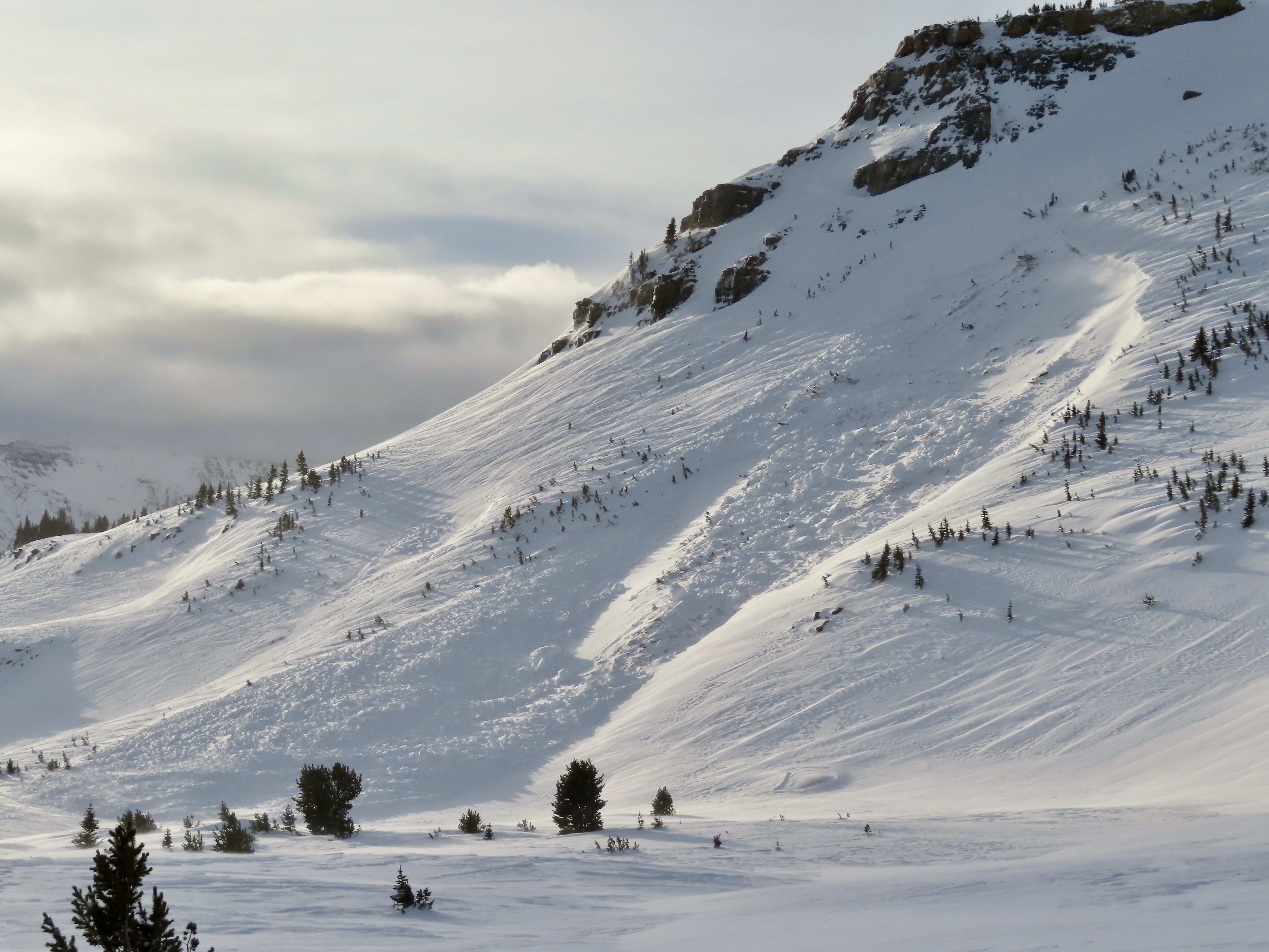
Cooke City
Republic Creek
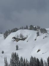
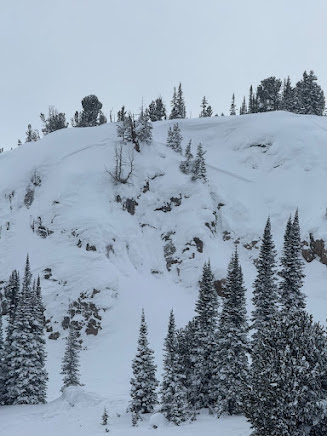
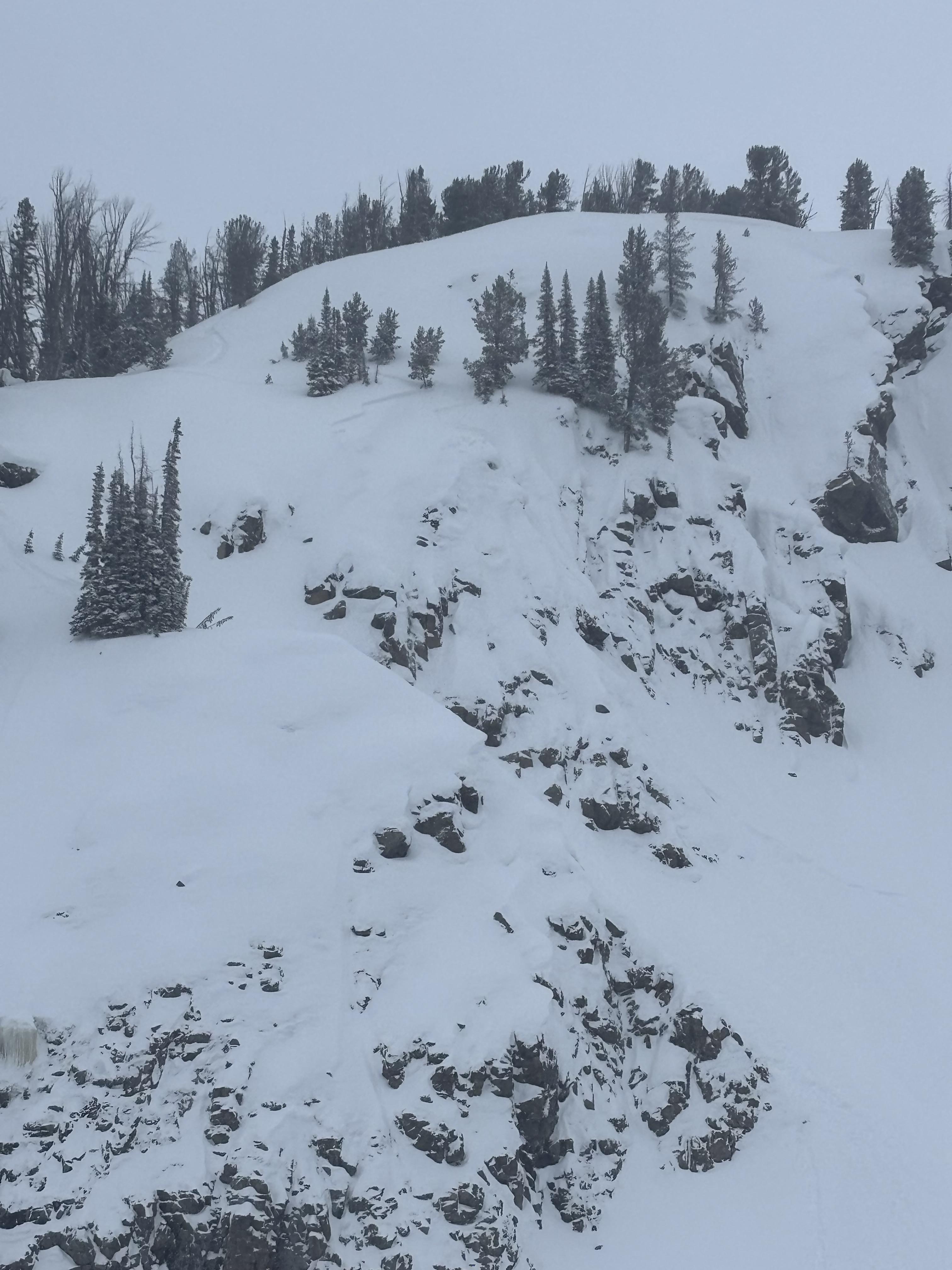
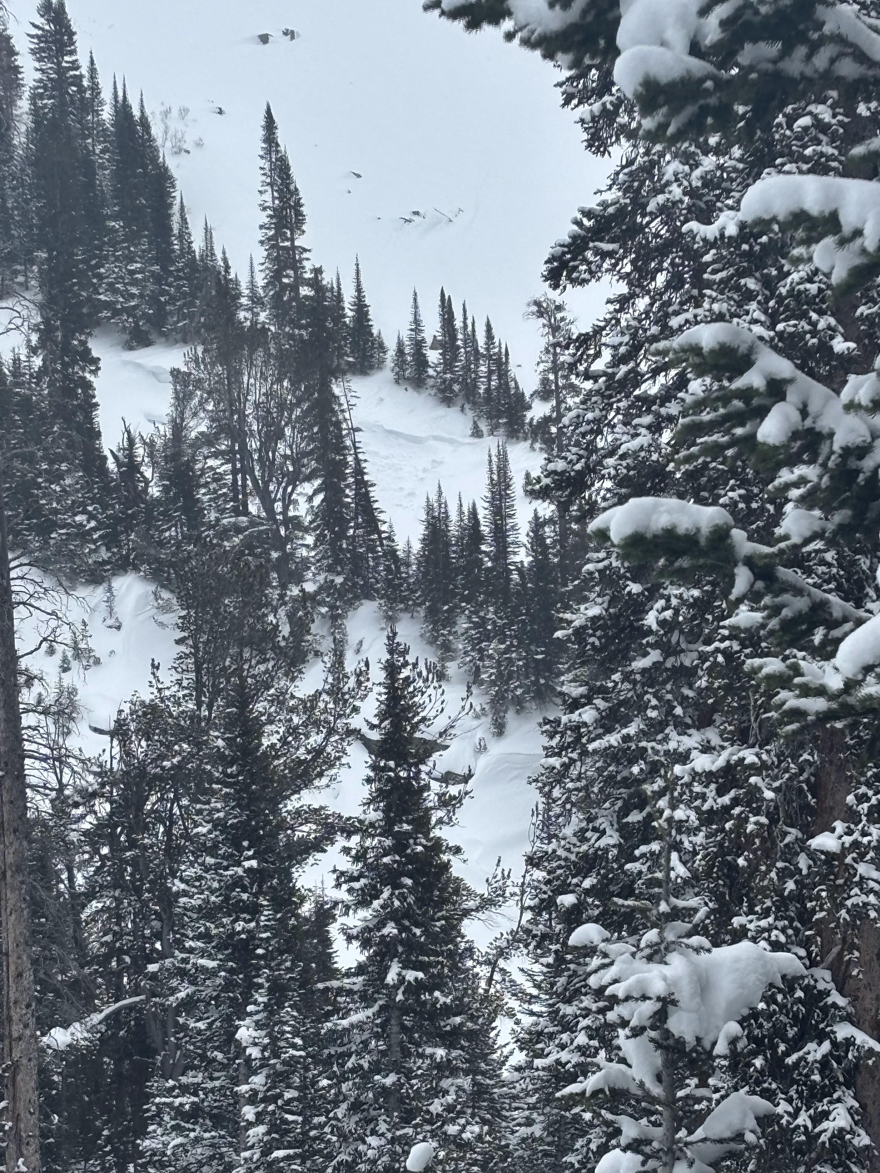
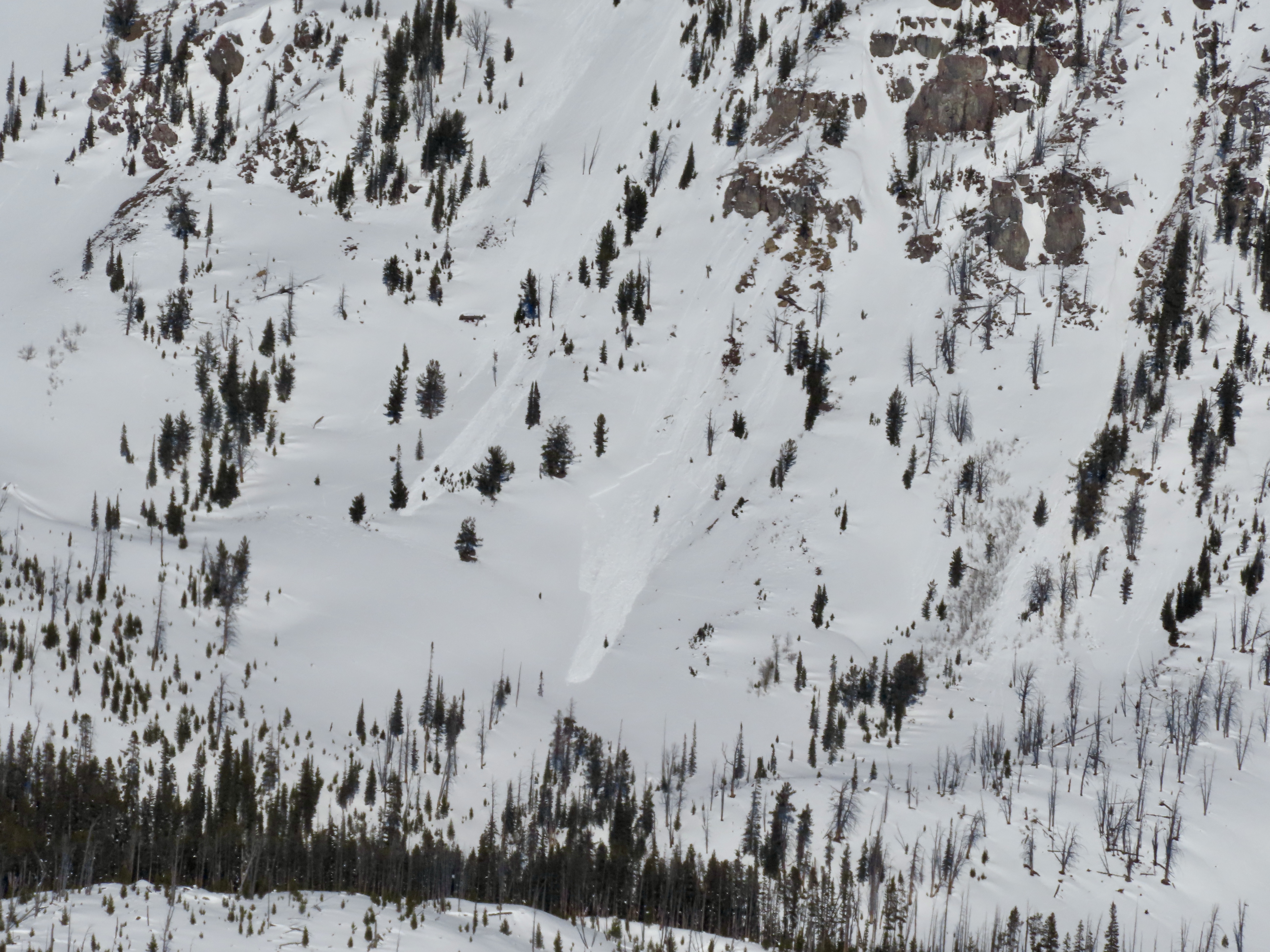
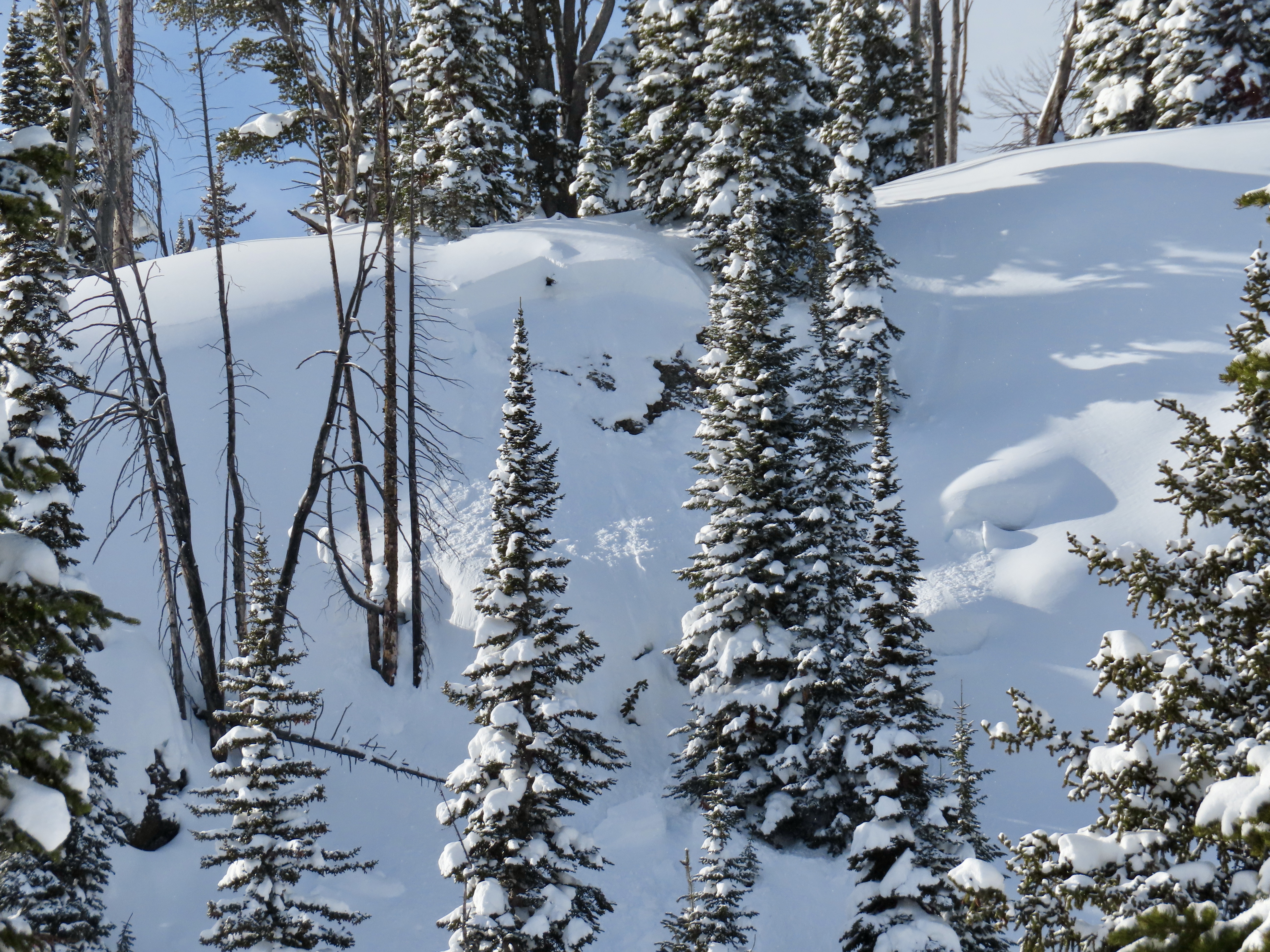
Wind Slab Avalanche in Republic Creek.
Republic Creek
SS-N-R1-D1.5
Elevation: 10,100
Aspect: SE
Coordinates: 44.9855, -109.9410
Caught: 0 ; Buried: 0
More Avalanche Details
SS-N-R1-D1.5
Elevation: 10,100
Aspect: SE
Coordinates: 44.9855, -109.9410
Caught: 0 ; Buried: 0
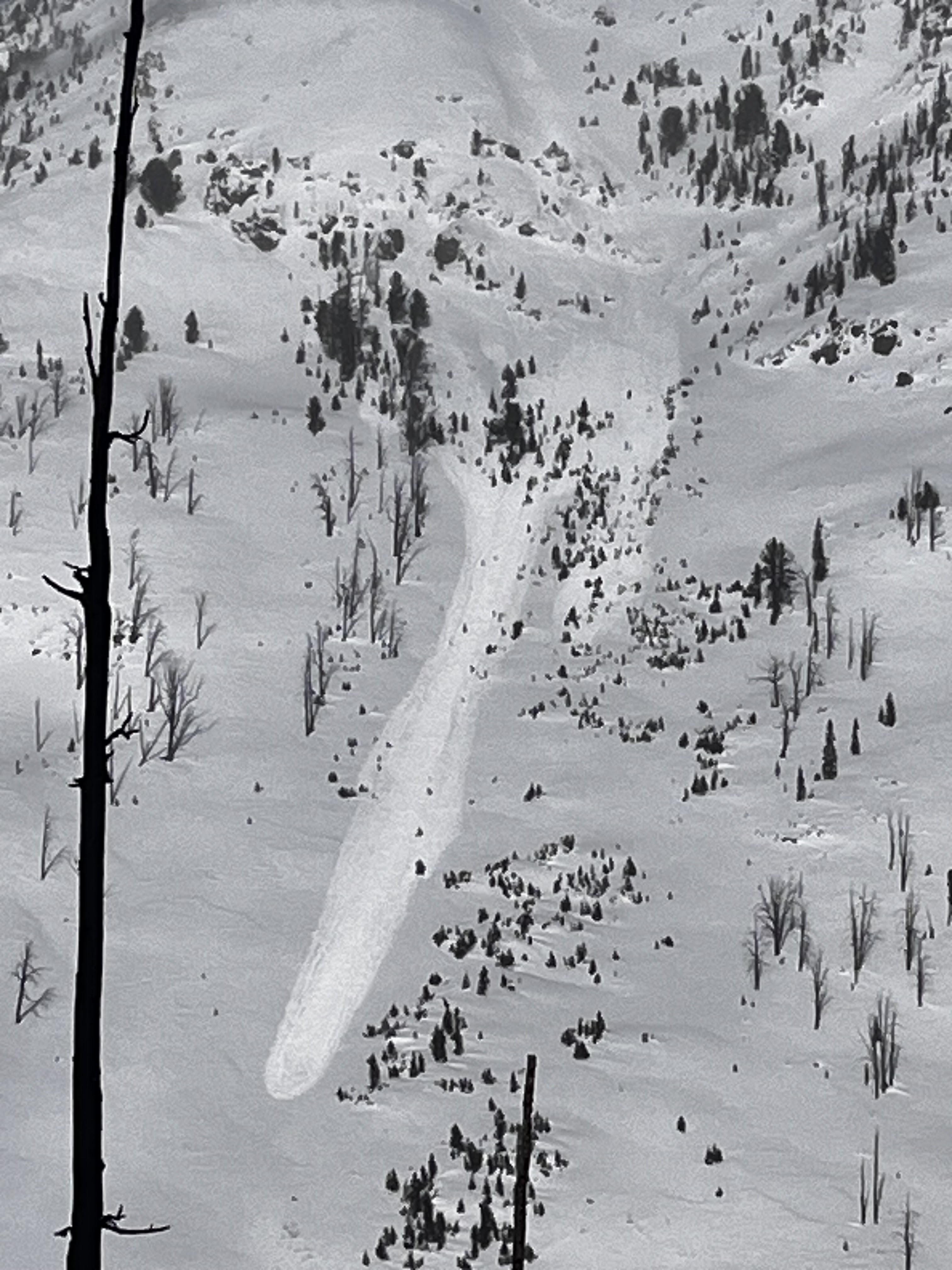
Saw what looked to be a small wind slab or cornice fall on South Siren in Republic Creek. SE facing, 10100 ft.
More Avalanche Details
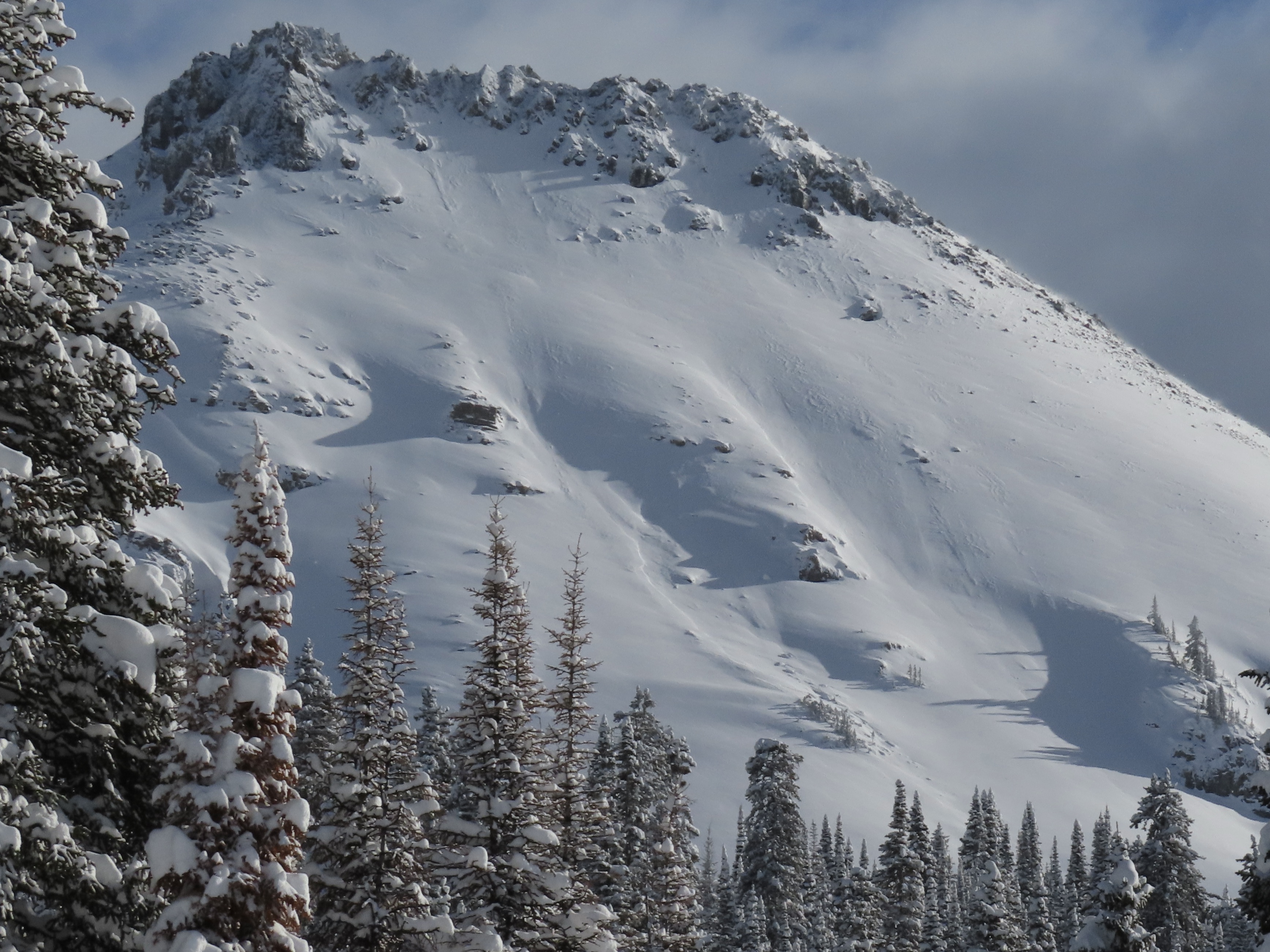
Cooke City
Zimmer Creek
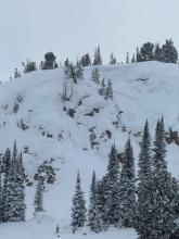
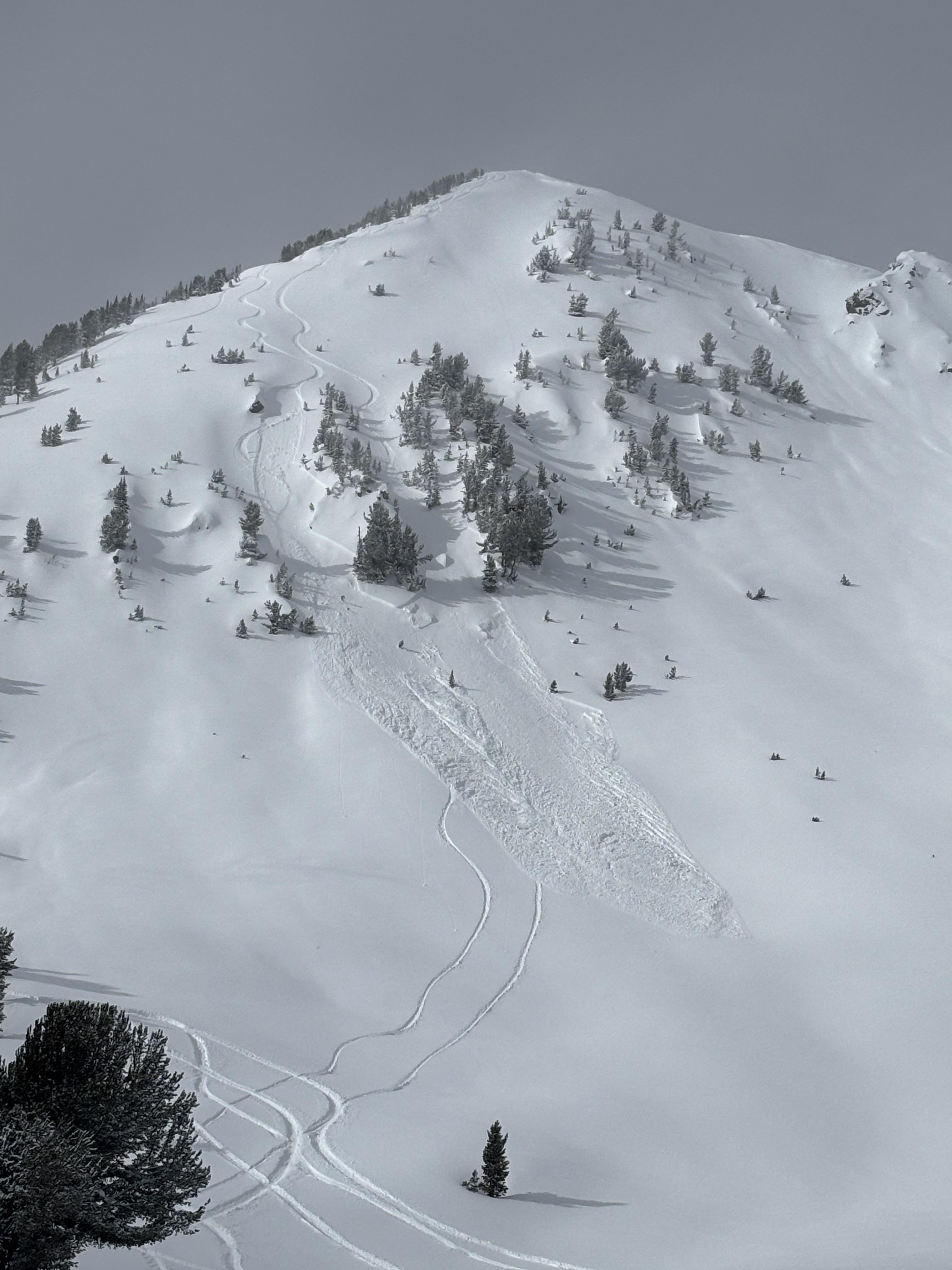
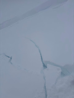
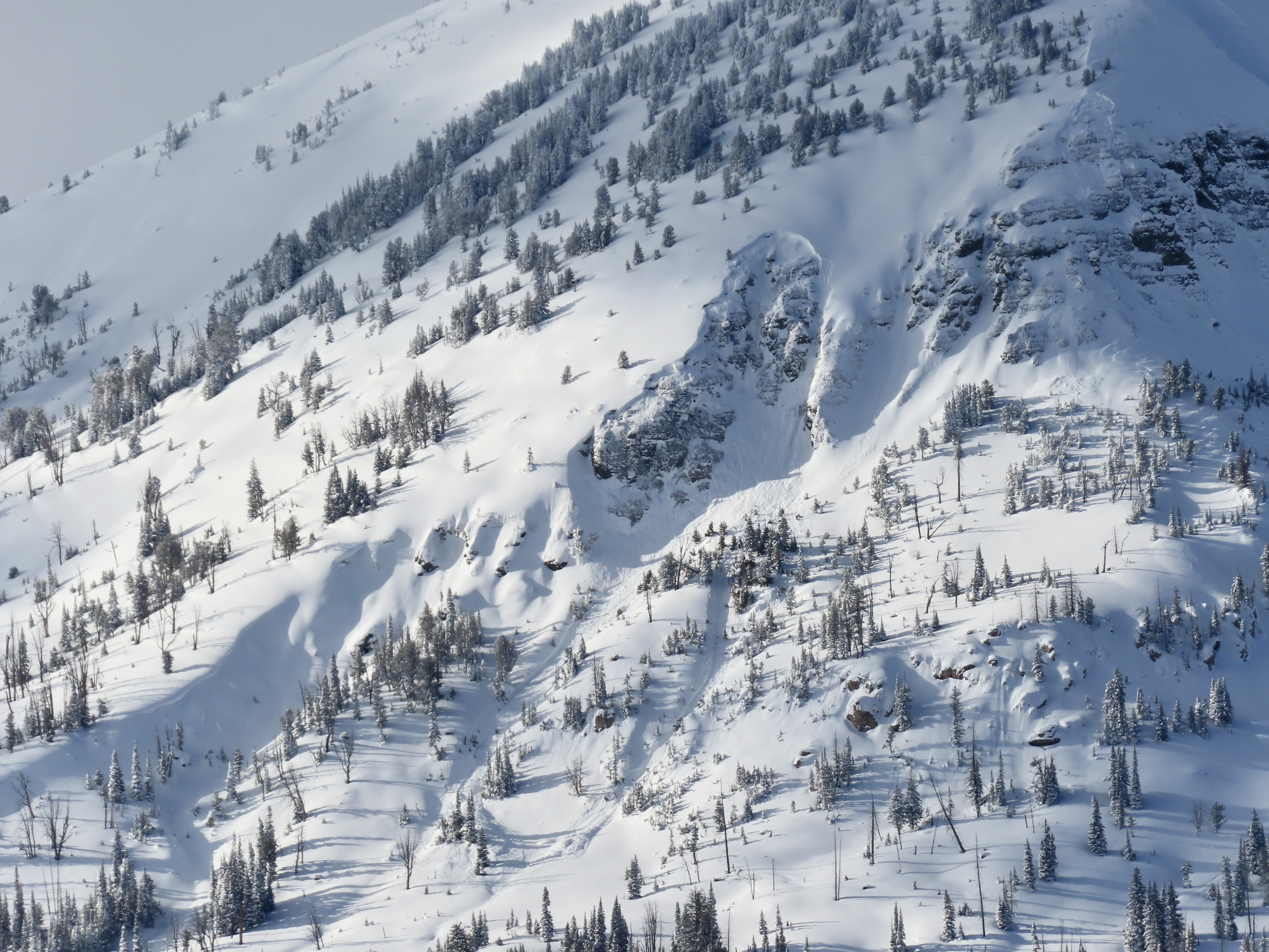
Wind Slab Avalanches near Zimmer Creek
Zimmer Creek
SS-R1-D1
Coordinates: 45.0999, -109.8840
Caught: 0 ; Buried: 0
More Avalanche Details
SS-R1-D1
Coordinates: 45.0999, -109.8840
Caught: 0 ; Buried: 0
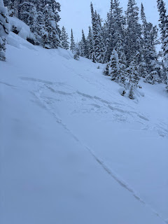
Went skiing north of Cooke City today near Zimmer Creek. I saw a few wind slabs. Some appeared to be skier triggered, some were natural. No other avalanches seen. Moderate to strong wind from the west all day. I saw shooting cracks in obviously windloaded areas.
More Avalanche Details
Relevant Photos
Displaying 1 - 40
-

-

Saw what looked to be a small wind slab or cornice fall on South Siren in Republic Creek. SE facing, 10100 ft. Photo: BPG
-

Saw a few wind slabs. Some appeared to be skier triggered, some were natural. Photo: BPG
-

Saw a few wind slabs. Some appeared to be skier triggered, some were natural. Photo: BPG
-

On Feb 9 we watched two snowboarders trigger separate wind slabs, while riding one at a time in avalanche terrain, on the south side of Scotch Bonnet. Photo: J. Mancey
-

On Feb 9 we watched two snowboarders trigger separate wind slabs, while riding one at a time in avalanche terrain, on the south side of Scotch Bonnet. Photo: GNFAC
-

On Feb 9 we saw a fresh natural wind slab near Wolverine, R1-D1.5. Photo: GNFAC
-

Saw this small soft slab above Round Lake today. SE facing, 9500 ft. Likely skier triggered, there were lots of ski tracks on that hill. Photo: J Mundt
-

A little wind load cornice break, but it broke while I was coming down that track to the right. Photo: S Strenge
-

This is the N side of scotch bonnet, looks like a big break, didn’t get any closer than this however. Photo: S Strenge
-

N face of crown butte, looks like it slid before the dirt event (we think the end of the storm yesterday/ or last night must have been dirty snow?). Photo: S Strenge
-

Avalanche east aspect of Henderson. This slid sometime between 11:30 - 12:30 on 2/4/24. Photo: BPG
-

Avalanche on north aspect of Fisher Mountain. This likely slid sometime between 2/2-2/3. Photo: BPG
-

Avalanche north aspect of Crown Butte. This likely slid sometime between 2/2-2/3. Photo: BPG
-

Some recent avalanche activity noted on east Mt. Henderson. Photo: B Fredlund
-

Some recent avalanche activity noted on Miller Ridge. Photo: B Fredlund
-

Skied north of Cooke City. Lots of cracking and small slabs on pillows. Observed one small wind slab on NW facing slope 9200 ft. Photo: BPG
-

Skied north of Cooke City. Lots of cracking and small slabs on pillows. Photo: BPG
-

On Jan 30 we spotted several loose wet avalanches that occurred yesterday in steep, rocky terrain up Sheep Creek. Photo: GNFAC
-

On Jan 30 we noted an old, deep persistent slab avalanche on a NW' aspect near the south end of the Republic Creek drainage. This likely broke around a week ago. Photo: GNFAC
-

On Jan 27 we saw a cornice fall on a very big steep slope up Republic Creek which did not trigger anything large or deeper, but entrained some snow and ran over a thousand feet vertical. Photo: GNFAC
-

On Jan 27 We saw one old, but very large persistent slab avalanche further up Republic Creek (pictured). It was on similar aspect and elevation as a somewhat more recent persistent slab in nearby Hayden Creek, North-northeast, 10,000'. It appeared to be 6'+ deep and 500'+ wide. The bed surface and crown had been partially drifted in, so it seemed it was probably at least a week old...? Photo: GNFAC
-

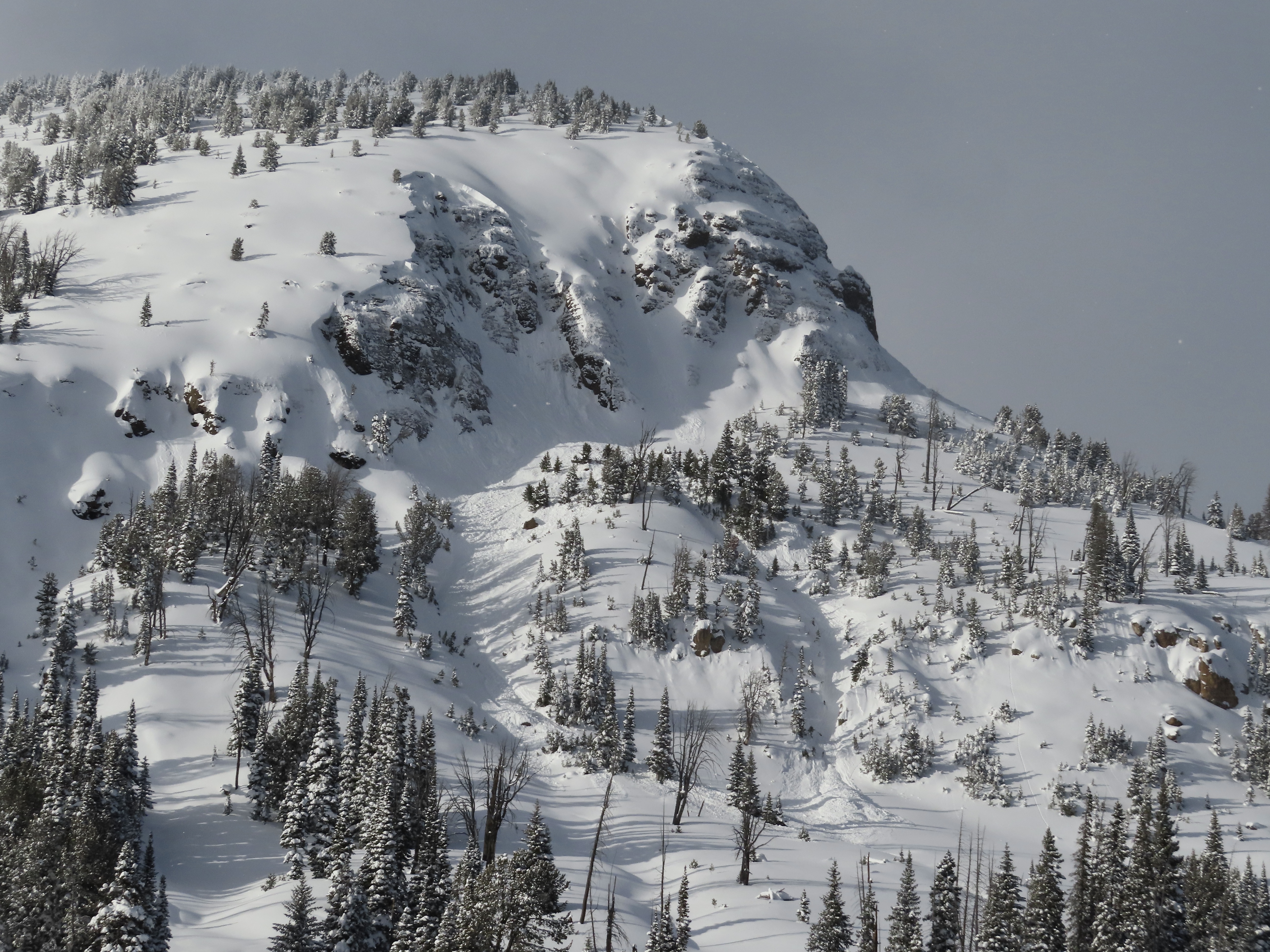
On January 26 we saw a handful (4-6?) of old wind slab avalanches of various ages. The most recent and largest appearing, but still not very fresh, was on the north side of Scotch Bonnet (attached photo). Most were D1-D1.5, the slide pictured was D1.5-2. Photo: GNFAC
-

While touring today, we saw a deep slab avalanche at the southern end of the Hayden Creek drainage. NE aspect. It seemed to be recent, likely in the last day or so. Photo: N Mattes
-

Wind slab avalanche on E Henderson North of the large slide path close to Fisher Pk. R1 D2,1-2' deep, 200' wide. It broke aprx 200' below the summit mid slope. It looked like it broke on the 19th. Photo: BPG
-

On 1/12 observed a D .5 soft slab near Long Lake above the snowmobile trail. Also saw some small dry loose activity on E facing terrain in Zimmer Creek. Photo: BPG
-

Woody Ridge north of the "KNBs." Northwest facing slope, crown elevation approx 9600'. Ran 1000 to 1200'. Photo: N Gaddy
-

Woody Ridge north of the "KNBs." Northwest facing slope, crown elevation approx 9600'. Ran 1000 to 1200'. Unsure of when it went, we did not notice it this morning only this afternoon on the hike out. Photo: N Gaddy
-

Observed a large avalanche on a west facing slope approx 10000ft, with a higher crown at 10200'. Crown depth 4-6'. HS-Ns-D2-R2-O . Ran 1000ft and into terrain I had previously considered safe. Photo: N Gaddy
-

Observed a large avalanche on a west facing slope approx 10000ft, with a higher crown at 10200'. Crown depth 4-6'. HS-Ns-D2-R2-O . Ran 1000ft and into terrain I had previously considered safe. Photo: N Gaddy
-

Observed a large avalanche on a west facing slope approx 10000ft, with a higher crown at 10200'. Crown depth 4-6'. HS-Ns-D2-R2-O . Ran 1000ft and into terrain I had previously considered safe. Photo: N Gaddy
-

Observed a large avalanche on a west facing slope approx 10000ft, with a higher crown at 10200'. Crown depth 4-6'. HS-Ns-D2-R2-O . Ran 1000ft and into terrain I had previously considered safe. Photo: N Gaddy
-

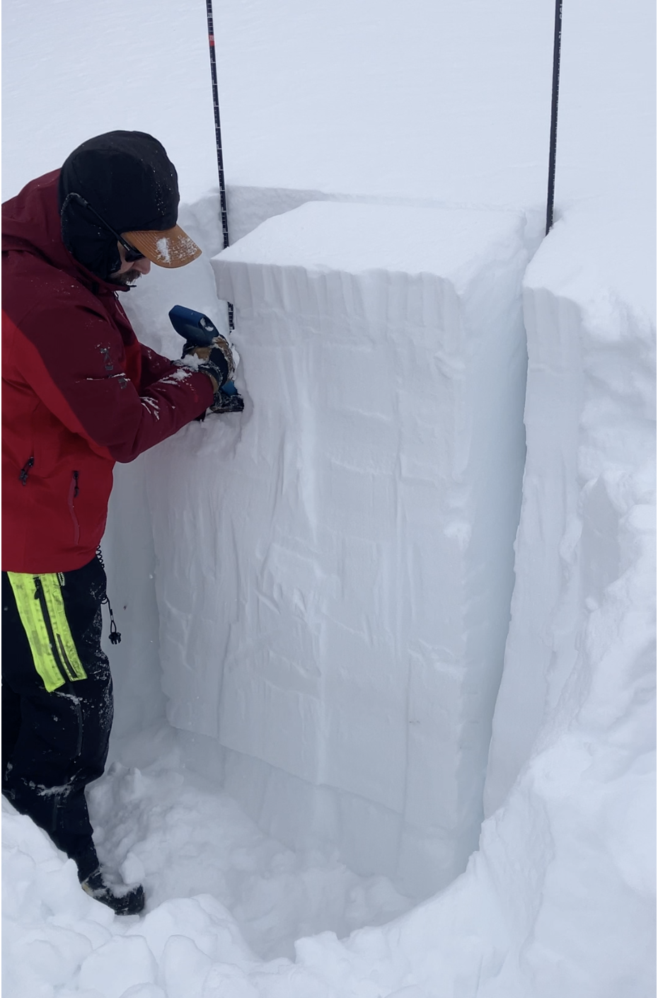
Jan 10, We dug a pit on Henderson Bench on a northeast facing slope, and one on Scotch Bonnet on a south facing slope (pictured). Both showed a 4' thick strong slab on weaker, faceted snow at the base. The weak layers are not terribly weak and didn't produce concerning test scores, so they may get better when they get a break from snowfall and wind-loading, but for now recent avalanches show these layers are weak enough and will produce more big avalanches as snowfall and wind continue. Photo: GNFAC
-

We looked at two 4-6' deep persistent slab avalanches that were reported yesterday on the east side of Henderson Mtn., which likely happened yesterday (Jan 9). Wind-loading was the likely trigger. There were not tracks near the larger one above the bench, where riders could easily get to, but they could have been filled in. The other slide was below the highest point below a cornice and likely natural. Both looked like they broke on facets at the bottom of the snowpack. Photo: GNFAC
-

We looked at two 4-6' deep persistent slab avalanches that were reported yesterday on the east side of Henderson Mtn., which likely happened yesterday (Jan. 9). Wind-loading was the likely trigger. There were not tracks near the larger one above the bench, where riders could easily get to, but they could have been filled in. The other slide was below the highest point below a cornice and likely natural. Both looked like they broke on facets at the bottom of the snowpack. Photo: GNFAC
-

On Jan 9 We saw many avalanches of various types and ages. Some occurred today and within the last 24 hours and some were up to a week old. Avalanche types ranged from 3-6' deep and broke on weak layers near the bottom of the snowpack to shallow soft, fresh wind slabs. Photo: GNFAC
-

On Jan 9 We saw many avalanches of various types and ages. Some occurred today and within the last 24 hours and some were up to a week old. Avalanche types ranged from 3-6' deep and broke on weak layers near the bottom of the snowpack to shallow soft, fresh wind slabs. Photo: GNFAC
-

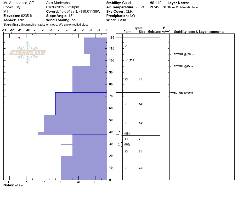
On Jan. 9 we rode away from our snowpit on Mt. Abundance we saw a fresh 3'deep x 10' wide slide that we might have remote triggered from the flat ridge above.
-

Jan. 9, About 45 minutes after we left a snowpit on Mt. Abundance, from a couple miles away, we saw a 4-6' deep avalanche that happened since we had been there, about 1000' up the ridge from our snowpit m. This slide was either natural or remote triggered by riders about 1000' away who were there after we were. Photo: GNFAC


Videos- Cooke City Area
WebCams
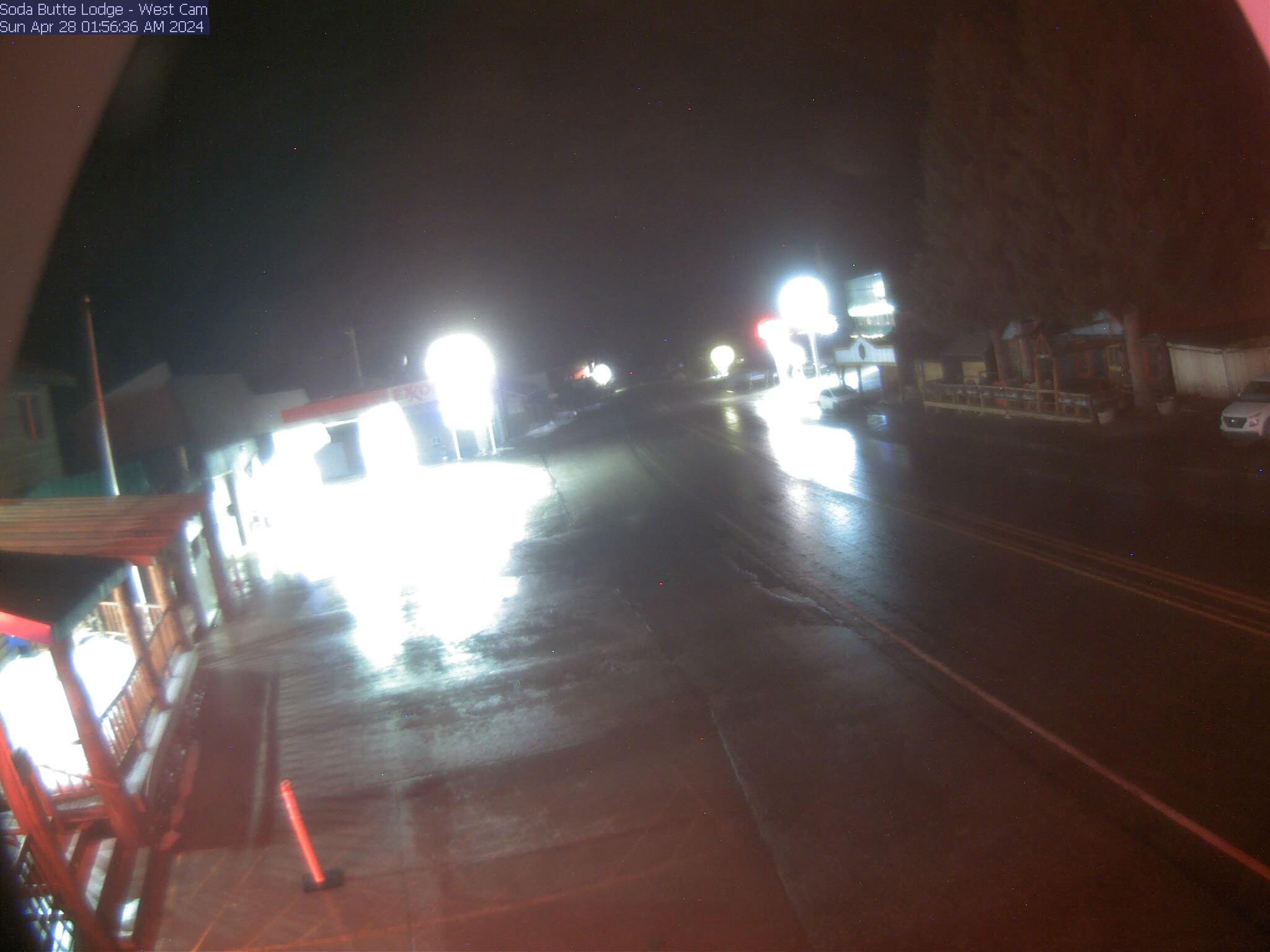
Soda Butte Lodge, looking West
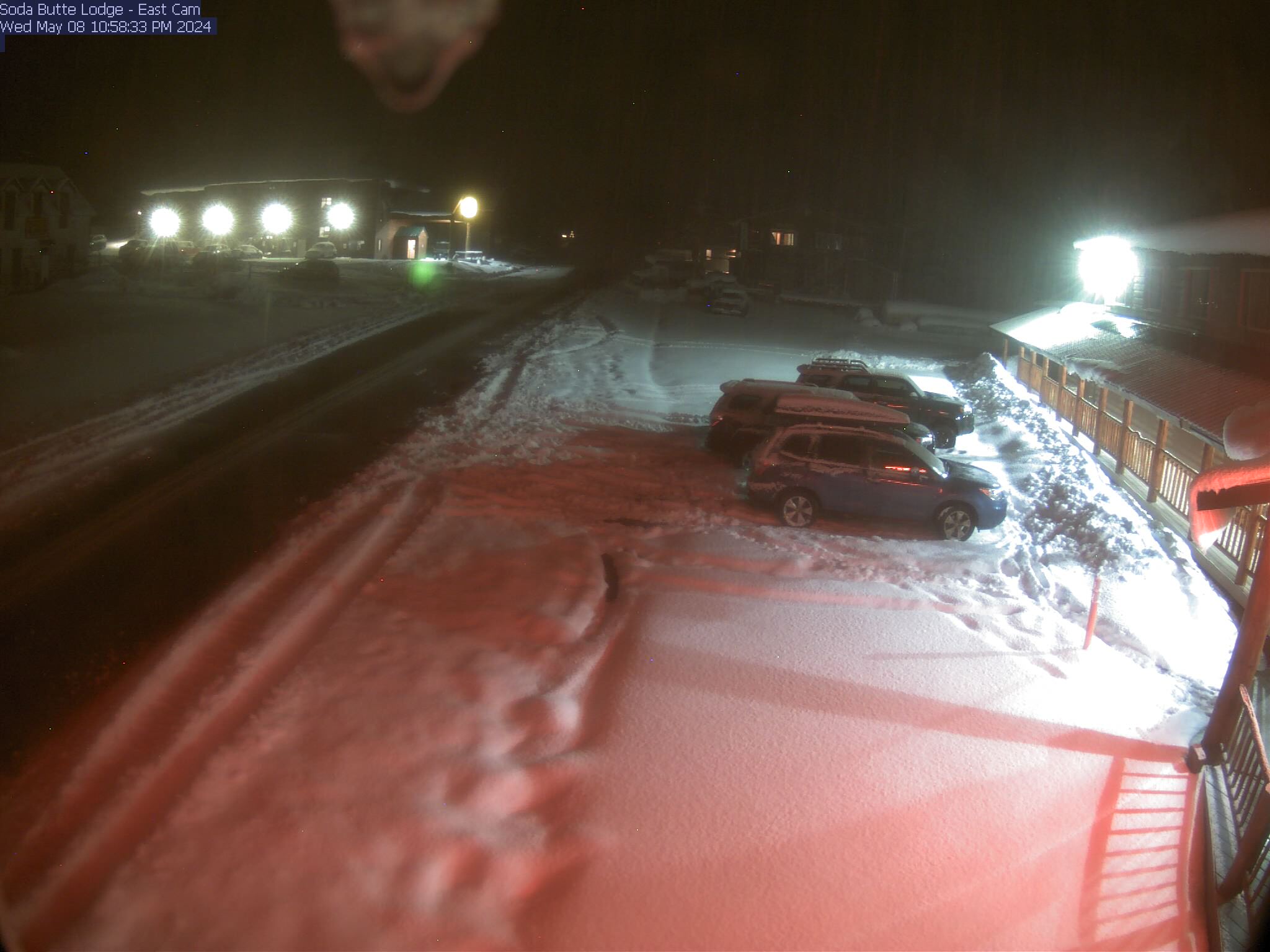
Soda Butte Lodge, looking East


Weather Stations- Cooke City Area
Weather Forecast Cooke City Area
Extended Forecast for2 Miles NNE Cooke City MT
Winter Storm Watch February 16, 05:00am until February 18, 11:00amClick here for hazard details and duration Winter Storm WatchToday
High: 13 °F
Partly Sunny
then Slight
Chance SnowTonight

Low: 4 °F
Snow Likely
Sunday

High: 18 °F
Snow
Sunday Night

Low: 17 °F
Snow
Washington's Birthday
High: 23 °F
Snow
Monday Night

Low: 3 °F
Snow
Tuesday

High: 13 °F
Snow Likely
Tuesday Night

Low: -9 °F
Chance Snow
Wednesday

High: 17 °F
Chance Snow